
BAKERSFIELD, Calif. (KBAK/KBFX) — The warmth continues across Southcentral California. Sunday’s temps topped out in the 80s for many across Kern County. Bakersfield scored 85, which came in just 3 degrees shy of the record for the date of 88 set back in 1905 and tied in 1926. Across the San Fernando Valley it was even warmer. Woodland Hills peaked at 97.
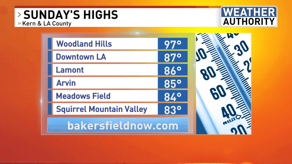
This is another example of what happens underneath a November ridge of high pressure and offshore flow. Very little change in the overall atmospheric pattern on Monday may yield readings similar to those of yesterday around the area. Tuesday and Wednesday also look warm, albeit progressively and slightly cooler each day. Might these be the last warm days for a while?
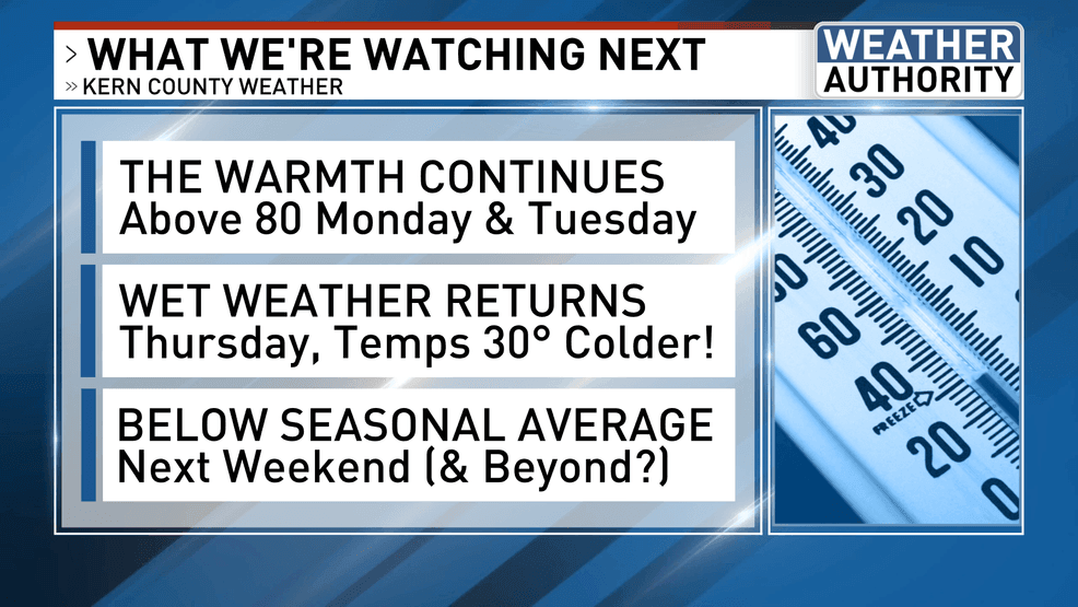
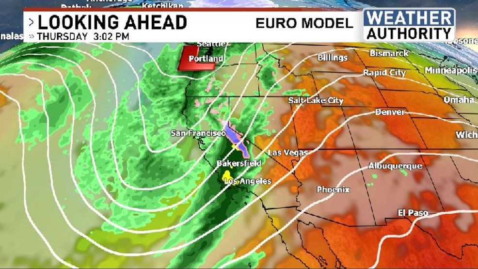
A wholescale reconfiguration of the upper-air pattern has been in the forecast with some consistency for many days now. This signal continues to indicate a sizeable Pacific trough carving out a series of low pressure systems over the ocean, eventually swinging onto and through California west to east and north to south. Our forecast temperature see-saw goes from the mid 80s down to the upper 50s from Monday to Friday, and that’s just for the South Valley. Afternoon highs could end up in the 30s across some of the mountain towns and in the upper 40s within the Kern River Valley on Friday, according to a sampling of the latest computer model data coming in. This airmass switch will be accompanied by a potent moisture pipeline, which would be acted on by the dynamics of a respectable autumn storm system. A generous serving of rainfall is possible up and down the state, with Kern County cashing in on our next winter-season storm of the season. Snow levels will be in play this time and those details should hopefully be better known in the days ahead. Our basic forecast outline paints Thursday as the wet weather day, with activity possibly lingering into Friday. The coldest air pushes in Thursday night and Friday.
 Comment with Bubbles
BE THE FIRST TO COMMENT
There are going to be a lot of moving parts to this forecast in the days ahead. Most models have come into agreement on the next handful of days. Thereafter, some differences of opinion come creeping in, which is to be expected. It appears that we are going to be entering an extended period of “cooler than seasonal average” temperatures along with the possibility of an active storm track into southcentral California. Stay tuned!