
El Niño: What to know as California leaders declare State of Emergency
An El Niño pattern has been present since June. As it strengthens, it will help influence the chance for wetter, stormier weather this winter on the West Coast.
 SACRAMENTO, Calif. —
California leaders officially declared a State of Emergency on Monday. The reason? El Niño and its potential to influence a stormier than normal winter on the West Coast.
This declaration allows emergency response resources to be readied and allocated ahead of any storm damage.
But it has prompted many questions over the past 24 hours. When will El Niño hit? How bad will it be? What should I do now?
Below are the answers to some of those big questions along with a check on the status of El Niño as of late September.
El Niño began in June
El Niño and La Niña patterns are tracked by measuring sea surface temperatures in a specific part of the tropical East pacific. When that water is warmer than normal for a three month period, an El Niño is declared.
Forecasters at NOAA declared an El Niño was present in early June. Since then, water temperatures have continued to rise and as a result, El Niño has continued to strengthen.
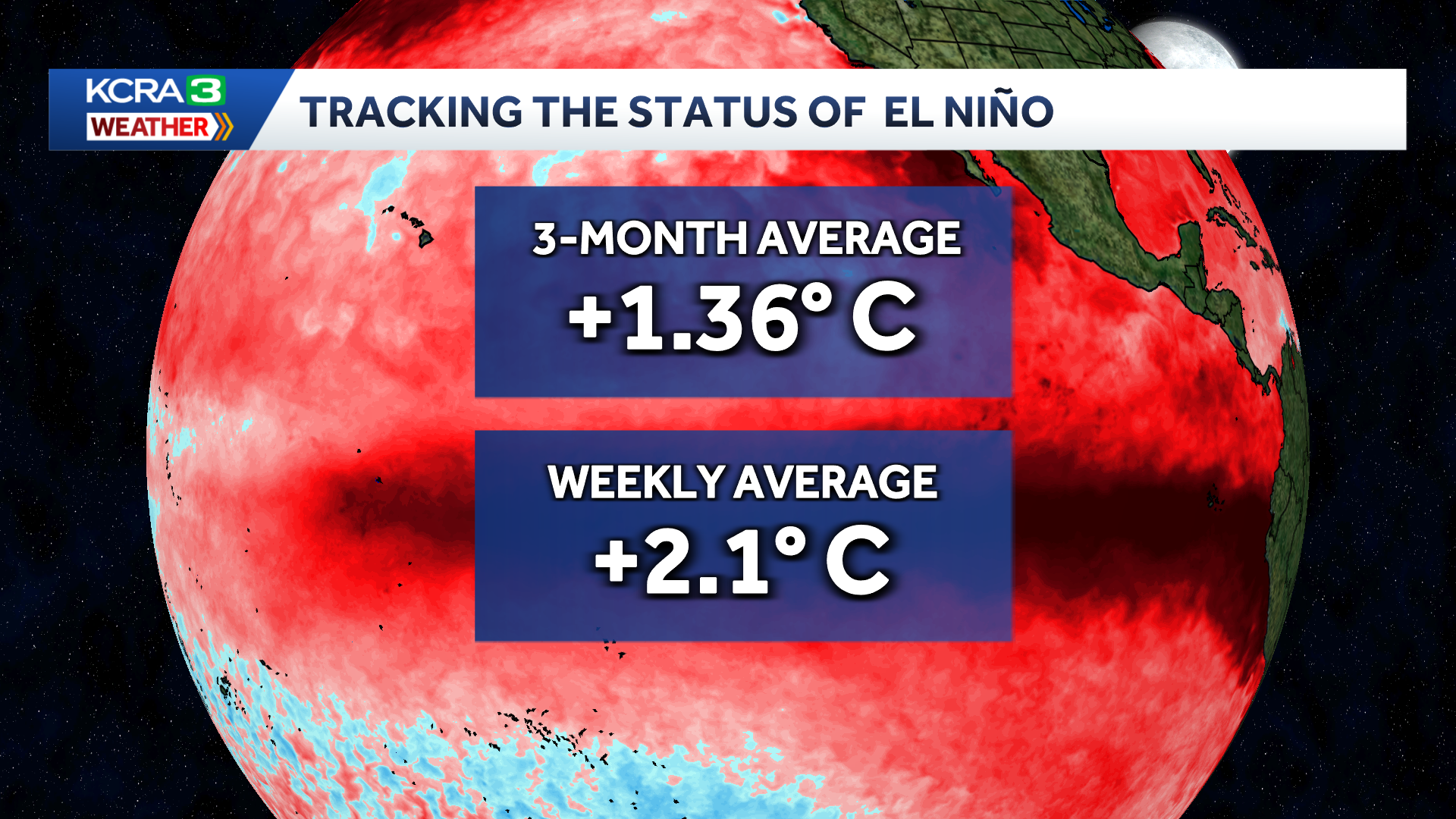
The most recent 3-month observation which covers June, July and August has the temperature at 1.36 degrees Celsius higher than normal. According to global standards, that reading indicates a “strong” El Niño is present.
Hearst Owned
The global standard for recording the strength of an El Niño or La Niña pattern relies on 3-month rolling averages of sea surface temperatures. The most recent observation spans June through August. According to that reading, a “strong” El Niño is present. More recent readings do show significantly higher temperatures, indicating that El Niño may be classified as “very strong” as early as next month.
More recently updated weekly readings show temperatures much higher. It is possible that El Niño may be classified as “very strong” as early as October.
NOAA’s September El Niño outlook highlighted a 75% chance that this year’s event could be the strongest in modern record. That record is +2.52 degrees Celsius during the winter of 1982 and 1983.
Very strong El Niño winters tend to be wet in California
And that is the most likely outcome this winter, but there is still a big range of possibilities for how things could go.
In general, the impacts of a major El Niño pattern are felt more strongly in Southern California than in Northern California.
Hearst Owned
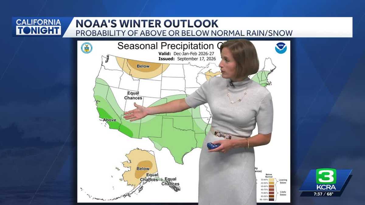
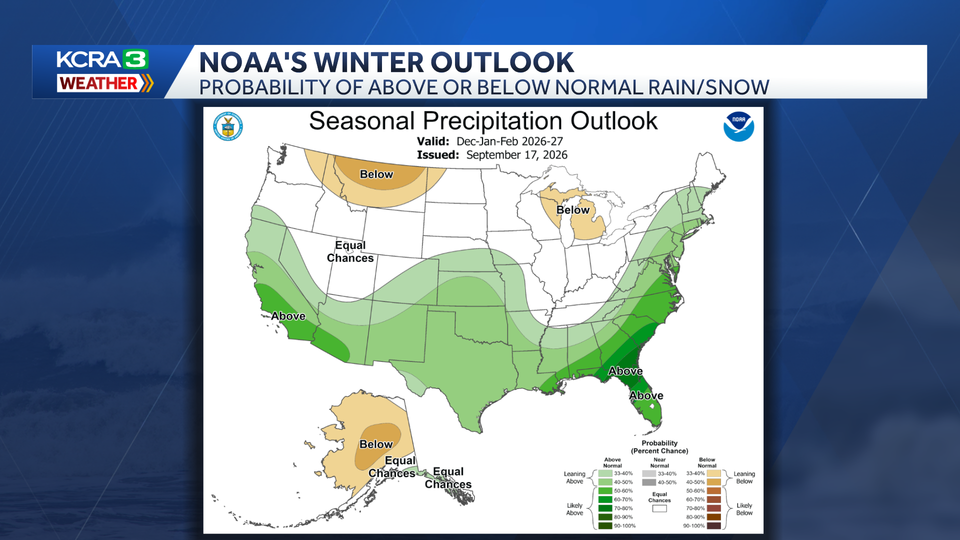
NOAA’s outlook for December, January and February favors wetter than normal conditions in California. The probability for wet conditions is higher for Southern California than Northern California.
Some of the concerns officials are trying to prepare for now center on coastal communities. Coastal flooding and erosion are a bigger threat this winter for a few reasons.
The combination of El Niño and a marine heat wave closer to the California coast has ocean temperatures running much warmer than normal. That warmer water takes up more space than cooler water, so water levels at the coast are also running higher than normal. That is likely to be the case through winter.
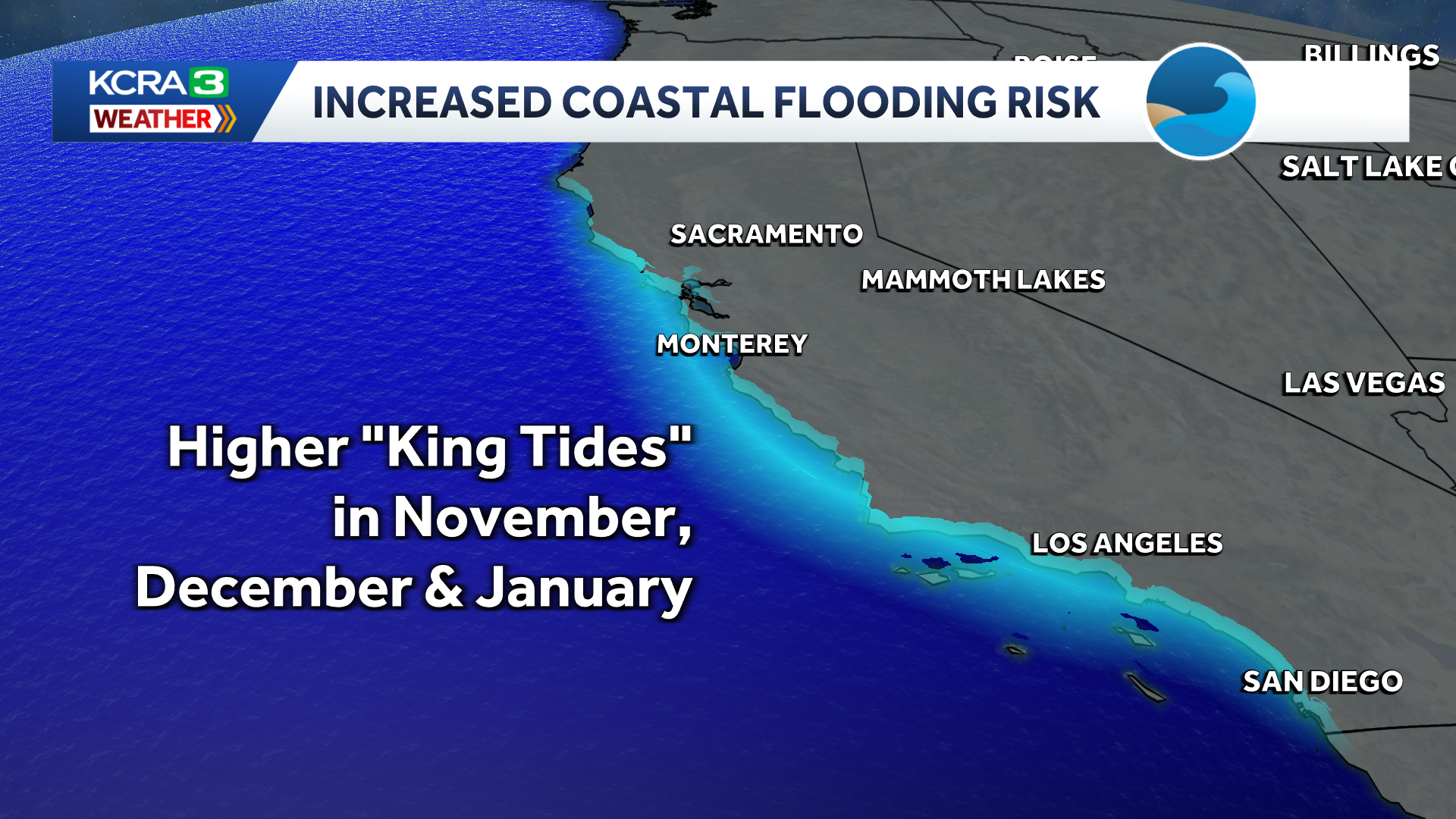
The highest tides of the year, known as king tides, are expected to occurring in late November, late December and late January. These higher tides layered with higher background ocean levels raise the risk for coastal flooding.
Hearst Owned
King tides will occur between November 24th and 26, December 23rd and 25th and January 21st through 22nd this winter.
If and when winter storms start rolling in, those higher water levels combined with the rough surf storms bring in can spell big trouble for coastal damage and erosion.
Of course, those types of storms can come in any winter, whether El Niño is tipping the scales or not. This year’s very strong El Niño does not guarantee a rough storm season, but it does increase the potential.
So what now?
The governor’s declaration of a “State of Emergency” can really be read as a “State of Preparedness” at this point.
Potential impacts from El Niño’s influence on winter are still months away. This is a good time to be thinking about any big winter readiness projects your property needs. Things like tree trimming, roof repairs and drainage issues should be addressed over the next couple of months.
This is also a good time to make sure you and your family have a plan in case of a flood emergency or major power outages. Have an emergency kit and go bag at the ready and know your evacuation route. These are good practices to have going into any winter season in California.
See more coverage of top California stories here | Download our app | Subscribe to our morning newsletter | Find us on YouTube here and subscribe to our channel.