

LOS ANGELES – A rare and powerful October storm is bringing heavy rain, high winds, and a threat of mudslides and tornadoes to Southern California, prompting evacuations and a state of emergency for some residents.
The storm, described by the National Weather Service as a “rare and very potent storm system,” is expected to be unpredictable, with the worst impacts arriving Tuesday afternoon.
Follow FOX 11’s live blog with the latest updates:
Keeping an eye on Eaton Fire burn scar area
3:30 p.m.: While the rain did not cause as much destruction as initially feared, crews are still keeping a close eye on any shifts in the land in the foothills of Altadena. The Los Angeles County Fire Department said it will keep coordinating with other agencies into Tuesday night to ensure safety.
“We’re still worried about mud and debris flows. All of that water is sitting in those hills and after the burn scars from the Eaton Fire, mud and debris flows are definitely first and foremost on our mind,” said Fred Fielding of the LA County Fire Department.
Fielding said they will monitor the hills for the next few days to ensure there is not any land movement.
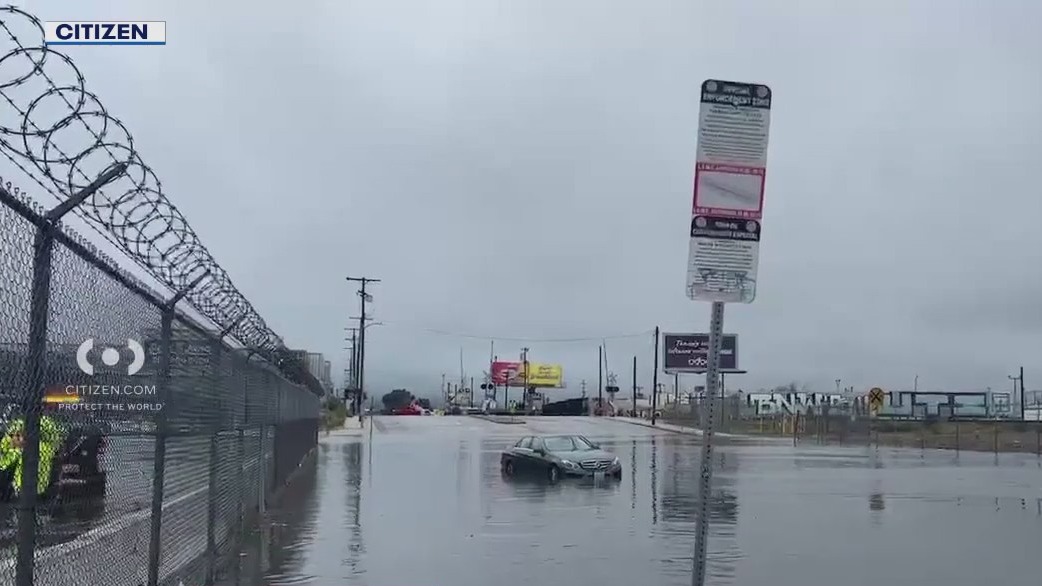
San Fernando Valley flooding
3:15 p.m. Too much water caved in the roof of a studio and cosmetics company on Sherman Way. One employee said they began feeling chunks of the ceiling fall off when they came in this morning, and suddenly heard what sounded like thunder as the water broke through the roof. No one was injured, but the damage is substantial.
Drivers trying to avoid the freeway gridlock found surface streets just as bad. Vineland, near the Hollywood Burbank Airport, was blocked off because of flooding — but at least two vehicles were seen driving through, past parking enforcement personnel waving for them to stop.
It rained steadily throughout the day, with gauges at Sepulveda Canyon and Mulholland reporting more than three inches of rain.
Truck hangs over freeway
2:45 p.m.: At the 5 and 118 freeway interchange in Pacoima, one of two crashed big rigs hung over the rail at the overpass. The crash shut down traffic for hours.
 Topanga Canyon reopens
2:30 p.m.: With the rain subsiding, a 3.6-mile stretch of Topanga Canyon Boulevard between Pacific Coast Highway and Grand View Drive has been reopened, according to Caltrans. Since that area is an active work zone, it will continue to be closed nightly between midnight and 5 a.m.
 5 Freeway reopens
12:40 p.m.: Two lanes have reopened on the northbound 5 Freeway at Lankershim Boulevard in Sun Valley, where flooding had prompted an earlier closure of all lanes, according to the California Highway Patrol. Meanwhile, all southbound lanes of the 5 Freeway and Hollywood Way in Sun Valley have also reopened following an earlier crash involving an overturned box truck.
Overturned box truck
11:30 a.m.: A box truck landed on its side and started leaking fuel on the southbound 5 Freeway near Hollywood Way in Sun Valley. LAFD crews have stopped the leak and are working to contain any runoff. Two people were examined for injuries. One has already declined to be taken to a hospital. Traffic is backed up between Hollywood Way and Sunland Boulevard. Nearby on the northbound side of the freeway, flooding has traffic backed up between Lankershim Boulevard and Sheldon Street.
 Flooded freeways
10:45 a.m.: All lanes of the northbound 5 Freeway are now closed at Lankershim Boulevard in the Sun Valley due to flooding on the highway, according to the CHP.
 Roof collapses in Sun Valley
10:15 a.m. FOX 11’s Christina Gonzalez is at the scene where a studio’s roof collapsed amid heavy rains slamming the region Tuesday morning.

FOX 11’s Christina Gonzalez is at the scene of a studio where the roof collapsed amid heavy rains and gusty winds in Southern California.
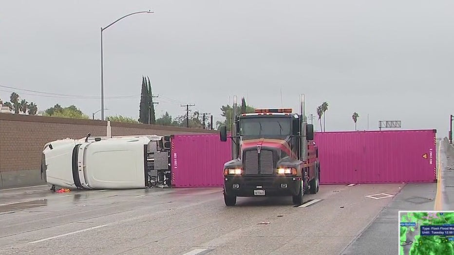
Overturned big rig
10 a.m.: An overturned big rig has shut down all but one lane on the westbound 91 Freeway near Brookhurst Street in Anaheim. Drivers should expect heavy delays and consider alternate routes.
 OC evacuations
9:55 a.m.: Orange County has just issued mandatory evacuation orders for areas in Trabuco Creek, Hot Springs Canyon and Bell Canyon — all near the Airport Fire burn scar — effective at 10 a.m. Evacuation warnings remain in place for Long Canyon and Modjeska Canyon. The mandatory evacuation orders cover areas in:
Trabuco Creek including the RC Airport, fire station, campground/park and school;Bell Canyon including Starr Ranch; andHot Springs Canyon including Lazy-W Ranch.
Also at 10 a.m., the following road closures will take effect:
Trabuco Canyon Road at Rose Canyon;Plano Trabuco near Robinson Ranch;Grey Rock at Bell Canyon; andHot Springs Canyon at Ortega Highway.
To see an up-to-date map of evacuations, visit ochseriff.gov/airportfire.
Highland Park mudslide
9:40 a.m.: A mudslide has closed two lanes of the southbound 110 Parkway at Avenue 43 in the Highland Park area, and there is a vehicle on its roof in the left lane of the eastbound 210 Freeway at Sierra Madre Villa Avenue in the Pasadena area, the CHP reports. SigAlerts are in effect in both cases.
Flooding problems
9:30 a.m.: Flooding is affecting traffic on the 5 Freeway in Sun Valley and on the 14 Freeway in Newhall, the CHP reports.
The NWS has issued a flood advisory in effect in Los Angeles County until noon today due to the excessive rainfall.
Topanga closure
9:15 a.m.: Due to the rain, a 3.6-mile stretch of Topanga Canyon Boulevard between Pacific Coast Highway and Grand View Drive will remain closed Tuesday until further notice, according to Caltrans. That stretch is a work zone that has been closed nightly between midnight and 5 a.m., however, Caltrans closed the roadway early at 10 p.m. Monday, and has decided to keep the roadway blocked Tuesday morning to monitor storm conditions.
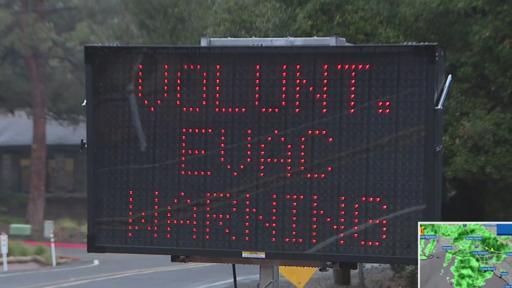
 — Evacuation warnings in effect
What we know:
Residents in areas burned in the Palisades Fire in Pacific Palisades, the Eaton Fire in Altadena, the Hurst Fire in Sylmar, and the Sunset Fire in the Hollywood Hills are advised to prepare to evacuate quickly if ordered, according to the Los Angeles Fire Department.
PREVIOUS COVERAGE: Evacuation warnings issued as dangerous storm threatens SoCal’s recent burn areas
The Sierra Madre Police Department is advising residents in specific high hazard locations to evacuate. Most residents in the Evacuation Warning zones are encouraged to voluntarily relocate. A temporary evacuation shelter has been established at Hart House Senior Center on 222 W. Sierra Madre Blvd.
In Orange County, evacuation warnings are in effect for Trabuco Creek, Bell Canyon, Hot Spring Canyon near the Airport Fire burn scar. Evacuation orders will be issued for areas Trabuco Creek including the RC Airport, fire station, campground/park and school, Bell Canyon including Starr Ranch and Hot Springs Canyon including Lazy-W Ranch due to possible debris flows along or near the Airport Fire burn scar. An evacuation warning remains in place for Long Canyon and Modjeska Canyon. To see an up-to-date map of evacuations, visit ochseriff.gov/airportfire.
 Weather alerts include tornado threat, flash flood warnings
What we know:
The rare storm system is also bringing a threat of tornadoes to Los Angeles, the first time the city has been in a tornado risk zone since February 2023, according to the FOX Forecast Center.
While uncommon, tornadoes do happen in the Los Angeles area. Most recently, a small one was reported in Los Angeles County in April. In 2023, the strongest tornado to hit the Los Angeles area in 40 years damaged several buildings in Montbello and injured one person.
SUGGESTED: Tornado in Oxnard damages a dozen structures; no injuries reported
NOAA’s Storm Prediction Center has included Los Angeles in a Level 1 risk area for severe thunderstorms on Tuesday – the lowest of the agency’s five-level scale.
The storm is expected to bring up to 4 inches of rain in some areas of Southern California. This marked the first Severe Thunderstorm Watch for the Los Angeles area in more than 17 years, since Jan. 27, 2008.
About 115 homes, mostly in Pacific Palisades and Mandeville Canyon, have been ordered to evacuate due to the potential for mudslides and debris flows in wildfire-scarred areas.
A flash flood warning and a shelter-in-place order have been issued for parts of Santa Barbara County. More than 16,000 people had already lost power as of Monday night.
The storm has also caused urban flooding in the San Francisco Bay Area and is expected to bring up to 3 feet of snow to parts of the Sierra Nevadas.
 Strike, rescue teams ready to respond
What they’re saying:
Los Angeles Mayor Karen Bass expressed her concern about the weather during a news conference Monday afternoon. She explained that strike teams, rescue teams, and helicopters were ready to respond to the storm.
Ariel Cohen, meteorologist in charge of the weather service in Los Angeles, stated that the storm is unpredictable. “The nature of this system is such that we cannot be certain about exactly when and where these impacts will strike, the exact details until right before they occur at the earliest,” he said.
Forecasters from NOAA’s Storm Prediction Center wrote, “An isolated tornado and wind-damage threat will be possible Tuesday morning through midday along the coast in southern California.”
The backstory:
The areas being evacuated were struck by a massive inferno in January that killed more than 30 people and destroyed over 17,000 homes and buildings in Los Angeles County.
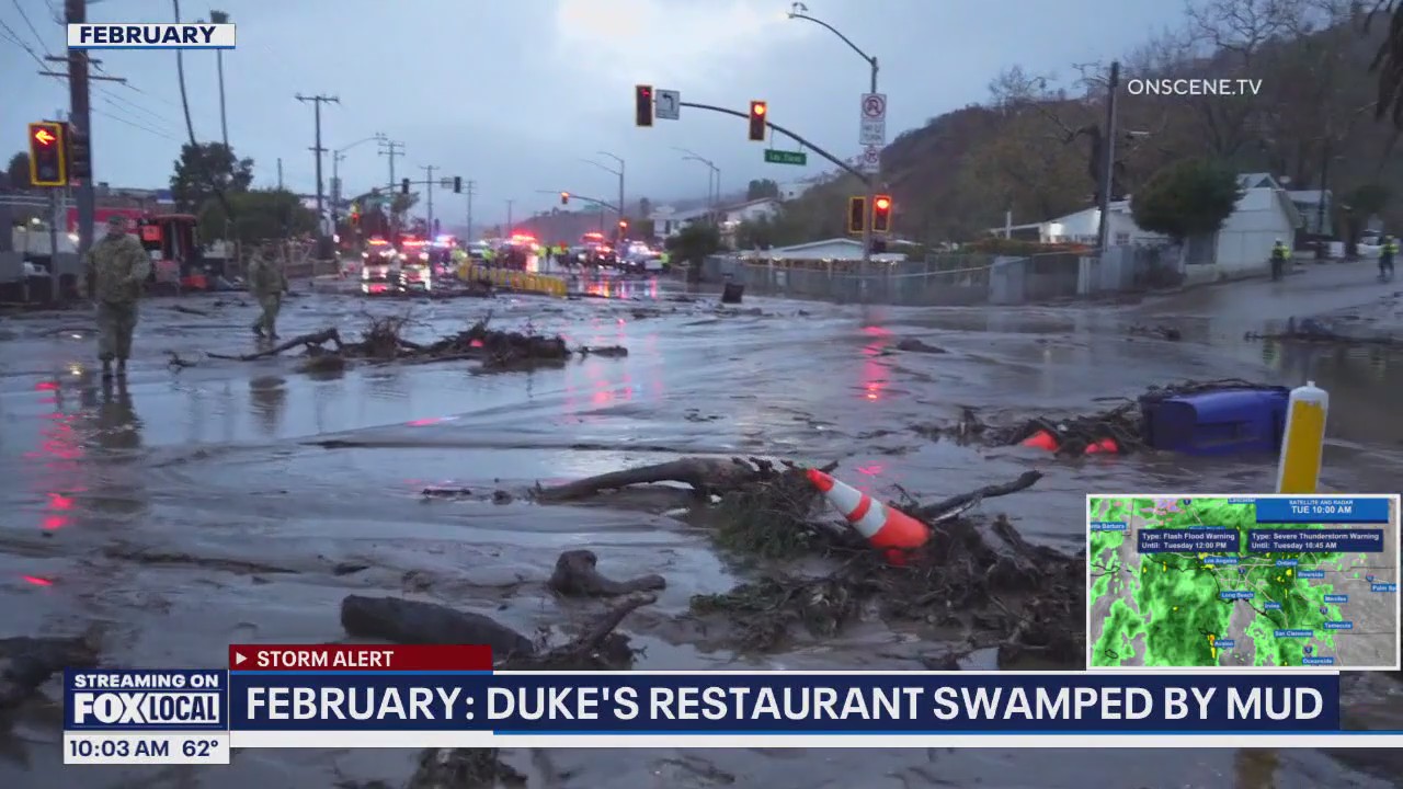
In February, torrential rains unleashed debris flows and mudslides in several neighborhoods that were torched by the January fires.
SUGGESTED: Rain triggers mudslide along PCH in Palisades Fire zone
In 2018, a similar situation occurred in Montecito, up the coast from Los Angeles, where mudslides after a huge blaze killed 23 people and damaged hundreds of homes.
When will the storm end?
What’s next:
The rain will diminish and end by late afternoon and early evening. Dry conditions and a warming trend will develop Wednesday and continue through Saturday.
The Source: Information for this story is from the National Weather Service, the FOX Forecast Center, and the NOAA’s Storm Prediction Center. City News Service and The Associated Press contributed.
Severe WeatherWeatherInstastoriesOrange CountyVentura CountyLos Angeles CountySan Bernardino CountyRiverside CountyInland Empire