
An atmospheric river event will bring widespread rain and mountain snow to much of Northern California, prompting CBS Sacramento to issue a First Alert Action Day for Thursday.
While rain arrives late Wednesday night, the most intense part of the storm is expected early Thursday morning between 3 a.m. and 10 a.m., when heavy rain and strong wind gusts move through the Valley.
Here’s what you should know.
Wind advisory and rain in the valley
Rain is expected to reach the Sacramento Valley late in the evening, with radar showing the leading edge around 8 p.m. and steadier rain by 10 or 11 p.m.
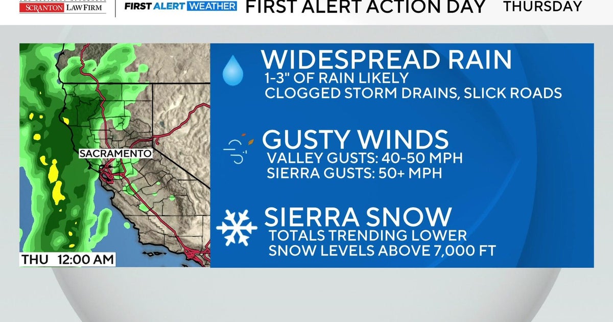
By Thursday morning, expect widespread heavy rain and gusty winds up to 50 miles per hour. This could cause flooding, especially in areas with poor drainage or leaf-clogged storm drains, and isolated power outages.
A Wind Advisory goes into effect Wednesday at 10 p.m. before easing later in the day on Thursday.
Sacramento is expected to receive 1.5 to 2 inches of rainfall from this system.

Rain in the valley should begin tapering off into scattered showers by Thursday afternoon. This is when the focus of this storm shifts to snowfall in the Sierra by the evening.
Winter Storm Watch and Sierra snow totals
A Winter Storm Watch is in effect for elevations above 5,000 feet in the Sierra Nevada from 1 a.m. Thursday through 4 a.m. Friday.
However, updated projections show snow totals trending lower due to higher snow levels. Donner Pass may now see 0 to 3 inches of snow, down from earlier estimates of 2 to 5 inches.
More from CBS News