
The Central Coast is expecting widespread rain and gusty winds on Thursday, with the heaviest rain expected between 5 a.m. and 2 p.m. Showers and periods of moderate rainfall will continue through the evening, and isolated downpours are possible in the afternoon.Mainstem river flooding is not expected, but minor urban and small-creek flooding is likely, especially in low-lying spots and areas with poor drainage. Drivers should watch for ponding on roads and reduced visibility.Winds from the south-southwest will sustain 20–25 mph, with higher gusts along southerly exposed coastlines and in elevated terrain. Gusts could approach 50 mph; Carmel-by-the-Sea may see gusts up to 48 mph.Rainfall totals will vary: coastal mountains 2–5 inches; coastal areas 1–2.25 inches; Salinas, Salinas Valley, and Hollister 0.5–1.25 inches.Looking ahead, lingering showers are possible on Friday as the system sags south. Saturday could bring more widespread rain depending on the track of a nearby low-pressure system. Another cold front is expected Sunday into Monday; timing remains uncertain, but a period of heavy rain appears likely. Additional impact days may be added as details come into focus.
SALINAS, Calif. —
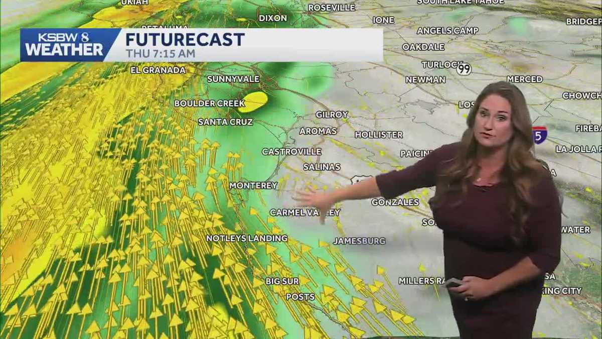
The Central Coast is expecting widespread rain and gusty winds on Thursday, with the heaviest rain expected between 5 a.m. and 2 p.m. Showers and periods of moderate rainfall will continue through the evening, and isolated downpours are possible in the afternoon.
Mainstem river flooding is not expected, but minor urban and small-creek flooding is likely, especially in low-lying spots and areas with poor drainage. Drivers should watch for ponding on roads and reduced visibility.
Winds from the south-southwest will sustain 20–25 mph, with higher gusts along southerly exposed coastlines and in elevated terrain. Gusts could approach 50 mph; Carmel-by-the-Sea may see gusts up to 48 mph.
Rainfall totals will vary: coastal mountains 2–5 inches; coastal areas 1–2.25 inches; Salinas, Salinas Valley, and Hollister 0.5–1.25 inches.
Looking ahead, lingering showers are possible on Friday as the system sags south. Saturday could bring more widespread rain depending on the track of a nearby low-pressure system.
Another cold front is expected Sunday into Monday; timing remains uncertain, but a period of heavy rain appears likely. Additional impact days may be added as details come into focus.