
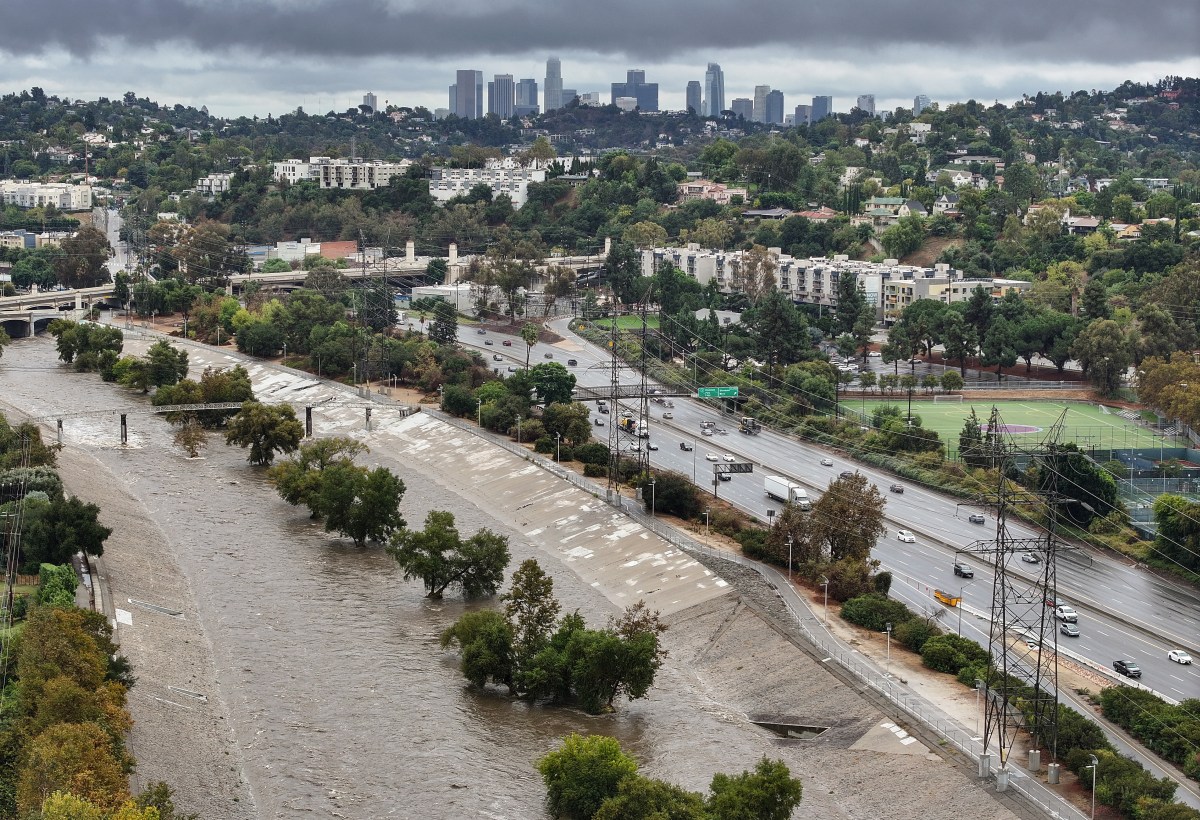
Millions of people are facing a flood risk on Friday as an atmospheric river pummels Southern California with torrential rainfall.
Areas near recent burn scars are at the highest risk of life-threatening floods, prompting Los Angeles County officials to issue evacuation orders to go into effect on Friday.
As of Friday, just after 1 p.m. ET, 380 homes were ordered to evacuate, Los Angeles County Office of Emergency Management associate director Emily Montanez told Newsweek.
Why It Matters
An atmospheric river is a “long, narrow region in the atmosphere—like rivers in the sky—that transport most of the water vapor outside of the tropics,” according to the National Oceanic and Atmospheric Administration (NOAA).
The storms brought by atmospheric rivers are known for heavy snow, heavy rain and strong winds. They are more commonly found on the West Coast, particularly during the winter months.
Although the storms can bring beneficial snow that helps supplement reservoirs throughout the summer dry season, they can also trigger deadly flooding, mudslides and widespread power outages.
 What to Know
Evacuation orders are in place for properties that “are at higher risk for mud and debris flow impacts due to the safety risk to people and animals as well as a higher risk for property damage,” in the following burn scars: Canyon, Bethany, Eaton, Palisades, Hurst, Kenneth, Sunset, Lidia, Franklin and Bridge.
“Law enforcement personnel are in the field making door to door contact to notify these specific properties,” Los Angeles County said in the order on its webpage. “Please follow all directions from field emergency responders throughout the duration of this event.”
National Weather Service (NWS) Weather Prediction Center lead forecaster Bob Oravec told Newsweek that areas of highest risk of flooding are those near recent burn scars. Wildfires can significantly alter an area’s landscape, and burned soil struggles to absorb water, causing rainfall to run off extremely quickly. This heightens the risk of flash flooding and mudslides for areas downstream.
Much of Southern California was under a flood watch on Friday, with millions of people facing impacts from heavy rain. The watch encompassed massively populated areas, including Los Angeles, San Diego, Santa Barbara, Long Beach, Malibu, and countless other cities.
What People Are Saying
Los Angeles County’s webpage about the storm: “Rain is expected across Los Angeles County starting Thursday, November 13 through to Sunday, November 16, with the potential for debris flows in recent burn scar areas.
National Weather Service (NWS) in a Friday forecast: “Excessive rainfall is the primary, life-threatening concern, with widespread flash flooding and debris flows likely across the vulnerable burn scar areas of Santa Barbara, Ventura, and Los Angeles Counties.”
NWS Los Angeles, in a flood watch: “Excessive runoff may result in flooding of roads, rivers, creeks, streams, and other low-lying and flood-prone locations, including Highway 101. There will be break between Friday afternoon and early Saturday morning when little to no rain is expected.”
What Happens Next
The NWS flood watch remains in effect at least through Saturday evening. Evacuation orders go into effect on Friday night at 8 p.m. local time and will remain in place through Sunday at 8 a.m. Evacuation warnings were issued on Thursday night and remain in place through Friday at 8 p.m.
People living in the impacted areas are urged to heed all advice from local officials and remain storm aware.
Update 11/14/25, 1:39 p.m. ET: This article was updated with comment from Emily Montanez.