
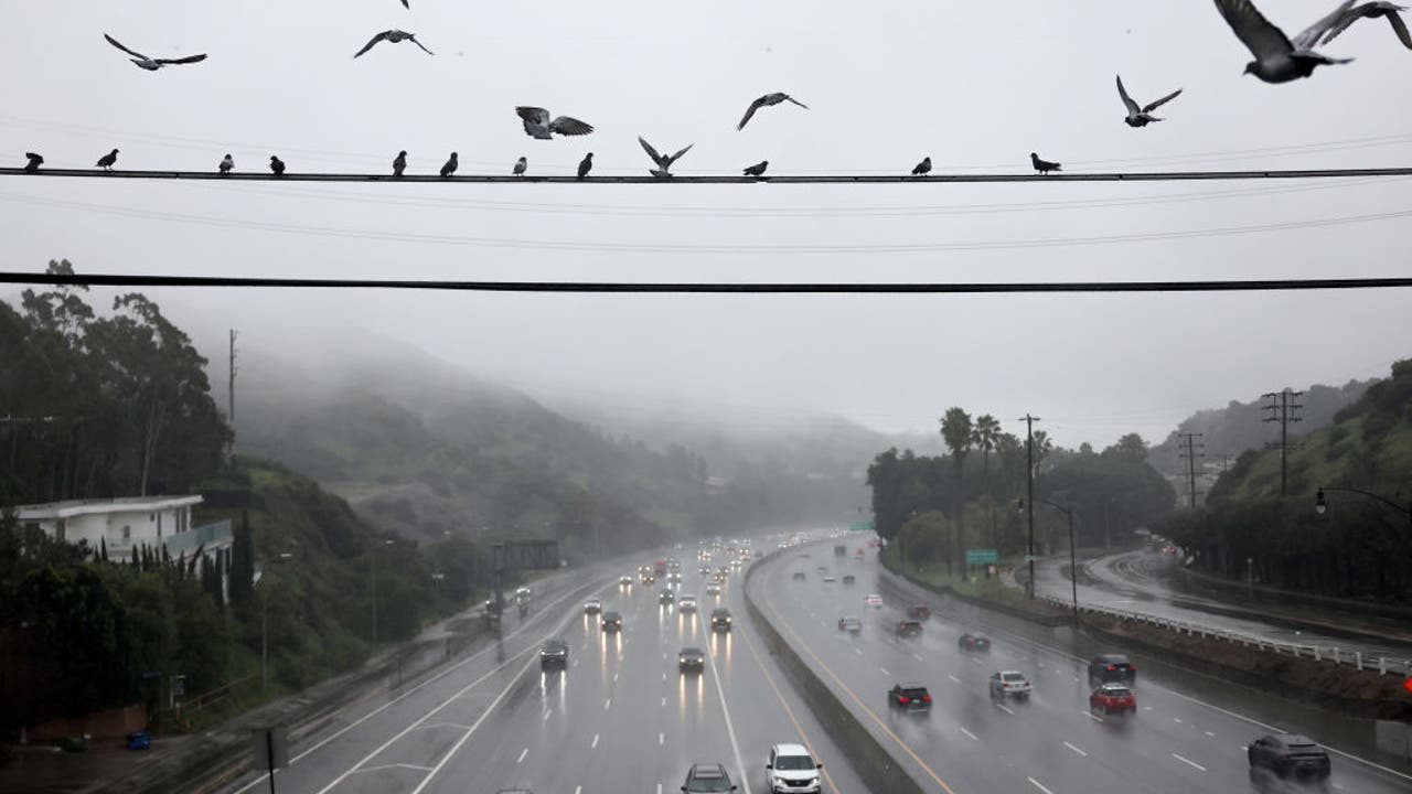
LOS ANGELES – Wet weather is expected in Southern California over the next several days as a series of storms move into the region.
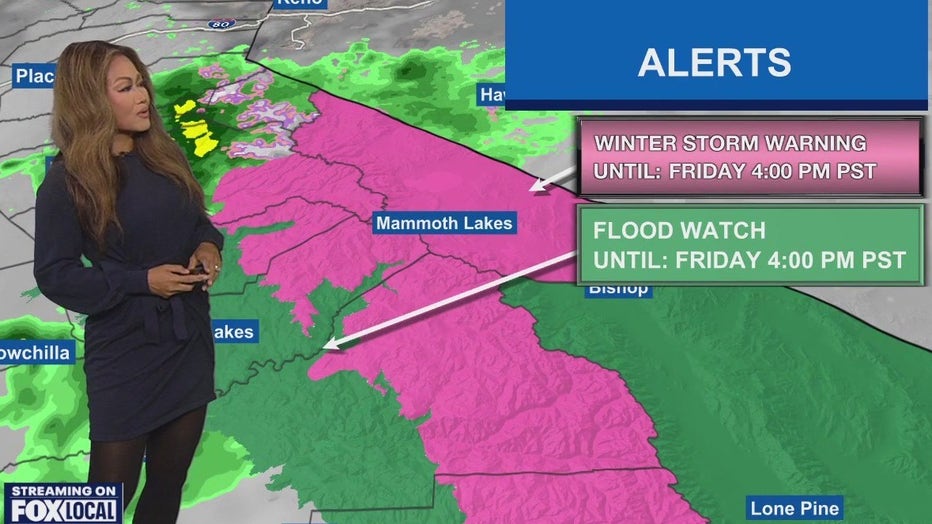
The National Weather Service is predicting the heaviest impacts to be between 3 a.m. and 6 p.m. Saturday, with a moderate risk for damaging flooding and debris flow. The storm is expected to last through Sunday.
What we know:
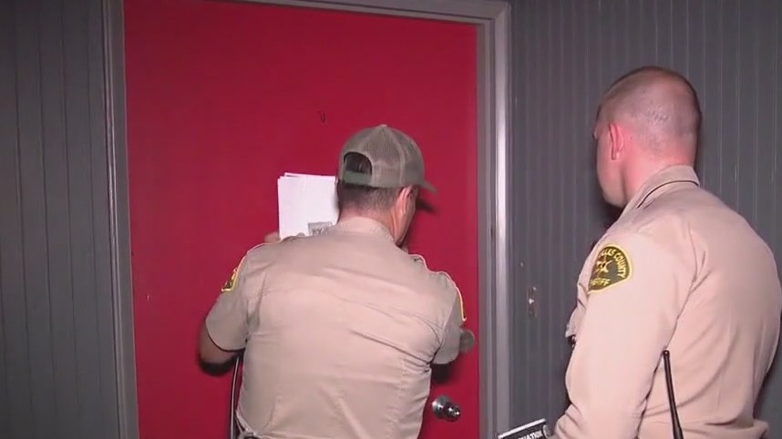
Ahead of the storm, California Gov. Gavin Newsom has pre-deployed additional emergency resources to Los Angeles, Orange, and Ventura counties. Additionally, LA County officials have issued evacuation warnings for recent burn scar areas, including Palisades, Sunset, and Eaton, in anticipation of potential mud and debris flow in vulnerable zones.
SUGGESTED: : Evacuations issued in LA County, Newsom sends additional resources
On Thursday night, Los Angeles County Sheriff’s deputies were seen going door-to-door in the Eaton Fire zone to inform residents of the evacuation warning and advise them to be prepared to evacuate at a moment’s notice.
There are chances of thunderstorms, heavy downpours, flooding, mudslides, and debris flow through the weekend, and millions are under a flood watch through 10 p.m. Saturday.
Timeline:
The first of three storms arrived late Thursday night. See a timeline for the next several days below:
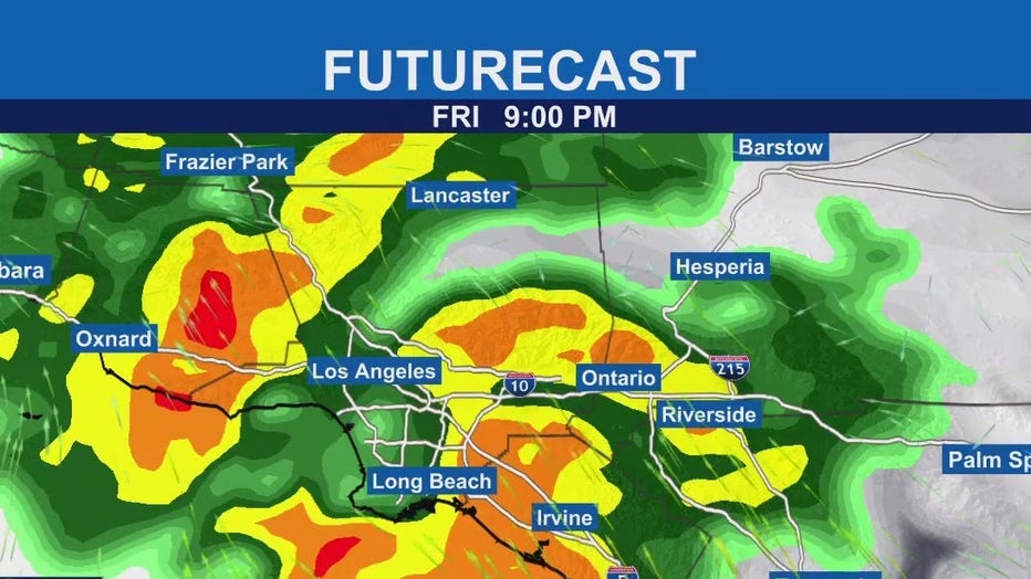
Friday: Scattered showers to start, with periods of moderate to heavy rain. The most intense rainfall is anticipated during the morning rush hour for L.A. and Orange counties, and in the Inland Empire.Friday night into Saturday afternoon: Nonstop and widespread heavy rain that could lead to mud and debris flow.Saturday afternoon and Sunday: Lingering showers.Monday and Tuesday: The second storm system arrives, bringing widespread showers. This system is expected to be weaker than the first.Thursday: A third storm system arrives Thursday and could last into Friday. 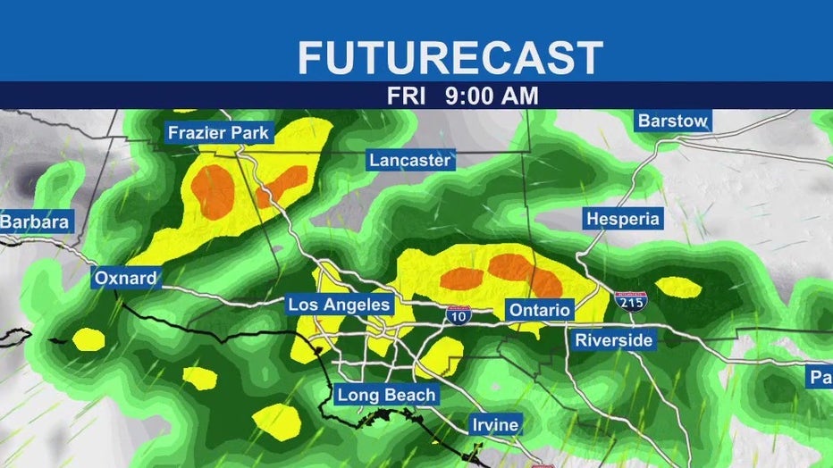
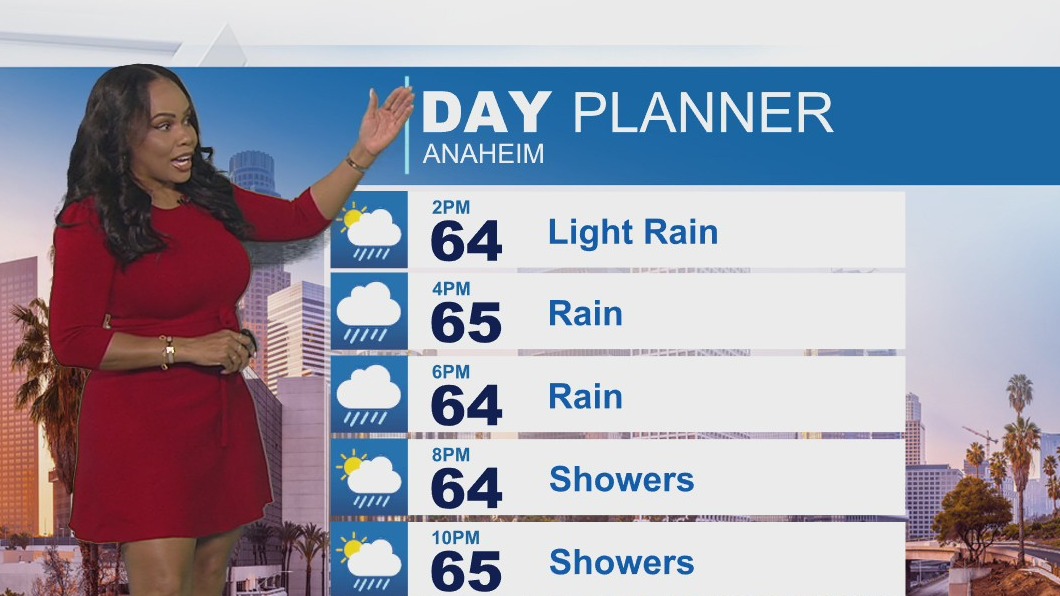
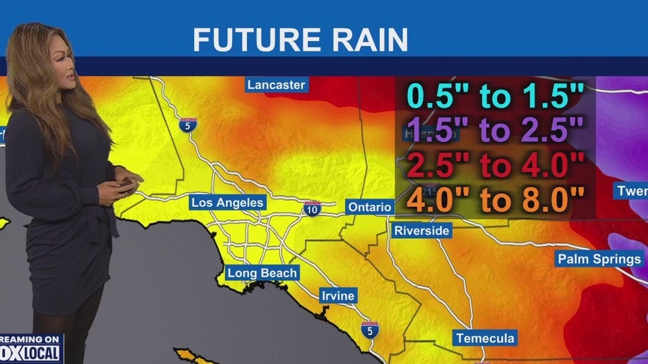
 How Much Rain Is Expected?
Rainfall from the first storm will last through the weekend.
Coasts and inland: Between 2 and 4 inches of rainFoothills and mountains: Between 4 and 8 inches
Peak rates remain around 0.25-0.50 inches/hour with isolated areas of 0.5-1.0 inches/hour, above the debris-flow threshold for the burn scar area.
What’s next:
Forecast models show chances of rain through the weekend and into early next week. The region will get a break Wednesday with mostly sunny skies, followed by another storm forecast to move in by Wednesday night into Thursday.
The Source: This information used in this story is compiled from official statements by California Gov. Gavin Newsom, updates from Los Angeles County officials, and forecasts from the National Weather Service.
Severe WeatherInland EmpireLos Angeles CountyVentura CountyRiverside CountySan Bernardino CountyOrange County