
What to KnowBursts of heavy rainfall are in the forecast overnight and Saturday, when flash flood watches will be in effect for most of Los Angeles County and Southern California. Evacuation warnings are in effect for communities near some burn scars, including near the Eaton Fire area in Altadena and the Palisades, Hurst and Sunset fire burn zones.Showers will linger through the weekend with a chance of rain early next week. Snow levels will start at 8,000 feet, lowering to 6,000 feet Thursday night into Friday. Half of California is drought-free in mid-November with pockets of moderate to severe drought in Southern California.
Widespread flood watches will be in effect overnight as the second wave of a mid-November storm unleashes steady rain in Southern California, raising the threat of flooding and debris flows in the region’s recent wildfire burn areas.
Evacuation orders were in effect for some properties considered at high-risk for debris flows in the Palisades, Eaton and other fire zones. Evacuation warnings were in place for other burn areas, meaning residents should be prepared to leave.
The system, which could also produce thunderstorms, hail and even small tornadoes, moved into Santa Barbara and Ventura counties Thursday night and brought scattered showers to Los Angeles County by early Friday morning. Rainfall was expected to intensify into the weekend with flood watches in effect overnight and through Saturday for parts of Los Angeles, Orange, San Bernardino and Riverside counties.
Rainfall rates of up to 1 inch per hour are possible, increasing the Saturday flood risk.
Here’s what to know about the mid-November storm.
Storm timeline
Overnight and early Saturday morning: Steady rain with increased threats for flooding and debris flows. Flood watches go into effect for a widespread area.
Midday Saturday: Rainfall rates reach their peaks with an increased chance for thunderstorms.
Saturday evening: Rainfall starts to wind down, but showers continue into the night.
Sunday: Lingering showers, but most areas will start to dry out.
A separate, but less powerful, system appears on track to deliver more rain early next week.
Temperatures will be in the 60s for most of the region. Strong wind gusts are possible.
Rain and snowfall estimates
Most areas: 2 to 5 inches. Normal precipitation for November in downtown Los Angeles is 0.76 inches.
Mountains and foothills: 3 to 6 inches
Snow levels: Around 8,000 feet, lowering to 6,000 feet Thursday night into Friday. A few inches are possible at resort level.
Rainfall estimates and the storm timeline might change, depending on the path of the storm.
Evacuations
On Friday morning, the city of Los Angeles said evacuation orders were issued for “select vulnerable properties within burn scar areas” beginning at 8 p.m. Friday through 8 a.m. Sunday. LAPD Chief Jim McDonnell said the evacuation warnings that had been issued in the Pacific Palisades, especially areas near the burn scar zones, are now under evacuation orders “due to the increased risk of mud and debris flow.”
“Recent burn areas, including those impacted by the January 7 wildfires, remain highly susceptible to mud and debris flows,” the city said in a statement. “Residents in these areas are urged to stay vigilant, monitor official weather updates, and avoid unnecessary travel during the storm—especially if they have been advised of potential mudflow risks in their neighborhoods.”
Los Angeles’ Emergency Operations Center will activate at 6 p.m. Thursday.
Evacuation warnings also were issued Friday for parts of Ventura County.
“If your home is within the impacted area, please evacuate before 8 p.m. tonight,” McDonnell said. “Take your family, pets, medications, important documents, and any essentials you may need.”
Similarly, Los Angeles County updated the evacuation warnings to orders in Altadena, urging those who live in recent burn areas to leave their neighborhoods by 8 p.m. Friday. The evacuation order was expected to expire at 8 a.m. Sunday.
Debris flow risk
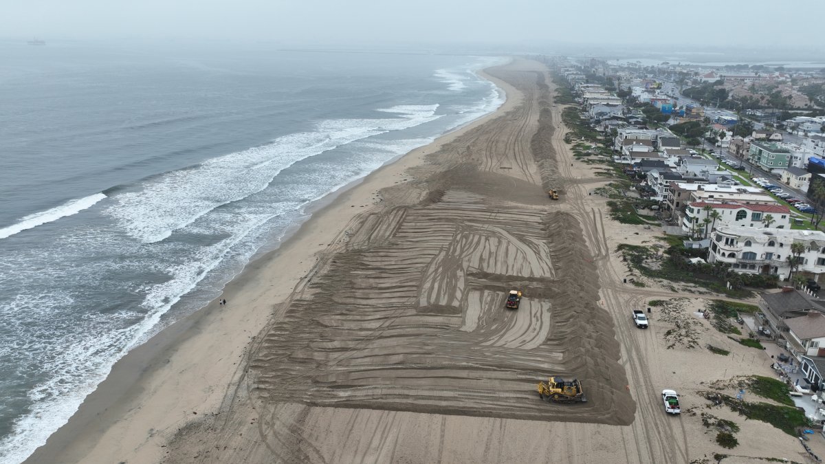
After months of mostly dry weather in Southern California, dry soil can quickly become over-saturated and unable to adequately absorb moisture. The result can be damaging mudslides and debris flows, which collect large rocks, trees, branches and other items as they move downhill, sometimes with alarming speed.
In wildfire burn areas, the risk is higher. Burned soil repels water, meaning debris flows can be triggered with much less rainfall that areas with healthy vegetation.
An atmospheric river will bring heavy rainfall, likely with dangerous flooding and debris flows, to parts of Southern California today into the weekend.
A debris flow happens when normally dry soil becomes overly saturated, reaching a point where it turns to a liquid state and… pic.twitter.com/o7wQu4HSPM
— National Weather Service (@NWS) November 14, 2025
Road closures
In the Palisades Fire area, Caltrans will close Topanga Canyon Boulevard between Pacific Coast Highway and Grand View Drive at 10 p.m. Thursday. Caltrans officials said motorists should expect the stretch to remain closed at least through the Friday morning commute, but potentially through the weekend, depending how the storm develops.
That stretch of Topanga Canyon has been undergoing nightly repairs, with the road closed between midnight and 5 a.m.
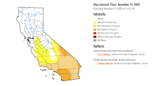
The California Drought Monitor map for Nov. 13, 2025.
California drought update
Moderate to severe drought was reported in pockets of Southern California with most of the state drought-free, according to Thursday’s Drought Monitor update.
Nine percent of California was in severe drought, the second-least severe of the Monitor’s four drought categories. Areas include most of Orange County, western Riverside County and slivers of San Bernardino County.
About 32 percent of the state was in moderate drought. Nearly 50 percent of California was drought-free.
At this time last year 5 percent of the state was in severe drought with 17 percent in m moderate drought. Three months ago near the end of a hot and dry summer, 23 percent of the state was in severe drought with nearly 40 percent in severe drought.