
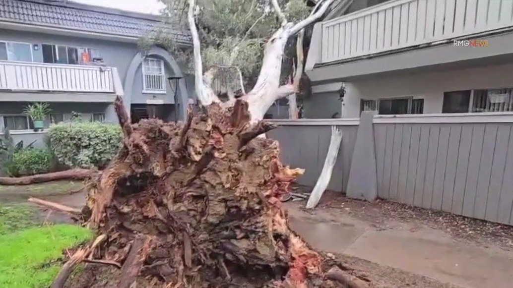
LOS ANGELES – After a weekend of heavy rain and flash flooding, Southern California will once again get hit with yet another round of storms.
The second round of storms, following Round 1 from Friday to Sunday, is expected to bring rain Monday and Tuesday. A third round of storms is expected to make an appearance Thursday and into Friday, according to FOX 11 Meteorologist Star Harvey.
While evacuation orders and warnings from last weekend have since expired, officials are warning Angelenos to stay aware as flooding and mudslide threats are expected to linger over the next few days.
Below are the latest updates from FOX 11 as we track the rain system:
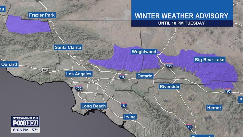
6 p.m.: A Winter Weather Advisory is in effect until 10 p.m. Tuesday for the high elevation areas of Frazier Park, Wrightwood, and Big Bear lake.
Those areas could see five to ten inches of snow by the end of Tuesday.
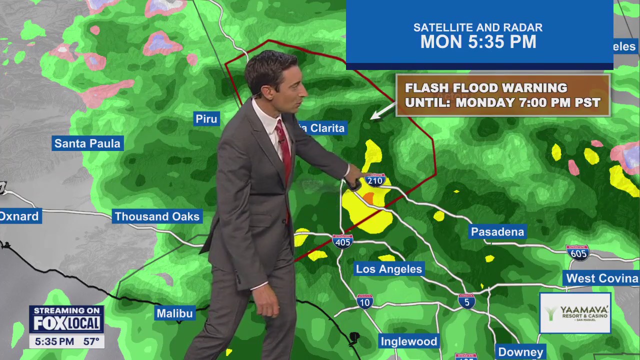
4:50 p.m.: The National Weather Service has issued a Flash Flood Warning for West-Central Los Angeles County until 7 p.m.
Second storm arrives Monday
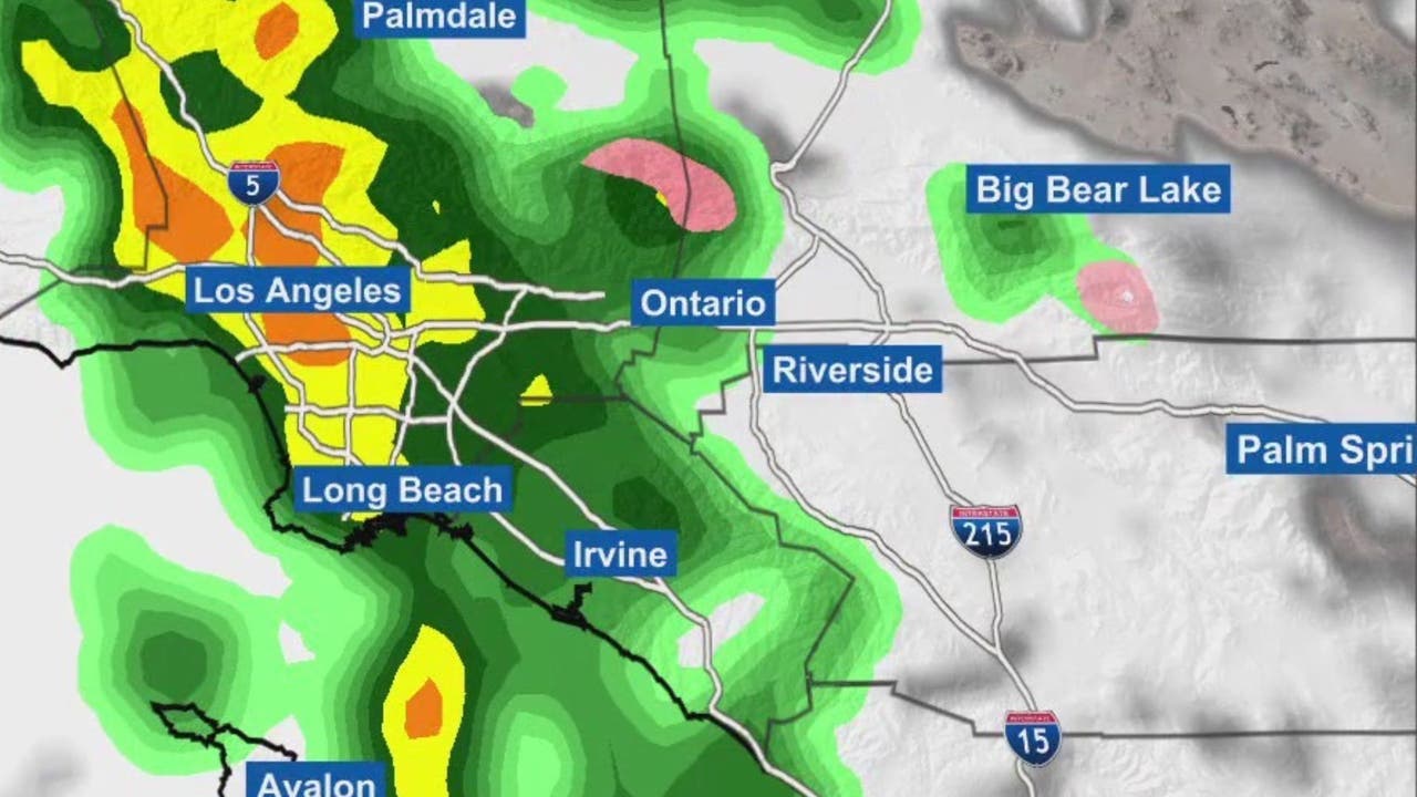
3 p.m.: A cold front will bring moderate to heavy rainfall with a slight chance of thunderstorms across LA County through Monday evening.
The National Weather Service issued several flood advisories Monday afternoon as some storm cells dropped rain at a rapid pace in parts of the area. Many areas, however, saw only light rain, but enough to dampen streets heading into the afternoon commute.
“Behind the front (Monday night) and Tuesday, an unstable and showery pattern will prevail as the upper low drops southward,” according to the NWS. “By Tuesday evening, rainfall totals with this system are expected to range from 0.50-1.00 inches for coastal/valley areas with 1-2 inches for the foothills and mountains. Rainfall rates through Tuesday are expected to generally be under 0.50 inches per hour and will generate nuisance flooding across the area.”
But forecasters warned that isolated pockets could see rain rates of about an inch per hour, which could trigger more serious flooding and debris flows. A dusting of snow was also possible along the Grapevine stretch of the 5 Freeway on Tuesday morning.
What to expect for the rest of the week
What’s next:
Forecasters said the rain would continue to fall into late Monday night, “with decreasing showers continuing into Tuesday.”
The storm system was expected to be out of the area by late Tuesday. But another storm system is expected to arrive by Thursday afternoon.
The Source: This story was reported with information from FOX 11’s ground and sky crews, local officials, the National Weather Service and FOX 11’s Weather Team.
Severe WeatherWeatherLos Angeles CountyOrange CountySan Bernardino CountyRiverside CountyVentura CountyInstastoriesCalifornia