

What to KnowShowers will increase after lunchtime on Thursday with some heavy rain overnight.Shower chances will linger into Friday with cloudy skies and cool daytime highs.Some rain could linger into early Saturday, with mountains and deserts having the highest chances
Forecasts for San Diego County on Thursday called for yet another storm, albeit weaker, to hit the area, bringing more wet weather.
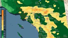
“The next low-pressure system from the northwest will bring more widespread showers late Thursday afternoon into Friday,” said the National Weather Service.
There will also be a 15% chance of thunderstorms on Thursday. Shower chances will linger into Friday with cloudy skies and cool daytime highs. Some rain could linger into early Saturday, with mountains and deserts having the highest chances, meteorologist Sheena Parveen said.
Widespread showers with a 15% chance of thunderstorms Thursday afternoon into Friday night. Lighter, more scattered showers are expected Saturday, the NWS said.
Snow levels were also predicted to lower to around 6000 feet late Thursday night, and there could be moderate to heavy snowfall in the mountains above 6500 feet.
Once the current storm system moves through the greater San Diego area, warmer, drier conditions are predicted through the Thanksgiving holiday.
“Drier and warmer next week with high temperatures warming to within a few degrees of average for Tuesday and Wednesday,” the NWS said.
Thursday temperatures:
COAST: increasing clouds, PM rain – low 60s
INLAND: increasing clouds, PM rain – low 60s
MTNS: PM Showers – upper 40s
DESERTS: late rain – mid 60s