
The biggest storm in months unloaded heavy rain and mountain snow across California to start the week, forcing evacuations near areas devastates by historic wildfires.
Published Oct 15, 2025 11:46 AM EDT
|
Updated Oct 15, 2025 1:05 PM EDT
The southwestern U.S. had a wide range of weather conditions, including powerful winds, heavy rain, flooding and even snowfall in California’s mountain regions.
The first major storm in months barreled into California earlier this week, delivering the wettest October day in years and prompting evacuations near areas scarred by the historic wildfires from January.
The storm resembled the powerful winter storms that typically hit the West Coast during the middle of the wet season, unleashing widespread rain and mountain snow. Precipitation began on Monday across Northern and Central California before spreading into Southern California on Tuesday.
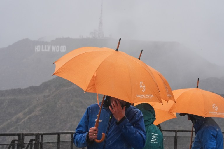
Tourists from Poland carry umbrellas in front of the Hollywood sign as rain falls while visiting the Griffith Observatory Tuesday, Oct. 14, 2025, in Los Angeles. (AP Photo/Damian Dovarganes)
Evacuations were ordered for some areas surrounding the Eaton Fire and Palisades Fire burn scars due to the risk of flooding and mudslides, according to ABC7.
In these areas, the charred, vegetation-free ground acts more like pavement than normal soil, resulting in a much higher risk of debris flows and destructive flooding. As of Wednesday morning, no major mudslides had been reported near the burn scars.
Rain comes down on a neighborhood in the Palisades Fire zone on Tuesday, Oct. 14, 2025, in the Pacific Palisades section of Los Angeles. (AP Photo/Ethan Swope)
Downtown Los Angeles measured 1.38 inches of rain on Tuesday, the wettest day in the city since February and the biggest single-day rainfall total in the month of October in 16 years.
Rainfall was heavy enough to set daily rainfall records elsewhere across Southern California, including in Burbank, where 2.28 inches washed away the previous record of 0.25 of an inch set on Oct. 14, 2009. New records for the date were also set in Camarillo, Santa Maria and Lancaster.
Despite the soaking, California remains in a rainfall deficit for 2025 after a dry start to the year. San Diego has received only 76% of its historical average rainfall so far, while San Francisco has measured just 67% of normal through Oct. 14.
In the higher elevations, the storm delivered a preview of winter with snow blanketing the Sierra Nevada. Drivers along Interstate 80 near Donner Pass faced treacherous travel as snow accumulated.
“First storm of the year is here and so is chain control,” California Highway Patrol posted on X. “Snow is falling, roads are slick, and we’ve already got vehicles taking detours into the brush. If you’re headed this way, SLOW DOWN and give yourself extra space!”
Mammoth Mountain was one of the snowier spots in California, where the ski resort measured 10 inches of snow. Cold Spring Summit also reported 13 inches.
Snow covers Mammoth Mountain, California, on Tuesday, Oct. 14, 2025. (Dakota Snider, Mammoth Mountain)
The same storm that brought rain and snow to California is now sweeping eastward, poised to spark severe weather across the central U.S. through the end of the week and into the weekend.