
The cold front that moved across Central Florida overnight is set to drop temperatures even lower into Wednesday morning, according to the National Weather Service.
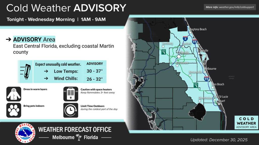
Most of the region is under a Cold Weather Advisory from 1-9 a.m. Wednesday as temperatures drop to the low to mid 30s, but the wind chill will make the feels-like temperatures as low as the mid 20s.
“Wind chills this cold could be hazardous for those without access to adequate warmth, clothing, or shelter,” the NWS stated in its forecaster’s discussion.
Many cold-weather shelters in Central Florida have opened their doors to support those at risk.
A Freeze Watch is also in effect for the same period for Lake County and inland Volusia County.
Highs today will range from the upper 50s as the front moves farther south before the overnight chilldown.
“Breezy northwesterly winds of 8-12 mph, with gusts to around 20 mph at times, will make daytime temperatures feel a couple of degrees even cooler this afternoon,” the NWS stated.
Similar conditions will repeat on Wednesday into Thursday, which is New Year’s Day, and again into Friday, although Tuesday night into Wednesday morning should be the harshest of the week.