
A cold New Year’s Day in Central Florida; warmup on the way
LIKE WE’RE DOING THIS, RIGHT? YEAH. SO, OKAY. THE RADAR IS QUIET. THANKFULLY, THIS MORNING, THOUGH, WE DO HAVE ONE BIG THING THAT WE’RE MONITORING, AND THAT’S THE THREAT FOR FROST. THAT’S WHY IT’S IMPACT WEATHER OUT THE DOOR. IT IS COLD, COLD, COLD AGAIN. BUT THE NEXT COUPLE OF DAYS WE WATCH THE TEMPERATURES WARM AND THEN LOOKING AHEAD TO SATURDAY AFTERNOON EVENING. THERE’S EVEN THE CHANCE OF SOME RAIN. WE’LL GET TO ALL OF THAT IN A MINUTE. I’VE GOT TO GET YOU OUT THE DOOR FIRST, THOUGH, BECAUSE LOOK HERE IN VOLUSIA COUNTY, WEST VOLUSIA, 30 DEGREES IN DELAY ON SPRINGS. IT IS COLD, COLD THERE. 36 IN VICTORIA GARDENS, 32 AT THE SPRUCE CREEK FLY-IN. IT’S 41, THOUGH, RIGHT ON PONCE INLET AROUND SEMINOLE COUNTY. 36 IN CASSELBERRY AND ALTAMONTE SPRINGS, 33 ASTOR FARMS WAKING UP TO 37 DEGREES OVER AT THE SANFORD AIRPORT. IT’S 38 IN TITUSVILLE, 39 IN NORTH MELBOURNE. BUT YOU GET OVER TO THE BEACH SIDE OUT ON THE BARRIER ISLAND, 45 AT THE PORT, 46 OVER AT PATRICK. WIDE PERSPECTIVE SHOWING 39 IN ORLANDO. BUT LOOK AT OCALA. YOU ARE SITTING IN THAT HARD FREEZE TERRITORY NOW ONCE AGAIN AT 28 DEGREES. SO IT’S A GORGEOUS CLEAR SKY. IT IS A VERY COLD MORNING, BUT I WANT YOU TO NOTICE ON OUR DAY PLANNER FORECAST HOW TEMPERATURES CLIMB BEAUTIFULLY. 50 7:11 A.M., 1 P.M. 62. AND WE’LL TOP OFF AT 65 DEGREES. IT’S GOING TO BE AN ABSOLUTELY GORGEOUS DAY FOR US. TEMPERATURES NOT QUITE TO THE AVERAGE. THE AVERAGE IS 72, BUT AT LEAST WE’RE GETTING THERE WITH READINGS BACK INTO THE MID 60S. SO HIGH PRESSURE BUILDING IN THESE NEXT COUPLE OF DAYS THAT’S GOING TO BRING IN WARMER AIR FOR US. AND THEN THERE’S A WEAK COLD FRONT THAT’S GOING TO TRY AND SNEAK IN SOME SHOWERS COME THIS WEEKEND. FOR NOW, FUTURECAST SAYS LUNCHTIME SATURDAY, A FEW SHOWERS OUT BY I-75 AND THROUGH THE AFTERNOON. THERE MAY BE A FEW SHOWERS PASSING THROUGH, BUT THE OVERALL RAIN COVERAGE INCREASES SATURDAY LATE INTO OVERNIGHT EARLY SUNDAY. SO FOR THE MOST PART, WE’RE ACTUALLY LOOKING GOOD. WE’RE GOING TO BE ABLE TO DODGE MOST OF THE RAIN, BUT I AT LEAST NEED TO PUT THAT 30% COVERAGE IN THERE FOR SATURDAY. IN THE MEANTIME, FOR TODAY, IT’S IMPACT WEATHER THIS MORNING, BUT IT’S A BEAUTIFUL AFTERNOON TOMORROW. MORE CLOUDS, BUT IT’S A MILDER FORECAST. KEEPING WITH THAT MILDER STRETCH WILL DROP OFF A LITTLE BIT WITH THAT WEAK FRONT ON SUNDAY. AND THEN NOTICE MONDAY, TUESDAY, WEDNESDAY. THOSE TEMPERATURES CONTINUE TO CLIMB. COASTAL SEVEN DAY FORECAST WILL ACTUALLY LEAVE COASTAL SHOWERS IN ALL NEXT WEEK, SO JUST KEEP THAT IN MIND AS WE CONTINUE TO WARM THOUGH THE QUESTION BEGINS WHEN WILL THE NEXT COL
A cold New Year’s Day in Central Florida; warmup on the way

Updated: 5:59 AM EST Jan 1, 2026
A freeze warning and frost advisory have been issued for parts of Central Florida on Thursday morning.The First Warning Weather team is calling for Impact Weather until 8 a.m. for Sumter County, including the cities of Bushnell, Lake Panasoffkee, The Villages and Wildwood. A frost warning remains in effect for parts of southwest and west central Florida. Frost could harm sensitive outdoor vegetation. Sensitive outdoor plants may be killed if left uncovered.Ocala’s low temp this morning was 28 degrees. Meanwhile, it was 39 in Orlando.ImpactsFrost and freeze conditions could kill crops and other sensitive vegetation and possibly damage unprotected outdoor plumbing.Looking aheadFirst Warning Weather Stay with WESH 2 online and on air for the most accurate Central Florida weather forecast.RadarSevere Weather AlertsDownload the WESH 2 News app to get the most up-to-date weather alerts. The First Warning Weather team includes First Warning Chief Meteorologist Tony Mainolfi, Eric Burris, Marquise Meda and Cam Tran.What is Impact Weather?Impact Weather suggests weather conditions could be disruptive or a nuisance for travel and day-to-day activities.What is a Severe Weather Warning Day?A Severe Weather Warning Day suggests weather conditions that could potentially harm life or property.
A freeze warning and frost advisory have been issued for parts of Central Florida on Thursday morning.
The First Warning Weather team is calling for Impact Weather until 8 a.m. for Sumter County, including the cities of Bushnell, Lake Panasoffkee, The Villages and Wildwood.
A frost warning remains in effect for parts of southwest and west central Florida. Frost could harm sensitive outdoor vegetation. Sensitive outdoor plants may be killed if left uncovered.
Ocala’s low temp this morning was 28 degrees. Meanwhile, it was 39 in Orlando.

WESH 2 News
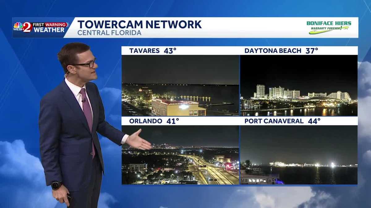
Temps on Thursday morning
Impacts
Frost and freeze conditions could kill crops and other sensitive vegetation and possibly damage unprotected outdoor plumbing.

This content is imported from Twitter.
You may be able to find the same content in another format, or you may be able to find more information, at their web site.
Looking ahead
This content is imported from Twitter.
You may be able to find the same content in another format, or you may be able to find more information, at their web site.
First Warning Weather
Stay with WESH 2 online and on air for the most accurate Central Florida weather forecast.
Download the WESH 2 News app to get the most up-to-date weather alerts.
The First Warning Weather team includes First Warning Chief Meteorologist Tony Mainolfi, Eric Burris, Marquise Meda and Cam Tran.
What is Impact Weather?
Impact Weather suggests weather conditions could be disruptive or a nuisance for travel and day-to-day activities.
What is a Severe Weather Warning Day?
A Severe Weather Warning Day suggests weather conditions that could potentially harm life or property.