
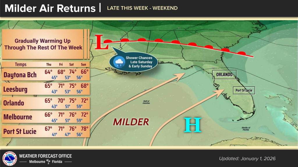
Central Florida woke up New Year’s Day to a frost advisory, but temperatures will continue to climb into the weekend, according to the National Weather Service in Melbourne.
Clear, sunny skies are on tap Thursday with highs moving into the 60s. Overnight lows into Friday will still be colder than normal dropping into the 40s, but Friday and Saturday will continue the warming trend each day.
With dry days on tap, Saturday’s highs should be in the mid 70s before a weather system over the Southeast U.S. brings a chance for any precipitation.
“High pressure over the Gulf will build eastward through late week, crossing the southern Florida peninsula on
Friday. An upper level trough moves farther eastward through the period, with increasingly zonal flow developing aloft,” the NWS stated in its forecaster’s discussion. “Locally, dry conditions prevail, with no mentionable rain chances through the period.”
Overnight lows should climb back up to the lower 50s by Friday night and upper 50s on Saturday night.
A cold front that could bring some winds and rain Saturday night could see overnight lows Sunday into Monday drop back into the upper 40s and lower 50s, but it won’t be as severe as the cold seen across Central Florida this week.