
TALLAHASSEE, Fla. (WCTV) – Cloudy and warm to end the holiday week. Showers are likely as we kick off the first weekend of 2026.
☁️Warm with clouds today:
Clouds are already here to start your Friday. Despite the cloud cover, it is still chilly. Temperatures in the 30s this morning.
Clouds will stick around throughout the day. Despite the lack of all-day sunshine, we will still reach the upper 60s and low 70s this afternoon. I do not expect any rain today.
Overnight clouds stick around. The blanket of clouds will help keep temperatures milder in the 40s and 50s.
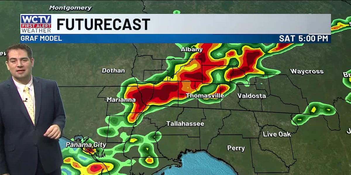
🌧️Rounds of showers on Saturday:
You can check out WCTV First Alert Weather Now for a long-form breakdown of this weekend’s rain and storms. ⬇️
Saturday’s weather will be one to keep a close eye on. Rounds of showers and storms are expected.
For locations west of the Apalachicola River, showers will be around during the morning as you wake up for your weekend.
For the majority of the Big Bend and South Georgia, the chance of rain and storms will be between 10 a.m. and 6 p.m. Several rounds of rain and storms are expected throughout the time period, but it will NOT be raining the whole day.
For the southeast Big Bend, rain will not move in until the afternoon.
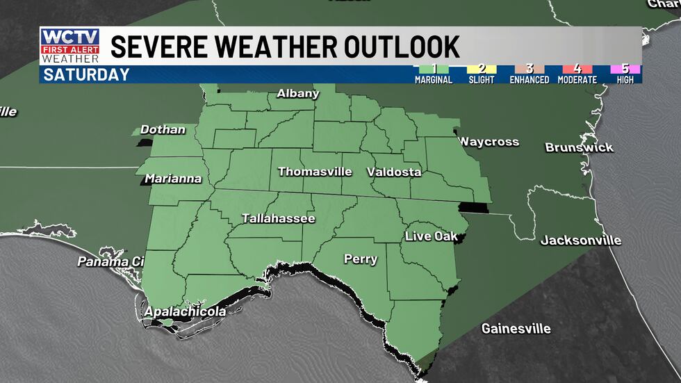
Severe weather is not expected, but there is a chance that one or two storms could reach severe limits producing 60 mph wind gusts, small hail, or a brief tornado. The chance of this is very low, but there is a chance. The Storm Prediction Center has placed our area under a marginal risk because of this.
 A chance of a few stronger storms Saturday.(WCTV)
Rain and storms should be out of the area by 7 or 8 p.m.
⛅Drier on Sunday:
The cold front will drag in drier and slightly cooler air. Morning lows will be in the 40s and a few 30s. Daytime highs reach the upper 60s with mostly sunny skies.
😎Turning above-average next week:
Sunshine to start the week with highs in the upper 60s.
Sun and clouds through the remainder of the week and warmer in the mid-70s.
To stay updated on all the latest forecasts and weather, follow WCTV First Alert Weather on Facebook and X (Twitter).
Click here to see all the latest weather headlines and here to view the First Alert Radar. Receive push alerts and watch the latest forecast anytime on the free WCTV First Alert Weather app. Click here to download it now.
Interested in becoming a WCTV First Alert Weather Watcher? Click here to join the team!
Copyright 2025 WCTV. All rights reserved.