
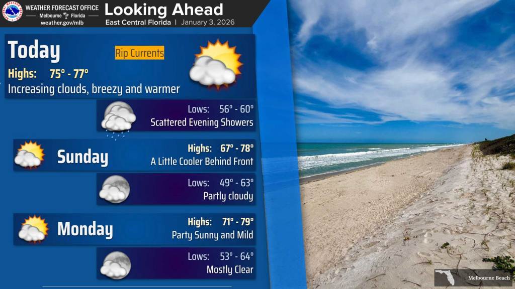
Central Florida will be in store for a warm day with light breezes before a cold front that won’t be as harsh as the previous front moves through the region Saturday night into Sunday, according to the National Weather Service in Melbourne.
Temperatures should climb into the mid 70s as southwest winds gust from 15-25 mph this afternoon.
Scattered showers are forecast then to push southward over east Central Florida, beginning Saturday evening into Sunday morning. Shower chances are higher north of I-4 as precipitation is expected to dissipate the farther south the front moves.
Drier air coming in means highs may hit only the upper 60s on Sunday north of Orlando and low 70s farther south.
By Monday, all areas will get warmer hitting the upper 70s. That sets up a week of spring-like weather in store for the region with highs into the low 80s on Tuesday and maybe as high as 85 degrees by Friday.
“Statistical guidance also shows a 10-20% chance of at least tying daily record highs late next week at Orlando and Leesburg,” the NWS stated.