
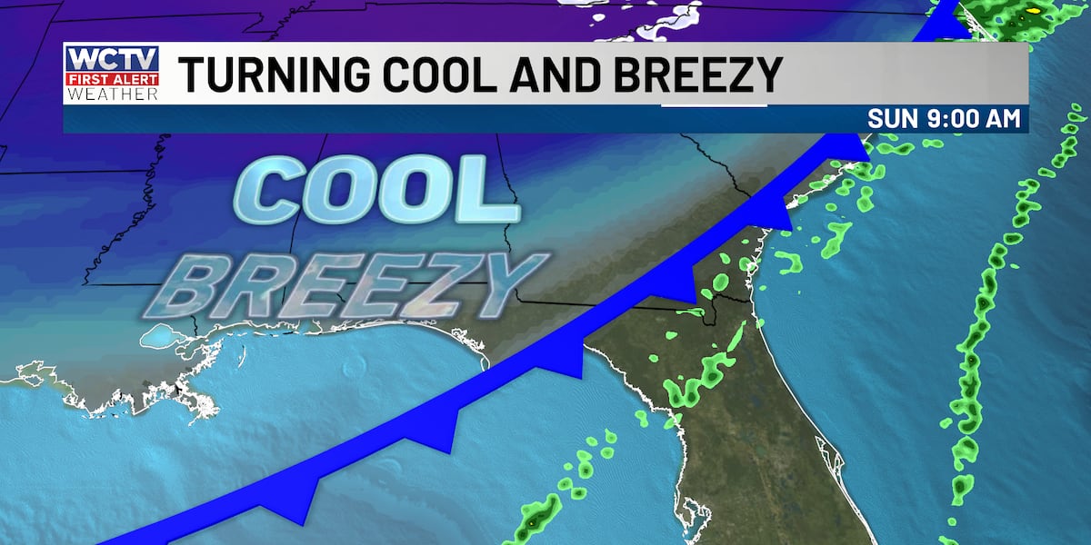
TALLAHASSEE, Fla. (WCTV) – A cold front is moving through the area this morning, bringing gusty winds, cooler temperatures, and rough boating conditions. While the front will pass through by late morning, its effects will linger throughout the day, with breezy conditions and a noticeable chill in the air.
Breezy Sunday with temperatures dropping into the 50s and 60s.Sunday: Gusty Winds and Cooler Temps
Lingering showers ahead of the cold front will clear out early Sunday morning for folks in the eastern Big Bend as the system moves through. Once it passes, expect much cooler conditions with highs only reaching the upper 50s across northern and western areas, and low to mid 60s in the southeast, which is slightly below normal for mid-January.
Gusty northwest winds will be the story today, with gusts between 20 and 30 mph throughout the afternoon. These winds are strong enough to make it feel noticeably colder and could knock around loose outdoor items. If you’re heading out, secure anything that could blow away.
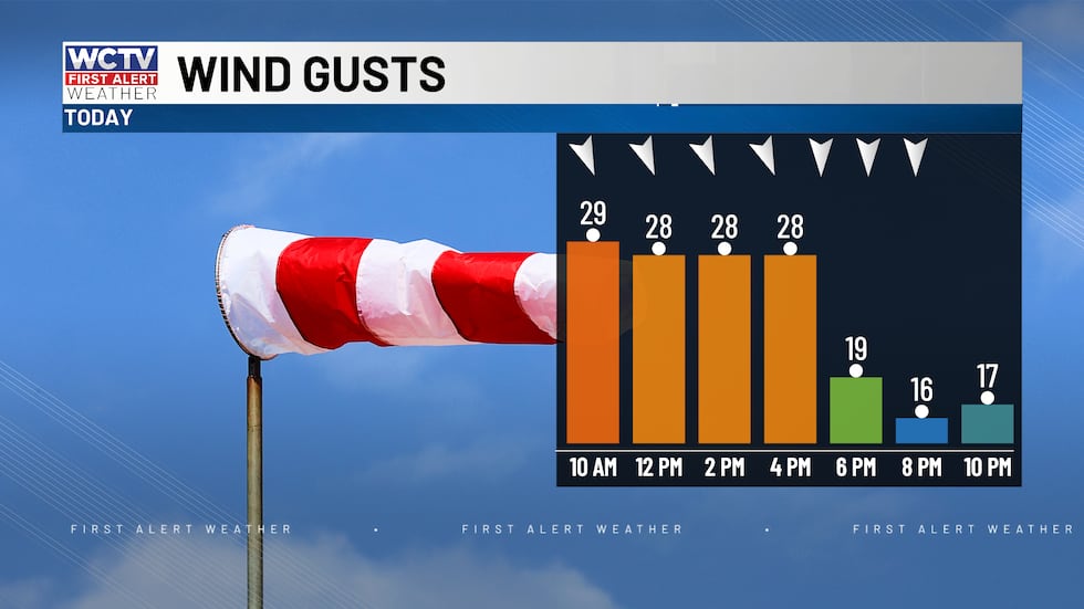 Winds are expected to gust over 20 mph this afternoon.(WCTV)Poor Boating Conditions Today:
If you’re planning to get out on the water today, be aware of hazardous conditions. Small craft advisories are in effect through Monday morning, with advisory-level northerly winds of 20-25 knots creating rough seas. Additionally, there’s a high risk for rip currents through late Sunday night, so swimmers should stay out of the water entirely.
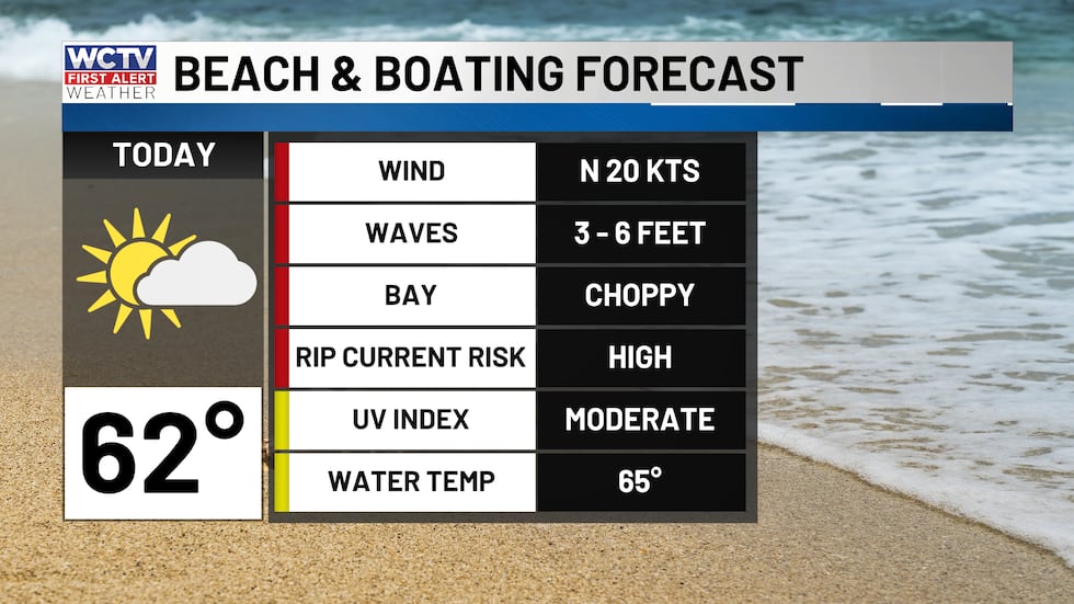 Beach and boating forecasts are a bit choppy today.(WCTV)Tonight and Monday: Cold but Calmer
Tonight will be cold with lows in the low to mid 30s across most of the area. While the front will have passed by morning, the cold air mass will remain in place. Monday will be a cool day with highs remaining in the 50s for most areas as high pressure builds in. Winds will be much lighter, making conditions more pleasant, though still chilly.
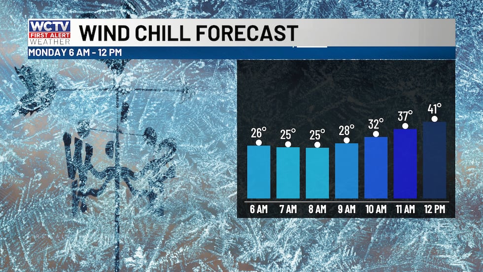 Wind chills in the 20s this morning.(WCTV)Looking Ahead: Another System Midweek
The cold air will briefly moderate by midweek, but another weather system is expected to move in by late Wednesday into Thursday. This system will bring a 30% chance of showers, though rainfall amounts look light. More importantly, it will usher in another round of gusty winds and another blast of cold air to close out the week.
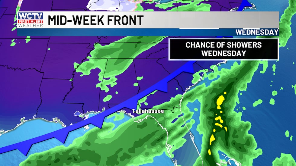 Another chance of showers arrives on Wednesday.(WCTV)
Expect cooler temperatures to return by Friday, so this cold pattern will persist through the weekend.
Track local weather 24/7 with WCTV First Alert Weather Now below.⬇️
To stay updated on all the latest forecasts and weather, follow WCTV First Alert Weather on Facebook and X (Twitter).
Click here to see all the latest weather headlines and here to view the First Alert Radar. Receive push alerts and watch the latest forecast anytime on the free WCTV First Alert Weather app. Click here to download it now.
Interested in becoming a WCTV First Alert Weather Watcher? Click here to join the team!
Copyright 2026 WCTV. All rights reserved.