
The work week started with some “light jacket” weather with temperatures in the low 50s inland and upper-50s closer to the coast.
What we know:
By 5 a.m., Monday morning, Central Florida had temperatures in the high-40s and low-50s. DeLand was 46 degrees, Sanford was 51 degrees and St. Cloud was 53 degrees. Closer to the water, Titusville was 60 degrees, New Smyrna Beach was 58 degrees Cocoa Beach was 63 degrees.
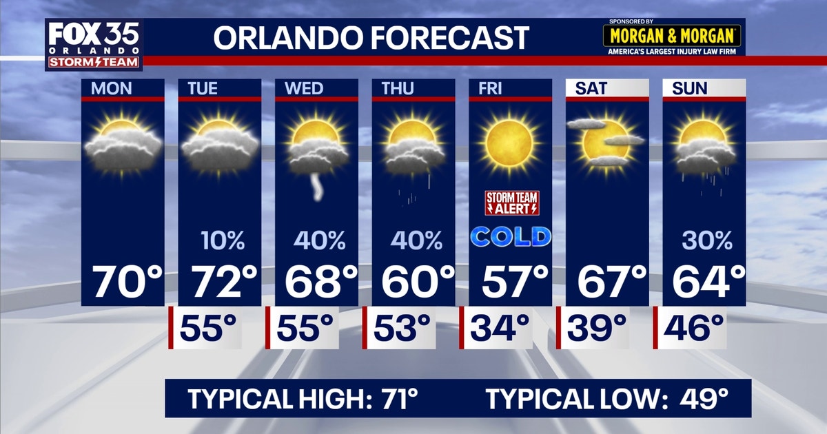
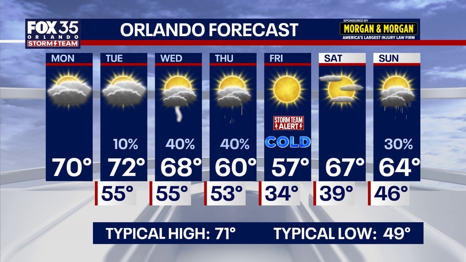
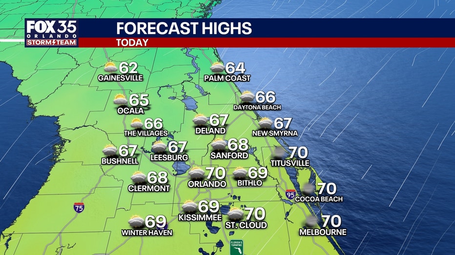
By this afternoon, highs will struggle to reach the low 70s. Areas northwest of I-4 will see highs near the mid 60s and southeast of I-4 closer to the upper 60s and low 70s. Clouds will stick around, leaving us with a partly to mostly cloudy sky.
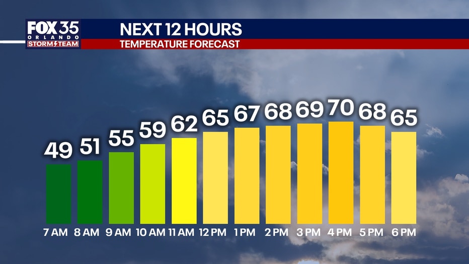
Temperatures in Orlando will reach 70 degrees by 4 p.m.
Tonight, temperatures will cool to the 40s and 50s once again for lows. Skies will remain partly to mostly cloudy.
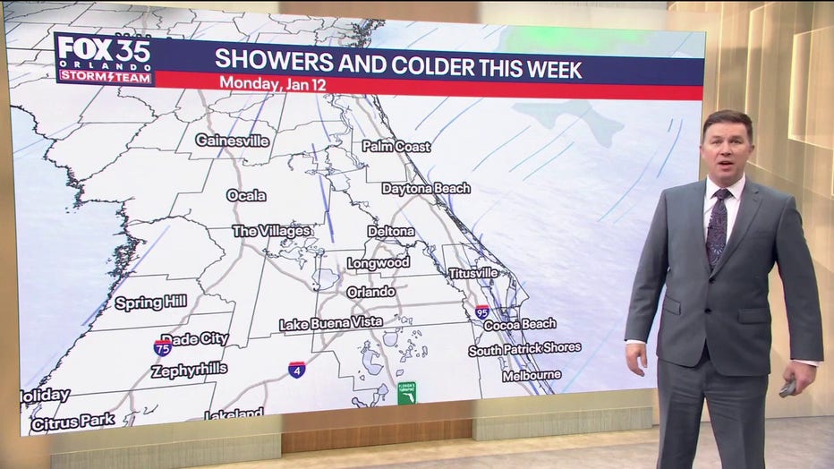
Showers are expected throughout the week.
Expect intermittent showers
As the temperatures are expected to warm up throughout the day, rain is expected as the week continues.
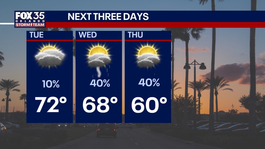
A southerly flow will develop on the edge of our area on Tuesday. About a 10% chance of a stray shower or two will be possible on Tuesday.
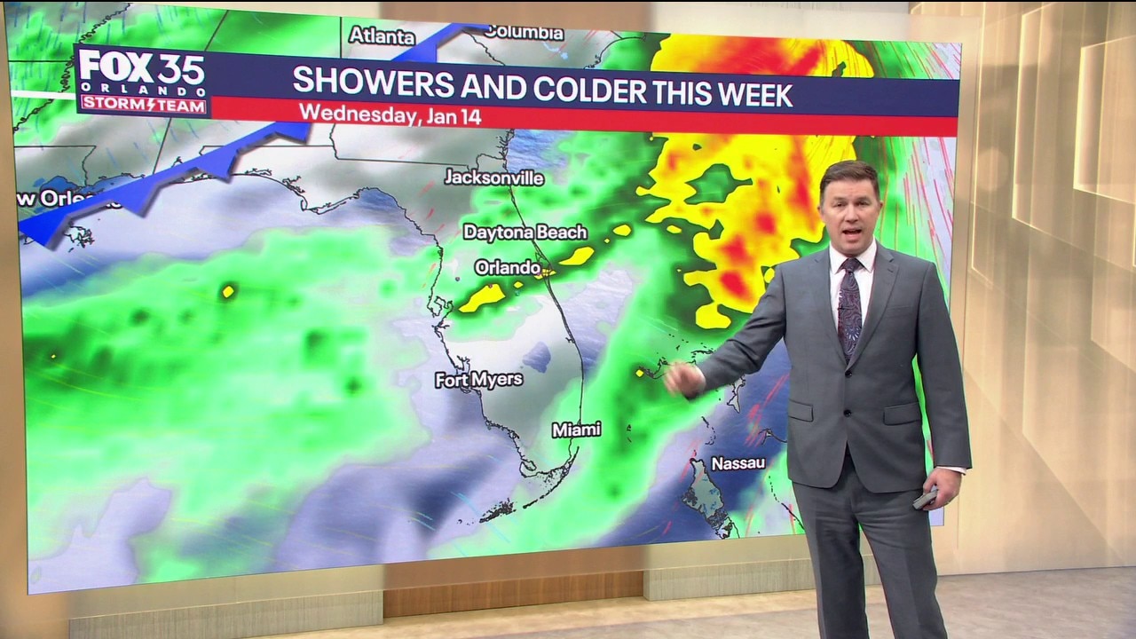
On Wednesday, a cold front will approach from the west, making Wednesday the wettest day of the week.
A 40% chance of rain and storms will be in store for Wednesday and Thursday as a few rounds of off and on wet weather possible. The current data suggests the highest chances will happen Wednesday after sunset.
“There’s going to be intermittent showers or moderate rain at time,” FOX 35’s Brooks Garner said.
Those in the area can expect rounds of rain by 8 p.m. on Wednesday with the possibility of thunder.
As the front comes through, more rain is possible through Thursday. Another wave of slightly lighter rain is likely late Thursday morning into the early afternoon. Thursday’s highs will be much cooler, only reaching the upper 50s and low 60s for highs with gusty winds.
In the forecast for Tuesday, Wednesday and Thursday, temperatures are expected to fall between 68, 60 and 57 degrees, respectively.
 Storm Team Alert
The FOX 35 Storm Team issued a storm alert for Friday, Jan. 16.
Cold air rushes in late Thursday, which will lead way to a very cold start to our Friday morning. It will be quite cold and blustery as people are making their way out the door, with temperatures in the 20s and 30s accompanied by gusty winds. Many areas will see temperatures fall at or below the freezing mark and wind chills will dip down into the 20s. High temperatures will struggle too, only reaching the mid 50s to upper 50s at best.
Wind chills on Friday morning will range from 23-26° across the Orlando area. Actual temperatures will reach freezing north of Orlando, from 27–32°. Orlando city lows are 33°-35° and afternoon highs will only reach the mid-50s.
Kids at the bus stop will need a big jacket and cold-sensitive plants and crops will need to be protected from the icy winds.
Download the FOX 35 Weather App for the latest forecast.
The Source: This story was written with information from the FOX 35 Storm Team.