
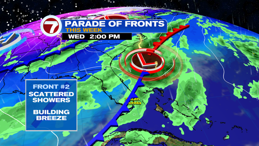
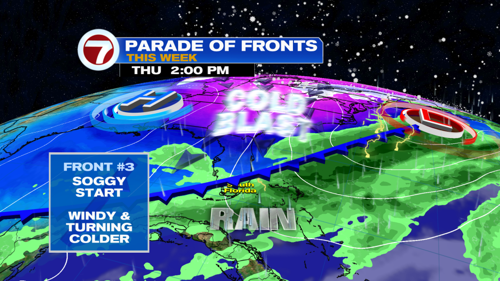
A series of fronts will impact South Florida through midweek and it will leave our weather unsettled. The first front has already crossed through and forecast to stall. Along that same front an area of low pressure will form and travel Northeast helping another front sweep through late Wednesday. Best rain chance all week will be early Thursday.
The third front will bring in a push of cold air throughout the day on Thursday. Therefore, clouds will clear and it will get colder!
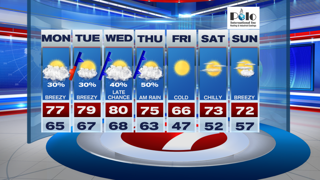
Big dip in degrees happens late week and into the week, so get ready to sport around the sweaters a few days South Florida. By Friday morning, a lot of areas around mainland South Florida will be waking up into the 40’s.
Have a wonderful week South Florida and make it a safe one!
Vivian Gonzalez
Meteorologist, AMS Certified
WSVN Channel 7
Join our Newsletter for the latest news right to your inbox