
TALLAHASSEE, Fla. (WCTV) – Sunday is the best rain chance in quite some time.
Heavy storms today:
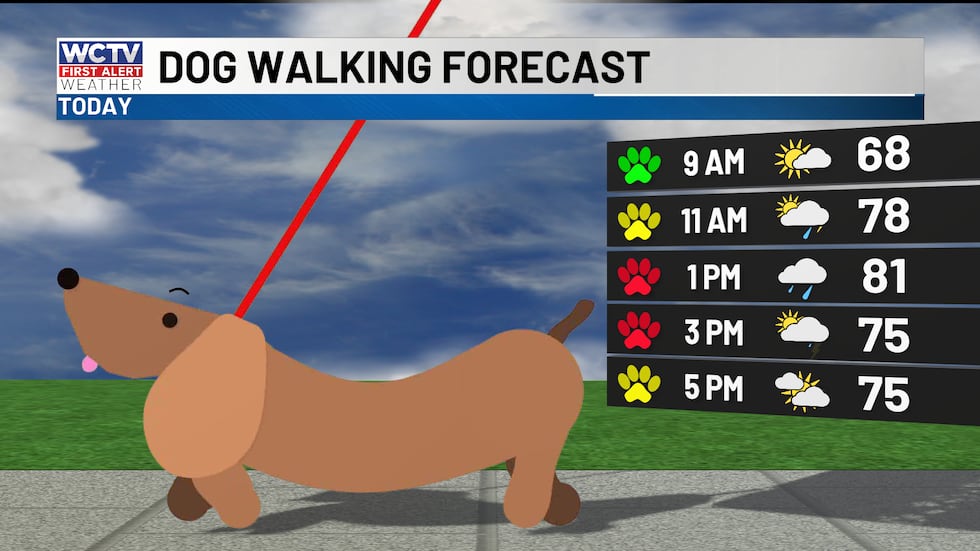
As you head out the door for grocery shopping, church, or any other errands, the morning will be just fine. Temperatures are still cool, near 60 and upper 50s.
 Showers and storms late morning into the early afternoon.(WCTV)
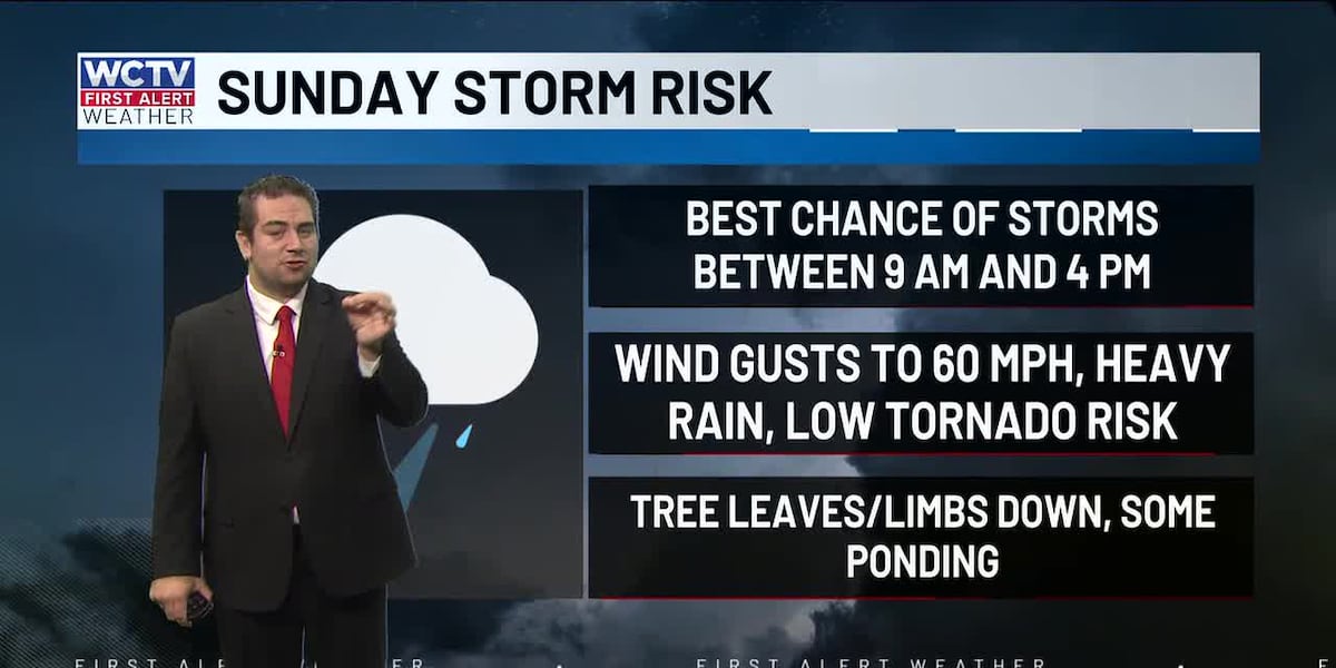
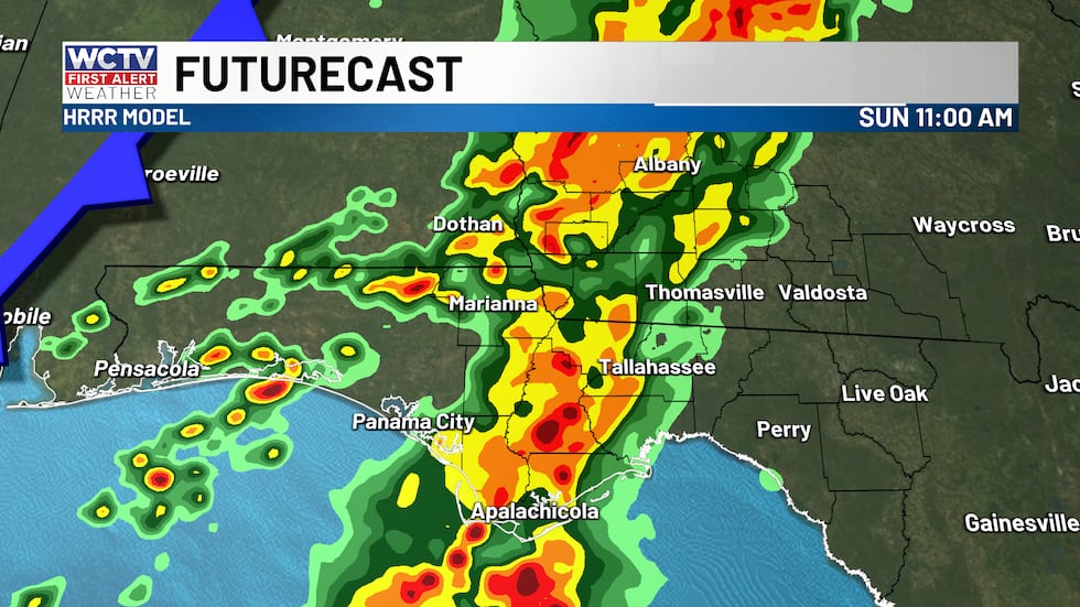
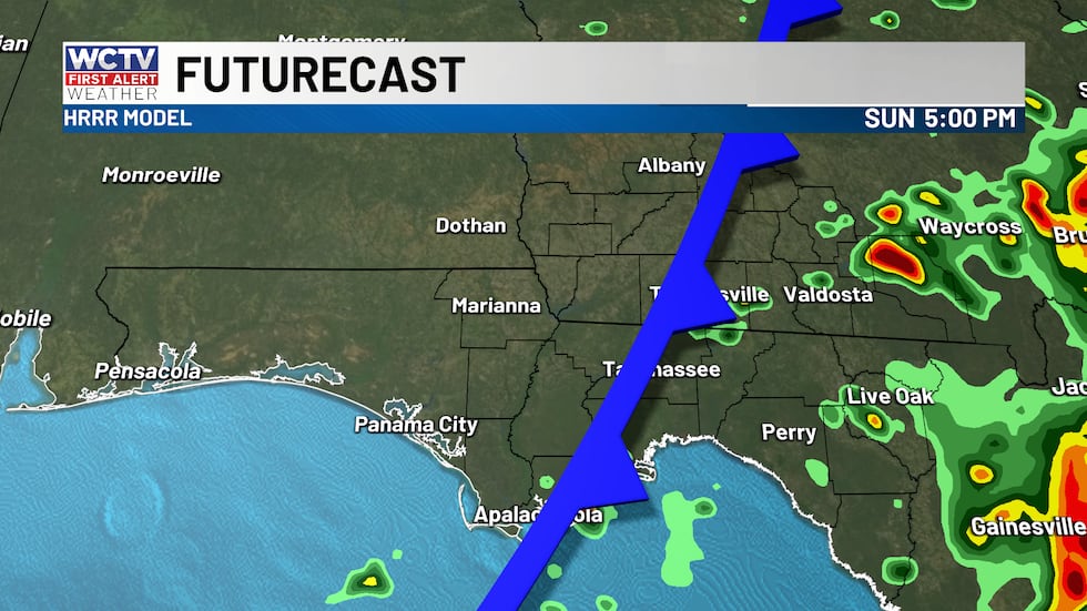
Showers and storms will start approaching the area from the west by 9 a.m., and some of these storms may be strong.
If you are heading to services or any indoor activity this morning, be sure to have a rain jacket because showers and storms are likely to move in by middayShowers and storms will start approaching the area from the west by 9 a.m., and some across the heart of the area.
 Showers and storms through the heart of the area.(WCTV)
a rain jacket because showers and storms are likely to move in by midday
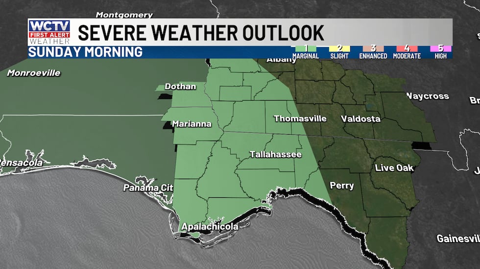
Most storms will NOT be severe, but there could be one or two storms that reach severe limits. That means wind gusts to 60 mph, and a brief tornado is possible given the wind shear in place. The Storm Prediction Center has the western Big Bend in a marginal risk for this reason.
 A few heavy storms are possible this afternoon.(WCTV)
Storms will be in the eastern Big Bend by late morning and should wrap up by 4 or 5 p.m. This means everyone should be drying out by the end of today. Rain totals between 0.25″ and 0.75″, some higher totals possible in a few spots.
 The front will move through this afternoon, drying things out by 5 p.m.(WCTV)
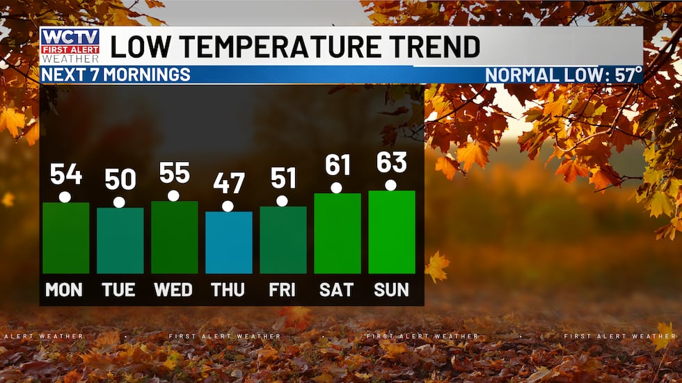
The cold front will drag some drier air into the area tonight. Lows will fall into the mid-50s with clear skies.
More dry next week:
As we start the new workweek, temperatures will be cool in the low 80s with low humidity and sunny skies.
Much of next week will remain dry and sunny. Afternoon highs in the low 80s. Chilly morning lows in the upper 40s and low 50s.
 Cool behind today’s cold front.(WCTV)
Tracking the tropics:
Invest 98L is expected to reach the Caribbean Sea. The National Hurricane Center has a 50% chance of development over the next 7 days.
Long-range models are not too concerning right now. Trends are keeping the disturbance in the Caribbean. We will get help from a cold front that will stall in the Gulf next week, deflecting it from reaching the Gulf at all. I will keep my eyes on Invest 98L for any changes.
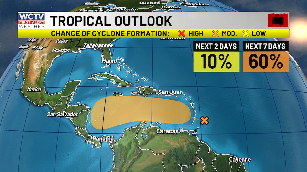 A 60% chance that Invest 98L will organize over the next 7 days.(WCTV)
To stay updated on all the latest forecasts and weather, follow WCTV First Alert Weather on Facebook and X (Twitter).
Click here to see all the latest weather headlines and here to view the First Alert Radar. Receive push alerts and watch the latest forecast anytime on the free WCTV First Alert Weather app. Click here to download it now.
Interested in becoming a WCTV First Alert Weather Watcher? Click here to join the team!
Copyright 2025 WCTV. All rights reserved.