
TALLAHASSEE, Fla. (WCTV) – [1/16 5 PM] The current forecast for the weekend is still on track. Let’s discuss the latest data without the hype and click-bait.
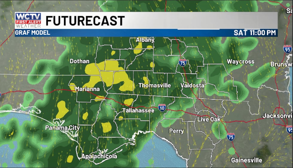
SATURDAY: Clouds and moisture will return to the region on Saturday. We are expecting spotty showers for the morning and afternoon. Saturday will not be a washout, so don’t cancel any outdoor plans. However, pack the umbrella to be safe.
(story continues below)
 We are expecting spotty showers for the morning and afternoon.(WCTV)
We have no severe weather or winter weather issues on Saturday. In fact, temperatures are much warmer to start the weekend. We climb into the mid-to-upper-60s.
For Saturday night, moisture continues to increase, and we are looking pretty soggy as widespread rain showers are likely. Again, temperatures are above freezing, so we only have a cold rain across the area for the overnight.
(story continues below)
 For Saturday night, moisture continues to increase, and we are looking pretty soggy as widespread rain showers are likely.(WCTV)
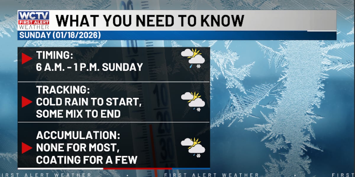
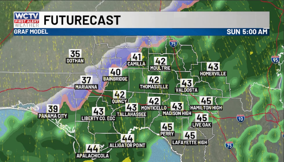
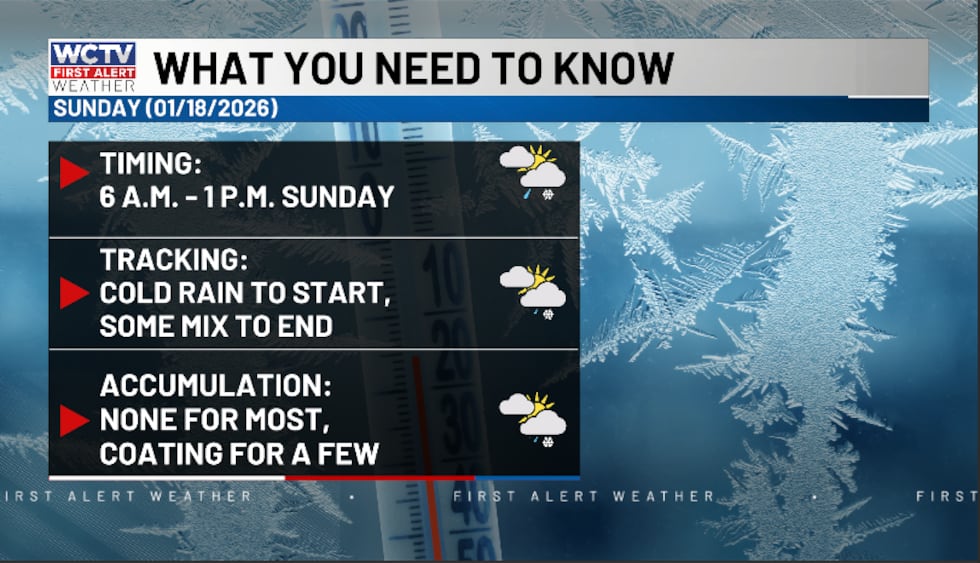
SUNDAY: Things become a little more interesting and messy by Sunday morning. Behind this system, cold air will start to rush into the region and cause a brief changeover from rain to wintry mix.
TIMING: The changeover should happen between 6 a.m. and 1 p.m. on Sunday. You will not see winter weather for the entire time period. However, during this time, there is a brief (1-3 hour) window of a wintry mix.
(story continues below)
 Behind this system, cold air will start to rush into the region and cause a brief changeover from rain to wintry mix.(WCTV)
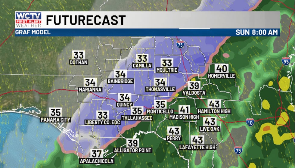 The changeover should happen between 6 a.m. and 1 p.m. on Sunday. You will not see winter weather for the entire time period.(WCTV)
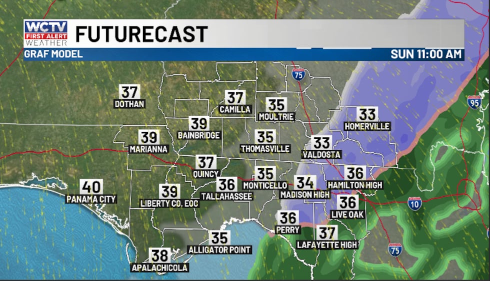 There is a brief (1-3 hour) window of a wintry mix Sunday morning.(WCTV)
ACCUMULATION: On the ground, temperatures are above freezing (33-36 degrees). As a result, most of what falls will melt. So, we are expecting no accumulation for most of the region. However, a few spots could see a light dusting or a light coating in the grass, on roofs and on cars. Right now, the better chance of a coating looks to be in our South Georgia counties.
IMPACTS: This is a completely different system from January of 2025. This weather system is quick-moving and dealing with above-freezing air. As a result, we are not anticipating major impacts at this point.
(story continues below)
 This is a completely different system from January of 2025. This weather system is quick-moving and dealing with above-freezing air. As a result, we are not anticipating major impacts at this point.(WCTV)
As always, the forecast can change over the next 24-36 hours. So, be sure that you stay weather aware and stay updated through the weekend. A word of caution, be careful with the social media hype. It is important to stay updated with trusted meteorologists.
By the afternoon on Sunday, the sunshine will return and temperatures climb into the mid-and-upper-40s. However, we are looking at another blast of frigid air for early next week. Lows tumble into the mid-20s for Sunday night, Monday night and Tuesday night.
To stay updated on all the latest forecasts and weather, follow WCTV First Alert Weather on Facebook and X (Twitter).
Click here to see all the latest weather headlines and here to view the First Alert Radar. Receive push alerts and watch the latest forecast anytime on the free WCTV First Alert Weather app. Click here to download it now.
Interested in becoming a WCTV First Alert Weather Watcher? Click here to join the team!
Copyright 2026 WCTV. All rights reserved.