
Northwest Florida will remain in an unsettled weather pattern through the end of the workweek, with isolated showers continuing Thursday and Friday as a weak cold front stalls near the region. Temperatures during this time will stay relatively mild with highs in the upper 60s.
Going into the weekend, our attention shifts to the winter storm that is expected to bring significant impacts to the southeast.
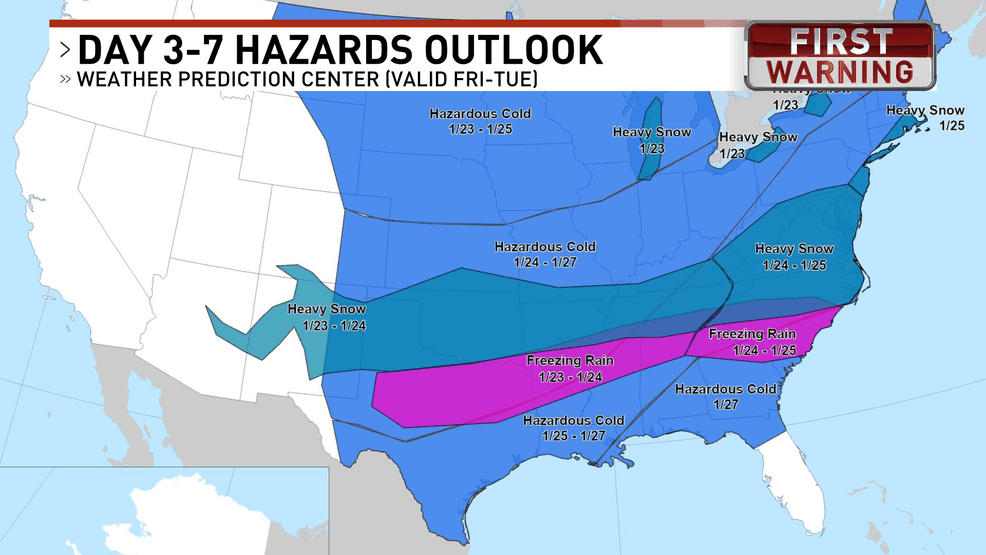
The freezing rain threat looks to stay well north of the Gulf coast
There’s still a lot of uncertainty in the forecast. We’re watching a strong Arctic air mass and how the upper-level weather patterns develop, and models don’t always handle these types of events very well. That’s why the forecast has been back and forth, and why we’re seeing such a wide range of possible temperatures. In some inland areas, forecast highs and lows still vary by as much as 20 degrees depending on the timing and placement of the cold air.
There are two main scenarios possible that depend on where a developing low-pressure system tracks.
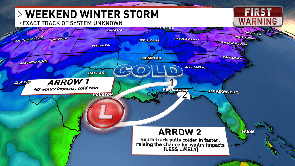
Our impacts will be dependent on the track of the low
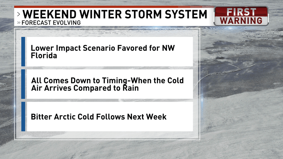
The more likely scenario has the storm system tracking north of Northwest Florida, which would limit winter weather impacts locally. This would result mainly in cold rain, with the potential for a few thunderstorms near the coast late Saturday into Sunday if warmer, unstable air can move inland. Even in this lower-impact scenario, lingering moisture combined with falling temperatures behind the system could still lead to slick spots on bridges and overpasses.
A less likely scenario involves the low tracking farther south, closer to the Gulf Coast. This would allow colder air to move south quicker, increasing the potential for freezing rain or sleet, mainly north of the immediate coast and closer to inland areas of southern Alabama and Mississippi. While this scenario is becoming less likely based on recent trends, it cannot be ruled out entirely at this time.
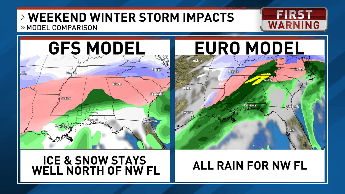
Overall, forecast guidance over the past 24 hours has trended farther north with the storm track, which continues to lower the risk of frozen precipitation for Northwest Florida. Models are in agreement that this will be a cold rain event for our stretch of the Gulf coast.
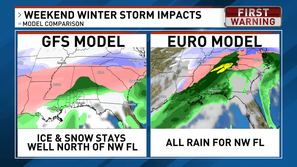
Both the GFS and Euro model show rain for NW Florida
However, regardless of how the weekend system unfolds, much colder air is expected to follow early next week. Overnight lows could drop into the teens and 20s, with wind chills falling into the single digits in the coldest inland areas. Daytime temperatures early next week may struggle to reach the 30s inland and the 40s near the coast, signaling the arrival of the coldest air of the season.
Here’s what we can say at this time