
A warm weekend is ahead before the cold returns next week.
Friday’s forecast starts with patchy fog before 8 a.m. that will clear up for an otherwise sunny day with highs at 81 degrees, according to NWS Melbourne.
There is a high risk of life-threatening rip currents at all area beaches.
Precipitation chances are at zero percent for the Orlando metro and Daytona Beach, but increase moving further south, peaking at 20 percent.
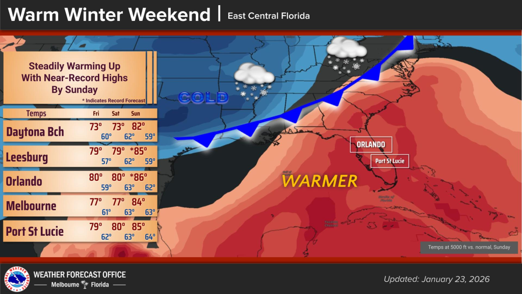
For the weekend, temperatures are expected to be near-record highs by Sunday, with temperatures in the 80s in Orlando and the high 70s throughout the rest of Central Florida.
Experts believe a cold front will pass by on Monday and colder temperatures will return, according to NWS Melbourne.
Chances are high that Tuesday and Wednesday will begin at temperatures at 40 degrees or less.