
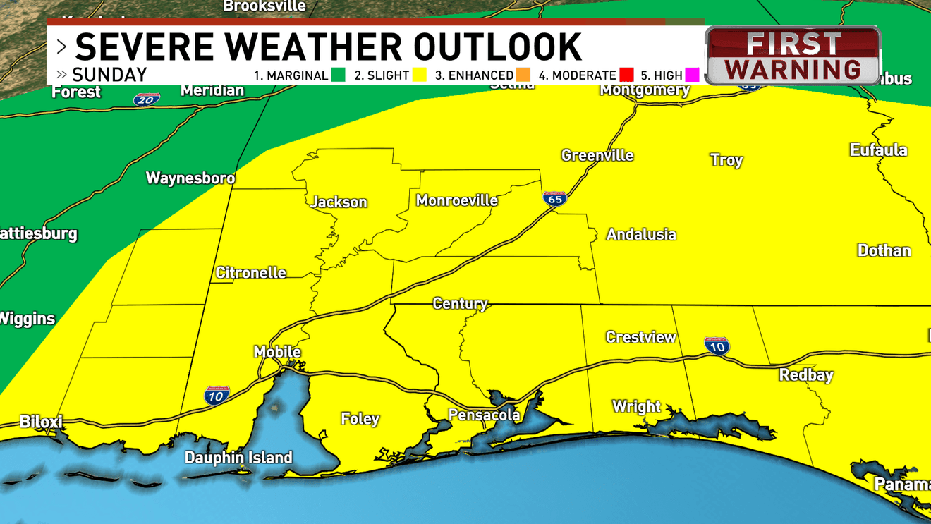
Big changes are ahead for our area beginning Sunday as we track two significant weather threats. Strong to severe storms followed by an unusually long stretch of dangerous cold.
A cold front will move through the region Sunday, bringing the chance for strong to severe thunderstorms, especially during the late morning and afternoon hours. Damaging wind gusts and an isolated tornado are possible. All areas remain under a Slight Risk (2/5) for severe weather.
An area of low pressure lifting ahead of the front Sunday will create a severe storm risk.{ }
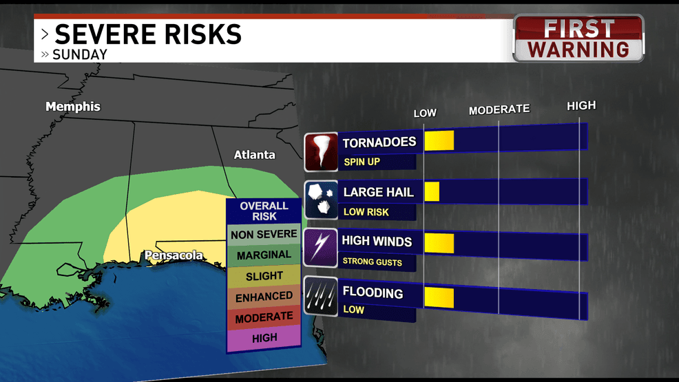
NW Florida is in a 2/5 risk for severe weather with the threat of spin up tornadoes and damaging winds
Storms will roll into NW Florida between 11 AM and 3PM, ending west to east.
Storms roll in late Sunday morning, and continue into the early-mid afternoon.{ }
Outside of storms, winds will increase with gusts reaching 30-40+ mph.
Winds will be very gusty ahead and behind the system.{ }
Once the front passes Sunday night, an arctic air mass will surge in, causing temperatures to drop quickly and remain well below normal for much of the week. Overnight lows Sunday night will fall into the upper teens to near 20 inland and the mid-20s near the coast, with even colder conditions Monday night as lows drop into the mid-teens inland and lower 20s along the coast.
Temperatures drop dramatically behind the front
This cold is expected to persist through at least Saturday night, with nighttime lows largely staying in the 20s, marking one of the longest stretches of cold weather the area has seen in decades.
Comment with Bubbles
JOIN THE CONVERSATION (1)
Gusty winds will make it feel even colder, with wind chills dropping to between 5 and 15 degrees late Sunday night into Monday morning and again Monday night into Tuesday morning, prompting an Extreme Cold Weather Watch that may be upgraded in the coming days, along with additional cold weather advisories likely through the week.
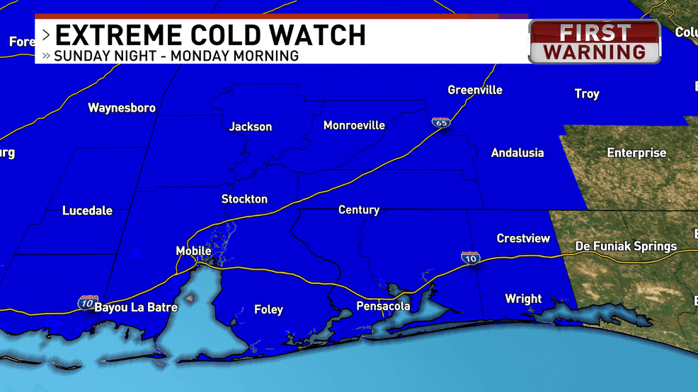 The Extreme Cold Watch includes the counties highlighted in blue