


Photo by Sean Foster on Unsplash
Save
Though South Florida has been spared from the winter storm that ravaged the East Coast and Midwest U.S. this past weekend, we’re still going to have a few weather anomalies of our own this week.
First on Monday, January 26, Miami and Fort Lauderdale are predicted to hit a high of 85 and 86 degrees, respectively. The previous record for Miami temperatures on this date was in 2017, reaching the same 85 degrees (according to CBS Miami Next Weather). In Fort Lauderdale, it was even more extreme, with the last record being 88 degrees in 1965. The average temperature for this time of year in South Florida normally hovers around 76 degrees.
Still, almost as soon as we hit that heat, the temperatures will do an about-face and plunge to a below-average number. Tuesday, January 27 will drop to a high of 68 and low of 53 in South Florida, while Thursday and Friday will drop to the high 40s in the mornings and low 60s during the day. That means a drop of about 30 degrees from Monday into Tuesday.
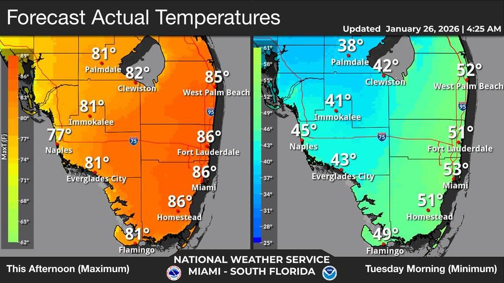 Actual temperature map of Monday versus Tuesday this week. Credit to the National Weather Service.
 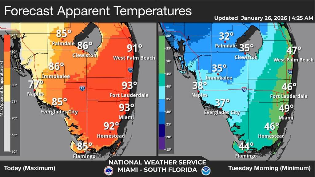 “Real feel” temperature map of Monday to Tuesday in South Florida. Credit to the National Weather Service.
The vast change in weather is mainly due to a powerful cold front moving into the region tonight. The cold weather will remain throughout the week, with highs in the high 60s and lows in the low 50s through this Sunday. In Miami specifically, Sunday will really take a chill with a high 68 and low of 41, according to The Weather Channel. There will also be a chance of rain this Friday and Saturday.
Earlier today, a special weather advisory was issued for The Acreage, due to 50 mph winds.
Also, a cold weather advisory has been issued for Glades and Hendry counties from midnight Monday to 9 a.m. Tuesday morning. The real-feel temps will be in the mid to low 30s.
So enjoy the warm weather while it lasts (basically, just today)!