
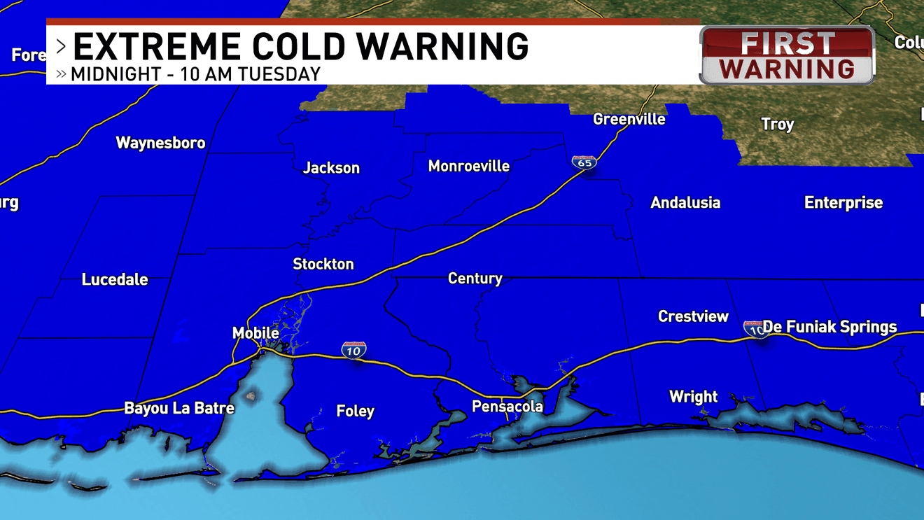
A dangerous blast of Arctic air remains locked in across the region, keeping temperatures well below normal through much of the week and into the upcoming weekend.
Overnight temperatures tonight will fall into the middle teens for inland communities, with low 20s closer to the coast. Even as winds slowly ease, wind chill values will stay in the low to mid-teens, making it feel even colder. An Extreme Cold Warning is now in effect for tonight as these hazardous conditions continue.
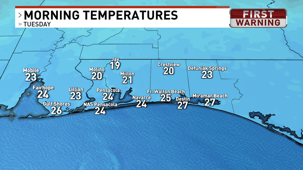
Lows Tuesday morning will be in the 20s
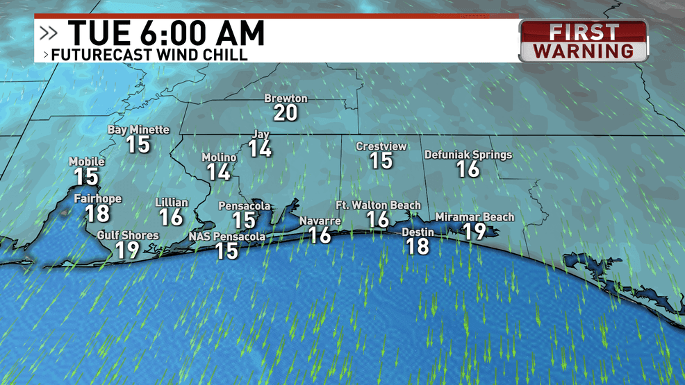
Wind chills Tuesday morning will be in the teens
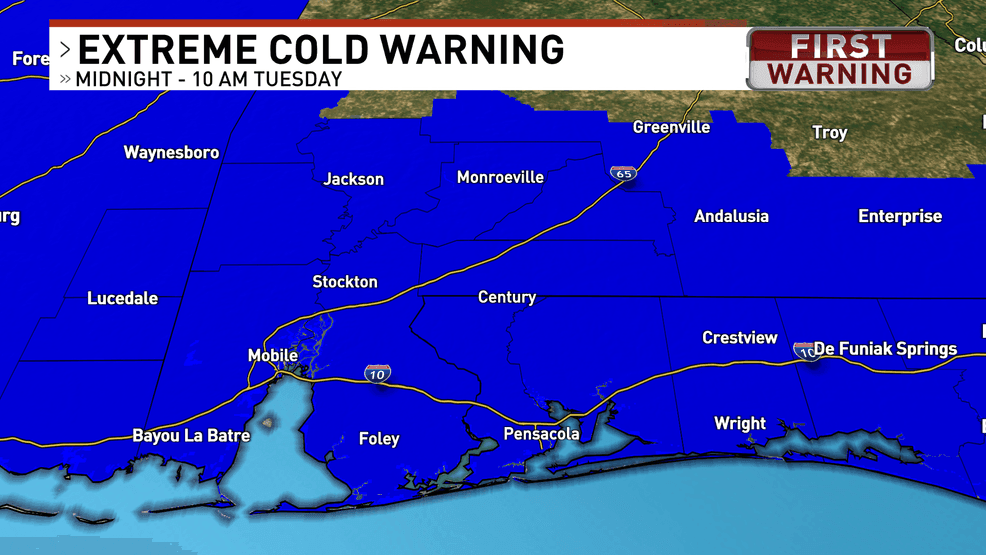
The dark blue indicates areas included in the Extreme Cold Warning
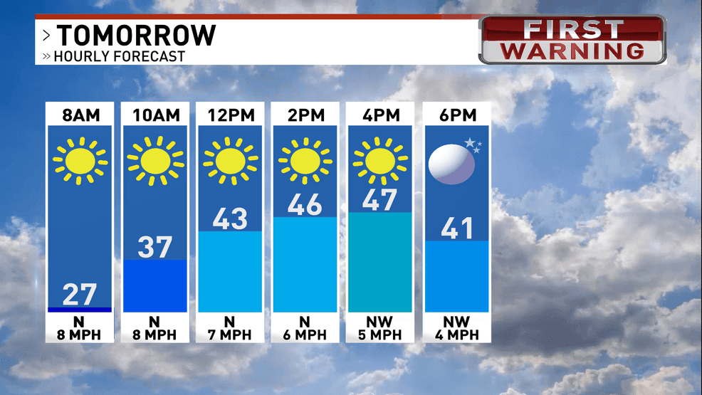
Tuesday will bring only a modest warm-up, with afternoon highs reaching the mid to upper 40s. Despite the sunshine, the air will remain very dry, and cold nights will persist through midweek. Temperatures will gradually moderate by Thursday, climbing into the low to mid-50s during the afternoon, though overnight lows will still be chilly.
Another cold front is expected to move through late Friday into Saturday. While moisture will be limited, a few isolated showers are possible ahead of the front on Friday. Behind it, yet another surge of Arctic air will spill into the area, bringing another round of cold temperatures for the weekend.
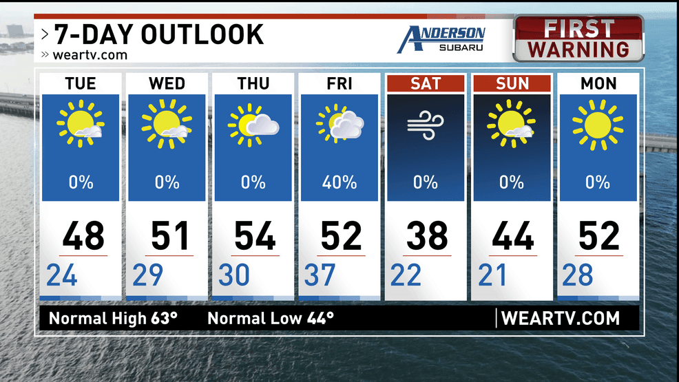
No warmth in sight over the next 7 days
Comment with Bubbles
BE THE FIRST TO COMMENT
Continue taking cold-weather precautions, especially during overnight and early morning hours, and stay tuned for updates as the next cold front approaches.