
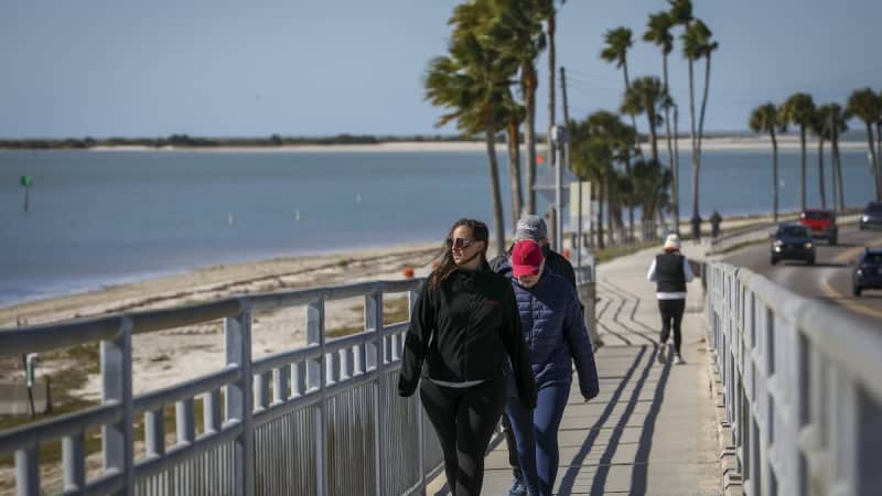
Coastal areas of Tampa Bay could be in for an extraordinary sight Saturday night — snow flurries.
Weather models have shown increasing chances of “Gulf effect flurries,” or a mix of snow and rain, near Tampa Bay’s shores, according to a Wednesday afternoon forecast discussion from the National Weather Service’s Tampa Bay office.
Forecasts show a 20% chance of rain and snow mix in Pinellas on Saturday night, and they mention flurries across much of the coast.
However, the weather service warned that confidence in the forecast is low.
The occurrence would be similar to the lake effect snow that falls in the northern U.S., said Tony Hurt, a meteorologist for the weather service.
“In this case, it’s going to basically be ocean-driven,” Hurt said.
A cold front is expected to whisk through Saturday, leaving behind bitter cold and gusty winds. The key factors behind any flurries will be an expected strong northwest wind and a massive difference in temperatures between the water and the air.
“That’s going to allow the moisture from the coastal waters to basically support some development of some clouds, and maybe some snow flurries right along the coast,” Hurt said.
Forecasters said the greatest question will be if enough moisture sticks around to produce flurries. Any flurries that do form would likely stay along the immediate coast, Hurt said.
A seven-day outlook for St. Petersburg said there is a slight chance of rain and snow showers between 11 p.m. and 1 a.m. Saturday night, along with scattered flurries after 1 a.m.
In Tampa, scattered flurries are also possible during that time frame,according to the weather service.
A National Oceanic and Atmospheric Administration map depicting winter storm impacts highlighted some areas in Florida and around Tampa Bay with a small chance of snow.
“Those chances are pretty low, but it’s still something I’ve never seen in my 40 years living in Florida,” Denis Phillips, chief meteorologist for Tampa Bay 28, wrote on Facebook about the map Wednesday afternoon.
The weather service emphasized that it does not expect snow to accumulate, and any flurries that fall would melt as they touch the ground.
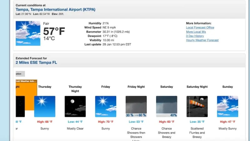
Regardless of any snow, the weather service said Sunday will bring some of the coldest air the region has experienced in about 15 years, when inland areas could drop into the 20s. Coastal areas will likely remain slightly warmer, but highs across the board will be in the 40s.
More cold days are on tap next week, but Tuesday will likely warm up slightly, reaching into the 60s by the afternoon, the weather service said.
The most recent instance of anything resembling snow falling around Tampa Bay was in early January 2010.
“We’re saying it was mostly sleet,” Nicole Carlisle, a meteorologist with the National Weather Service’s Tampa Bay office, told the Tampa Bay Times that year. “I think we had a couple of snow flurries mixed in there in Pasco, but the rest was sleet.”
The weather service said it was the first instance of snow or sleet in west-central Florida since 1996.
However, the last time measurable snow occurred in Tampa was January 1977, according to weather service records. Newspaper clippings from that day described parks crews trimming snow-covered palm trees, and photos showed white dustings along roads.
The chances of snow this weekend are low, Hurts said, “but not zero.”
• • •
The Tampa Bay Times launched the Environment Hub in 2025 to focus on some of Florida‘s most urgent and enduring challenges. You can contribute through our journalism fund by clicking here.