
ORLANDO, Fla. – A Freeze Warning and a Cold Weather Advisory are both in place for the majority of Central Florida until 9 a.m.
This will account for temperatures near or below freezing for several places and wind chills in the upper 20s and low 30s.
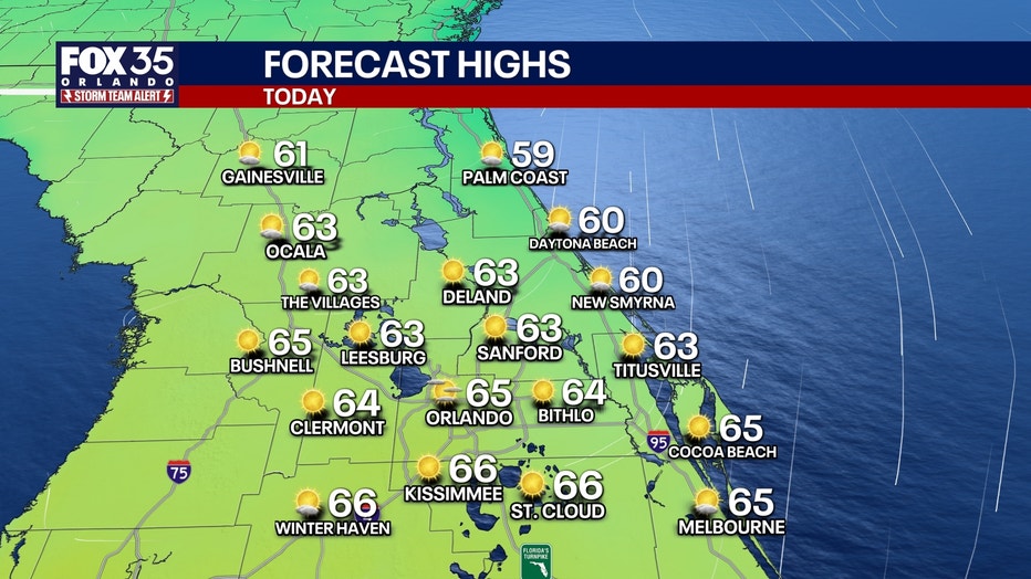
Highs today will see a slight improvement compared to this week so far, climbing into the low 60s near the coast and mid 60s inland. Clear skies will allow for plentiful sunshine today as well.
A few clouds will allow for mostly clear skies overnight. Temperatures won’t be quite as cold as previous morning, as lows dip down into the upper 30s and low 40s for most.
 Rain possible this weekend
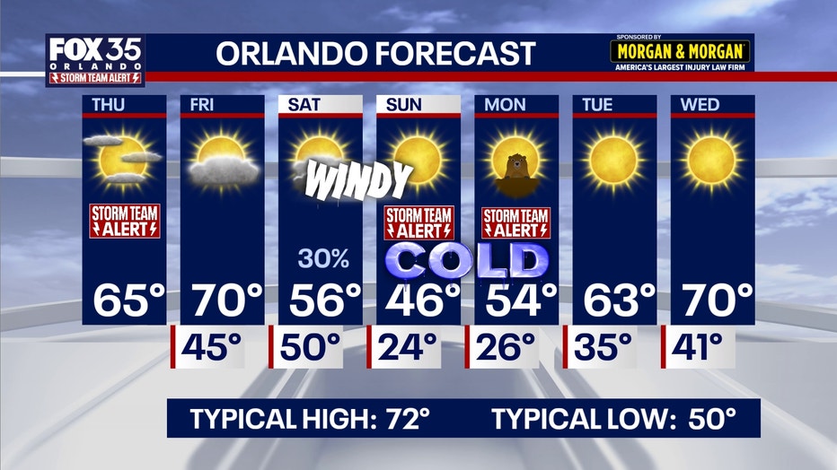
Temperatures will briefly thaw out as highs approach the upper 60s and low 70s tomorrow while staying dry.
Saturday will be a wet and very windy day as a powerful cold front pushes into the region.
Winds will gust up to 35 mph with a 30-40% chance of scattered showers. Best chances of rain look to take place during the morning hours.
Temperatures will only reach the mid-50s before tumbling Saturday night.
 FOX 35 Storm Team Alert
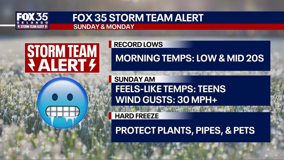
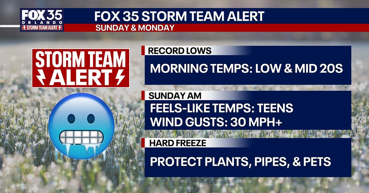
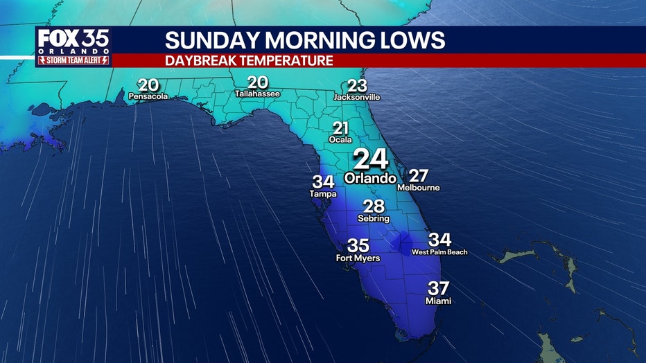
A rare and unusual frigid stretch will take shape Sunday and Monday. Some of the coldest air felt in years will move in Saturday night.
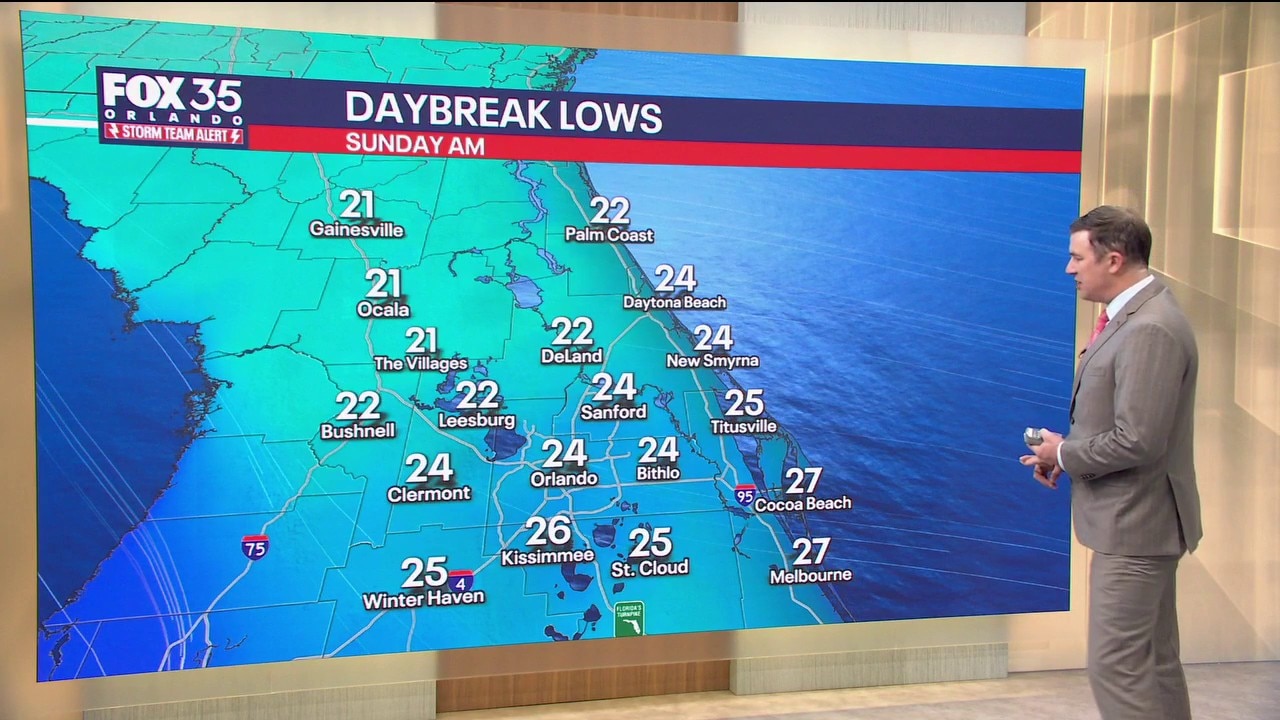
Lows will plunge into the low to mid 20s with wind chills in the teens and maybe even the single digits.
Daytime highs will only reach the mid and upper 40s at best Sunday afternoon.
Sunday night will feature another round of near-record cold temperatures, falling back down into the low and middle 20s.
Highs Monday will be better, but still below normal, climbing into the mid-50s.
The Source: This story was written with information from the FOX 35 Storm Team.