
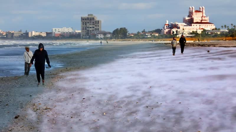
This weekend could be the stuff of Tampa Bay dreams, but don’t get your snow boots out yet.
The actual likelihood of snow? Minimal. And would it stick to the ground? Definitely not. But the possibility remains nonetheless.
“There’s a reason why it doesn’t snow here very much, or rarely,” said Paul Dellegatto, chief meteorologist for Fox 13 Tampa Bay.
“It’s because you need so much, so many things, to come together perfectly.”
Weather models show a slight chance of “Gulf effect” snow late Saturday into early Sunday. But ingredients like wind direction, air temperature and the amount of moisture in the air all have to be just right to cultivate any falling flakes.
One thing is certain: It’s going to be bitterly cold and blustery this weekend, when feels-like temperatures are expected to sink into the teens in parts of west-central Florida. Inland areas of Tampa Bay are under a rare extreme cold watch from Saturday night into Sunday.
“Bottom line, we are still forecasting a low chance for snow flurries and we are still expecting a plethora of hazards related to cold and wind,” a local National Weather Service forecast discussion said Thursday afternoon.
Here’s how this weekend may shake out, including just how the Gulf effect works — and how likely snow really is.
Gulf effect snow occurs when there is much colder air over relatively warmer water, said Kyle Hanson, a meteorologist for Spectrum Bay News 9.
More commonly, Tampa Bay can see Gulf effect precipitation after cold fronts, when low-level clouds form and lead to rain.
“We’ve seen that actually happen with past cold fronts this winter, but it’s not notable because it’s not snow,” Hanson said.
Water temperatures in the Gulf of Mexicoremain in the upper 50s, and this weekend, the air thousands of feet up will likely be in the teens and 20s.
That difference of warm water versus cold air could create the instability needed for snow flurries.
“In order for this to work, you need a wind to be kind of coming off the Gulf,” Hanson said.
Specifically, winds will need to come from the northwest. If the wind came just from the north, the air would be too dry and unable to support any rain or flurries.
Windier conditions over water can “excite some of the molecules and the droplets,” Hanson said. This increases evaporation and ups the moisture in the air.
Hanson said the ingredients are there for a perfect setup, but the greatest sticking point will be if these components line up.
For any flurries to occur, the moisture and the cold have to be around at the same time.
Significant cold fronts that barrel through Tampa Bay bring extra dry air — not good for rain or snow.
But the gusty winds could cause enough moisture to crop up for light precipitation.
“Here’s the thing, does that dry air win out?” Hanson said.
“We will have cold, dry air chasing moisture. And so, if the moisture can linger long enough, and the cold air can come in soon enough, then that is what could give us the chance for some Gulf effect flurries.”
Thursday afternoon, Hanson said model guidance showed there will likely be enough moisture to produce clouds Sunday morning, but there may not be enough to actually create snow.
In an early Thursday forecast, the National Weather Service said the chance for flurries is low, “but not out of the realm of possibilities.”
Dellegatto said he’s been watching model run after model run, and as of Thursday morning, coastal areas had about a 10% to 20% chance of snow flurries.
“It`s common in scenarios like this that drizzle or very light rain gets reported as snow … when in fact surface temperatures don`t support that possibility,” the weather service said in its Thursday afternoondiscussion.
The weather service said the best chance to see “frozen precipitation” will be from Citrus County south to Pinellas and Hillsborough.
The greatest bet to see flurries likely won’t be right on the beach, but maybe a few miles inland, Hanson said.
“That might be the sweet spot … even though it’s not likely,” Hanson added.
Dellegatto said he wouldn’t be surprised if he received reports ranging from around Brooksville down into north Pinellas County, like Dunedin.
Flurries could occur late Saturday to early Sunday. Hanson gave a rangefrom around 11 p.m. Saturday to about7 a.m. Sunday.
In Clearwater, for example, the weather service said there’s a small chance of sprinkles and flurries from 10 p.m. to 1 a.m. The likelihood of precipitation was just 10% as of Thursday afternoon.
Jeff Berardelli, chief meteorologist for WFLA News Channel 8, shared a weather model on social media Thursday that showed snow showers in Tampa Bay around 1 a.m. Sunday.
The weather service placed portions of west-central and southwest Florida under a rare extreme cold watch from Saturday night through Sunday morning. Those areas are also under a freeze watch for the same time.
Forecasters warned of dangerously cold wind chills that could fall into the single digits for some areas. A hard freeze, with the mercury dropping into the 20s, could occur.
The weather service advised dressing in layers if you have to go outside. It also advised keeping pets inside, checking on neighbors and practicing safe heating.
When cold weather approaches, experts remind residents to protect the four P’s: people, pets, plants and pipes.
A gale watch is also in place from Saturday morning through Sunday morning. Wind gusts up to about 50 mph could occur, and seas up 16 feet are possible in parts of the Gulf, Tampa Bay and Charlotte Harbor.
Forecasters warned that the strong winds can cause treacherous waters that can capsize or damage vessels.
The winds will coincide with the Gasparilla parade Saturday, when a flotilla is expected to travel across Tampa Bay.
As a result, event organizers modified the route so that Jose Gasparilla II will now set sail from Port Tampa Bay. Traditionally, the ship sails to the Tampa Convention Center through the Seddon Channel.
“Our maritime experts strongly encourage captains of local vessels to closely monitor weather conditions and exercise sound judgment when making boating decisions on Saturday morning,” the statement said.
In a social media post Thursday, parade organizers said they “reserve the right to modify or adjust event elements as needed.”
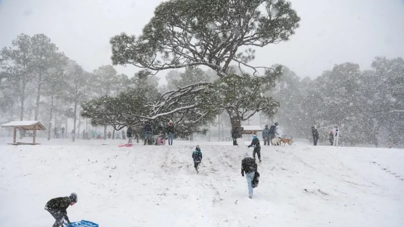
During a long cold spell in early January 2010, there were reports of snow and sleet in portions of Tampa Bay.
“So it does happen, it happens once in a while,” Dellegatto said of the extreme cold that year.
Typically cold fronts in Florida, and Tampa Bay, come and go, and in a few days, the AC is back on. This time around, a series of reinforcing cold fronts have plunged the region into teeth-chatting cold over and over again.
Should flurries fall, they won’t accumulate, the weather service said.
Tampa has only recorded measurable snow twice in its meteorological history: once in 1899, when a tenth of an inch fell, and in 1977, when two-tenths of an inch fell.
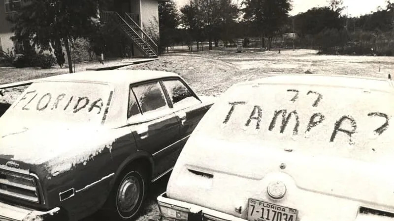
Newspaper clippings from 1977 described parks crews trimming snow-covered palm trees, and photos showed white dustings along roads.
On the slim chance it does flurry, it won’t snarl traffic or cause much of afuss beyond excitement, Dellegatto said.
“This is fun, because this isn’t a hurricane, this isn’t a severe thunderstorm … if it happens, it’s fun.”
• • •
The Tampa Bay Times launched the Environment Hub in 2025 to focus on some of Florida‘s most urgent and enduring challenges. You can contribute through our journalism fund by clicking here.