
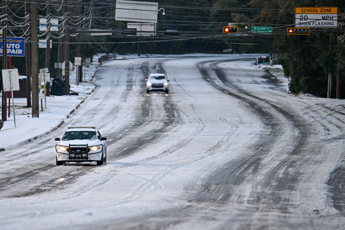
Portions of Florida are bracing for unusually frigid temperatures as an extreme cold watch goes into effect over the weekend, the National Weather Service (NWS) says.
Why It Matters
Forecasters caution that temperatures could fall well below freezing in the state, conditions that could pose hypothermia risks, threaten crops and pipes, and could set or challenge decades-old records in several cities, underscoring the rarity and potential severity of this cold blast for the Sunshine State.
What To Know
According to the NWS, “dangerously cold wind chills” in northern and northeast Florida could feel like 7 degrees. “The dangerously cold wind chills as low as 5 above zero could cause frostbite on exposed skin in as little as 30 minutes. Frostbite and hypothermia will occur if unprotected skin is exposed to these temperatures.”
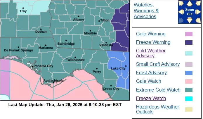
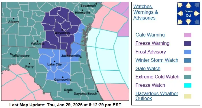
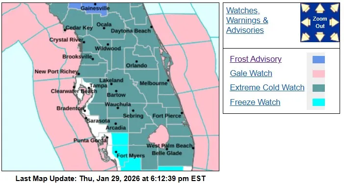
Portions of the Panhandle, northern and central Florida, and as far south as Martin and Palm Beach Counties, are facing the extreme cold watch.
In Palm Beach County, wind chills “as low as the middle teens to around 20 degrees” are possible, the NWS says.
NWS Meteorologist Richard Bann told Newsweek via phone on Thursday that “there are parts of the northern portion of Florida where single digit wind chills do happen, but it is unusual for how far south down the peninsula this goes.
“The thing about this is we’ve been in a pattern where a lot of cold weather has been on the eastern part of the United States. When we start getting into the Florida area, this is a rare long-duration hard-freeze along the Gulf Coast and down the Florida peninsula, with the coldest nights being Saturday into Sunday and Sunday into Monday. It is getting to a point where it is becoming an agricultural concern.”
Below are maps showing the areas in Florida facing the extreme cold watch:
 What People Are Talking About
NWS Jacksonville, on X Thursday: “Coldest air of the winter so far expected Sat Night & Sun Extreme Cold Watch issued: low temps in the teens & 20s, wind chills as low as 5-10F! Brief period of snow flurries/snow showers possible over inland GA & the coasts Sat Night – no accumulations expected #flwx#gawx”
WFLA-TV Chief Meteorologist Jeff Berardelli, on X Thursday: “*First Ever* EXTREME COLD WATCH issued for Central Florida and the Tampa Bay Area, east of I-75. Wind chills as low as 8° & a Hard Freeze for lows as low as 20° Sat Night/ Sun AM.”
What Happens Next
The NWS signaled additional warnings and advisories were likely ahead of the coldest period, with the Jacksonville office emphasizing preparation for dangerous wind chills.
Forecasters expect the cold to persist into early next week with a gradual, limited recovery before additional Canadian air masses press south.
