
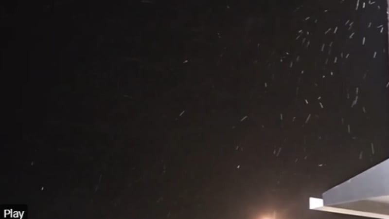
Snow flurries did indeed occur in the Tampa Bay area in the overnight hours Saturday into early Sunday morning.
The National Weather Service posted on social media a video of flurries that was taken at its office in Ruskin about 4:45 a.m.
Local meteorologists also were posting videos from viewers showing flurries in areas ranging from Inverness to Wesley Chapel to Palm Harbor.
National Weather Service forecasters had predicted a 20% chance of flurries as a cold front plunged through the Tampa Bay area, bringing whipping winds and the most frigid temperatures of the season.
The high temperature today may not get out of the 40s. Another cold night with lows in the 30s and even the 20s for places inland and north of Tampa Bay is expected. A number of cold weather advisories are in effect.
Though it has snowed in the Tampa Bay area before, it’s extremely rare.
Forecasters had said that flurries that formed overnight would have been Gulf effect snow, which occurs when there is much colder air over relatively warmer water. Water temperatures in the Gulf remain in the upper 50s, and this weekend, the air thousands of feet up was expected to be in the teens and 20s.
That difference of warm water versus cold air can create the instability needed for snow flurries.
• • •
The Tampa Bay Times launched the Environment Hub in 2025 to focus on some of Florida‘s most urgent and enduring challenges. You can contribute through our journalism fund by clicking here.