
JACKSONVILLE, Fla. — Here’s what the First Alert Weather Team said you can expect for the First Alert Weather forecast:
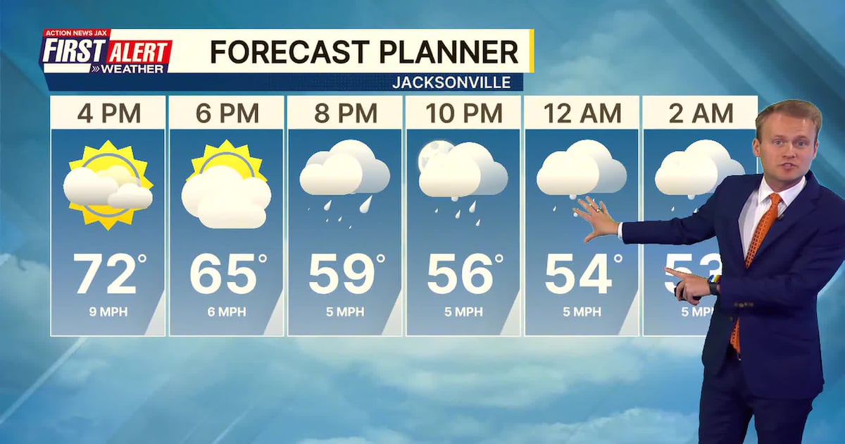
Some much-needed rain is headed for Jacksonville/NE Fl. & SE Ga. Showers will spread west to east, arriving in Duval Co. between 9 pm & midnight. While everyone gets some rain, amounts will not be significant – generally less than a quarter of an inch.Temps. will be colder on Thursday with gusty winds out of the north. Highs will only reach the mid 50s.Another freeze Thursday night for inland areas – near/west of I-95 with lows in the upper 20s to around 30 degrees… with at least patchy frost all the way to the beaches, where lows will reach the mid 30s.A warming trend will begin again on Friday & continue through the weekend. Highs will warm into the 60s…. & the 70s next week. Gusty winds Fri. & Sat., along with no rain, will continue the high risk for wildfires. No significant rain – after tonight – is in the First Alert Forecast through at least the middle of next week.
WATCH THE FORECAST | DOWNLOAD THE APPS
Follow Action News Jax Meteorologists on Twitter for updates:
Mike Buresh | Garrett Bedenbaugh | Corey Simma | Trevor Gibbs
First Alert 7-day Forecast: TONIGHT: Becoming cloudy with showers spreading west to east. Low: 46THURSDAY: Clouds gradually giving way to some sun… windy & colder. High: 54THURSDAY NIGHT: Clear & cold. Low: 30 – inland light freeze/frost… mid 30s at the beaches with some patchy frost.FRIDAY: Mostly sunny, windy & cool. 62SATURDAY: Sunny. 37/65SUNDAY: Sunny & nice. 37/68MONDAY: Mostly sunny, warmer. 43/71TUESDAY: Mostly sunny. 45/73WEDNESDAY: Partly sunny, quite warm. 52/78
ALLERGY TRACKER: See what the pollen counts look like in our area