
While Central Florida’s mornings will continue with cool conditions this week, temperatures will begin to climb as Florida returns to its normal, regularly scheduled sunshine programming, according to the National Weather Service.
The lack of rain on top of existing drought conditions, though, could continue to be a fire threat. No notable rain chances are in store for the region until next weekend at the earliest.
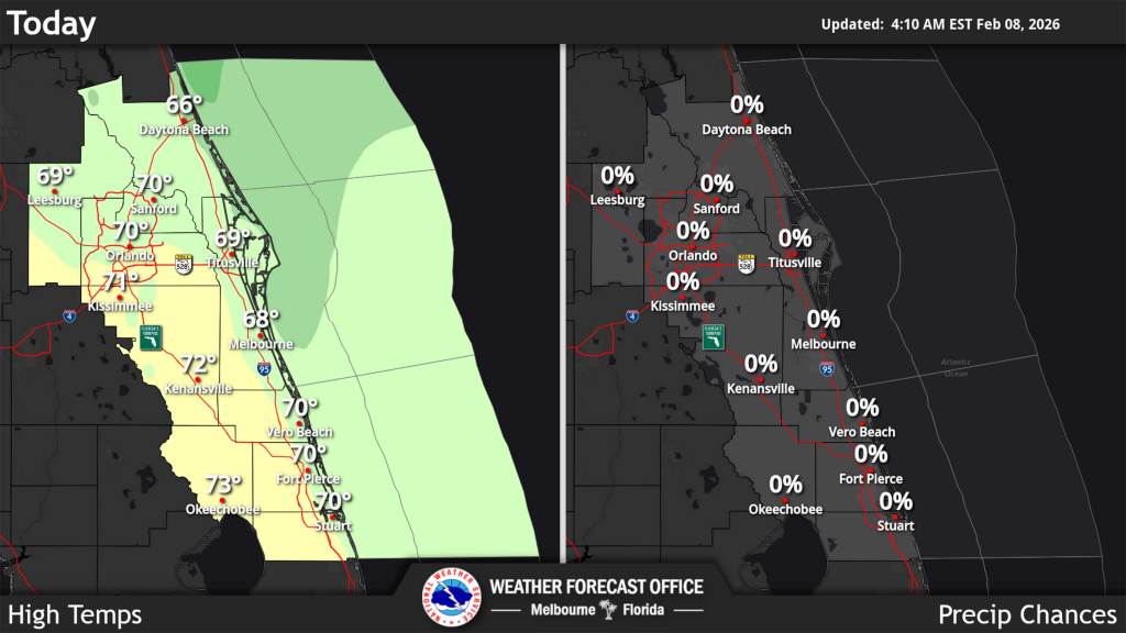
“A prolonged period of dry, warmer, and generally tranquil weather begins today, but not before one last morning with temperatures in the 30s,” reads the NWS Melbourne forecaster’s discussion Sunday. “At 1 AM, temperatures were falling into the 40s with the expectation that areas along and north of I-4 reach the mid/upper 30s by sunrise.”
However, the sun will begin to bring temperatures up with highs Sunday expected in the low 70s inland and in the mid to upper 60s on the coast.
“While a few more mid and upper level clouds could move across the northern half of the area into Monday morning, mostly clear conditions are forecast over a majority of east Central Florida,” the NWS stated. “Forecast lows Monday morning in the 40s to low 50s are still about 5 to 8 degrees colder than normal. Temperatures warm by a few more degrees Monday, reaching the low to mid 70s for most (upper 60s Volusia coast). Overnight lows heading into Tuesday fall shy of normal again by 5 or so degrees.”
The beaches remain a little risky with life-threatening rip currents expected for a few more days.
While models say another cold front could be in store by Sunday, the week will see steadily climbing temperatures.
“For now, confidence is greater in the extended temperature forecast, which highlights a warming trend through the week. Highs in the mid 70s to low 80s are forecast from Tuesday onward, with the exception of Saturday as cloud cover starts to increase,” forecasters said. “Overnight lows will largely settle into the 50s areawide. Dry conditions continuing all week long will likely worsen the current drought.”