
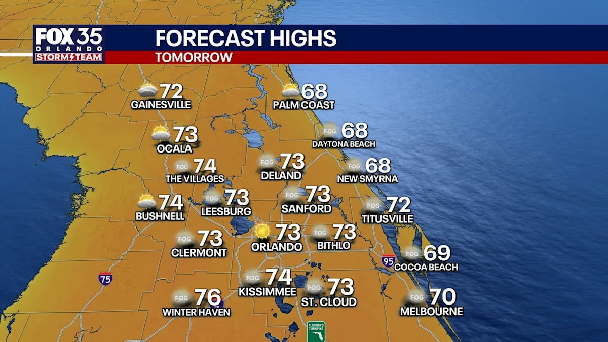
ORLANDO, Fla. – THIS EVENING/TONIGHT: Clear with some patchy fog forming overnight into early Monday morning. Temperatures will fall into the mid 40s.
LOOKING AHEAD: Lots of sunshine in the coming days with temperatures warming into the upper 70s to near 80 areas away from the beaches.
Tiny chance of a rain shower Thursday and Friday but only about 10% chances
Tricky forecast for the Daytona 500 with a front likely coming through Florida sometime between Saturday night and Monday of next week.
Too soon to know if rain will delay or postpone the race on Sunday – models are split if the race gets in before it rains, or is a decent rain/thunderstorm delay.
Other than the front late this weekend, no major weather systems are in sight — or changes in temperature.
MORE ON DAYTONA:
Advertisement
Advertisement
A cold front will try and pass across Florida late next weekend. Data is split – when does the front come through, and how strong is it? Range of outcomes ranges between severe thunderstorms and a major (likely multi-hour delay) or a dry race with minimal-no shower impact.
We should get more confidence in the forecast by Wednesday or Thursday of this week (for Sunday 2/15 afternoon).