
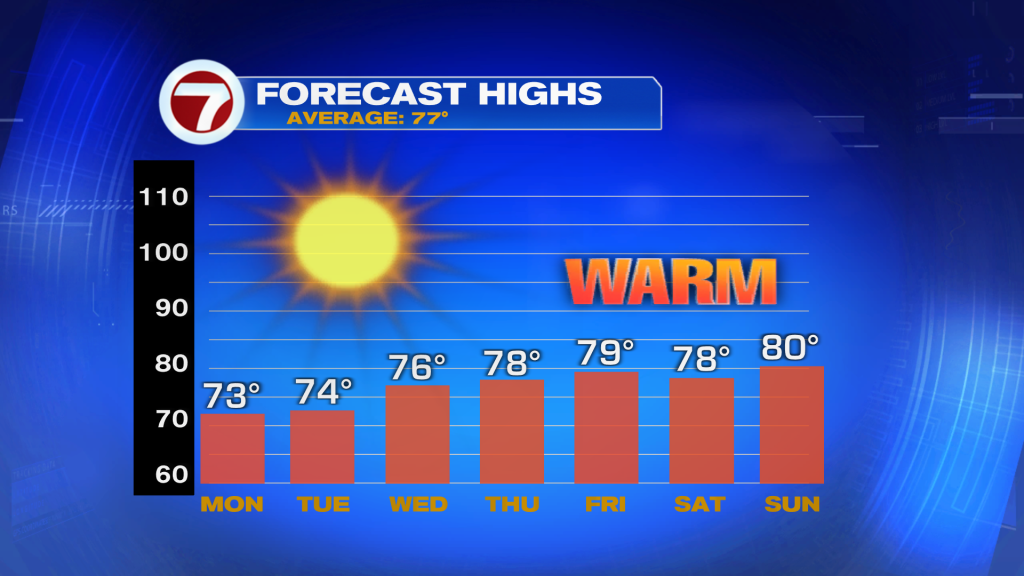
Calm and comfortable weather continues across South Florida this week as high pressure remains firmly in control. Forecast calls for it to stay dry with mostly sunny skies and just a few clouds drifting in off the Atlantic at times, especially along the East coast. High temperatures today will reach the mid to upper 70’s, with highs warming into the upper 70’s to near 80 degrees by Tuesday.
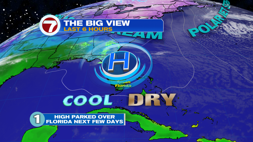
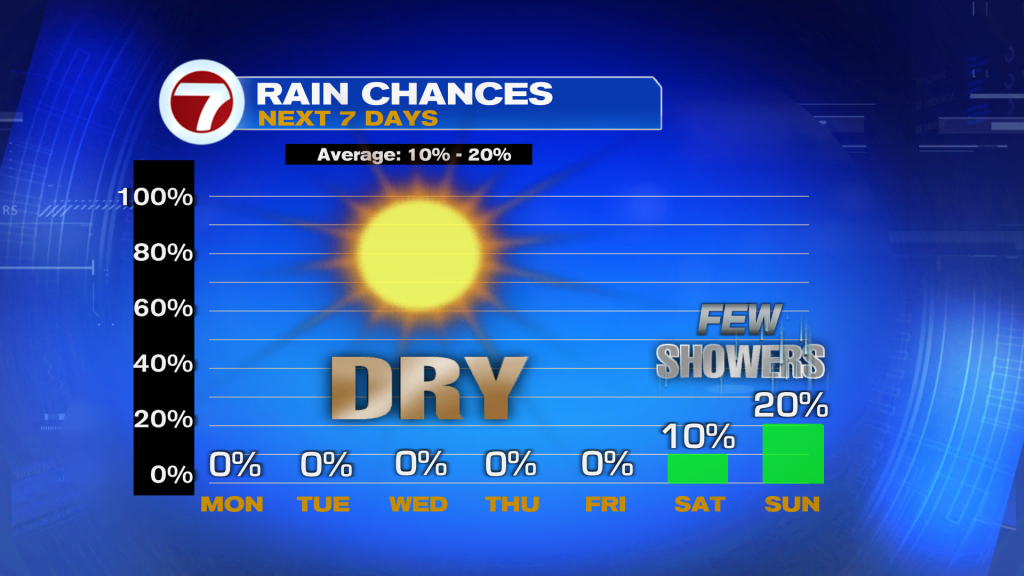
Later in the week, the overall weather pattern begins to shift slightly, but it does not look impactful or like a big change for us here in South Florida. While a weak front moves closer to us, there simply isn’t enough moisture around to bring rain, so most areas will remain dry through the end of the workweek.
Looking ahead to next weekend, a stronger cold front may get close enough to bring a few light, spotty showers. However, at this point, any rain would be brief and light, with no signs of widespread or heavy rainfall. It seems like the best chance will be on Sunday. Temperatures stay right where we like them, with afternoon highs in the upper 70’s to low 80’s and overnight lows dropping into the 50’s across Southwest Florida and the low 60’s along the East coast (this includes Broward and Miami-Dade).
Have a wonderful day South Florida and make it a safe one!
Vivian Gonzalez
Meteorologist, AMS Certified
WSVN Channel 7
Join our Newsletter for the latest news right to your inbox