
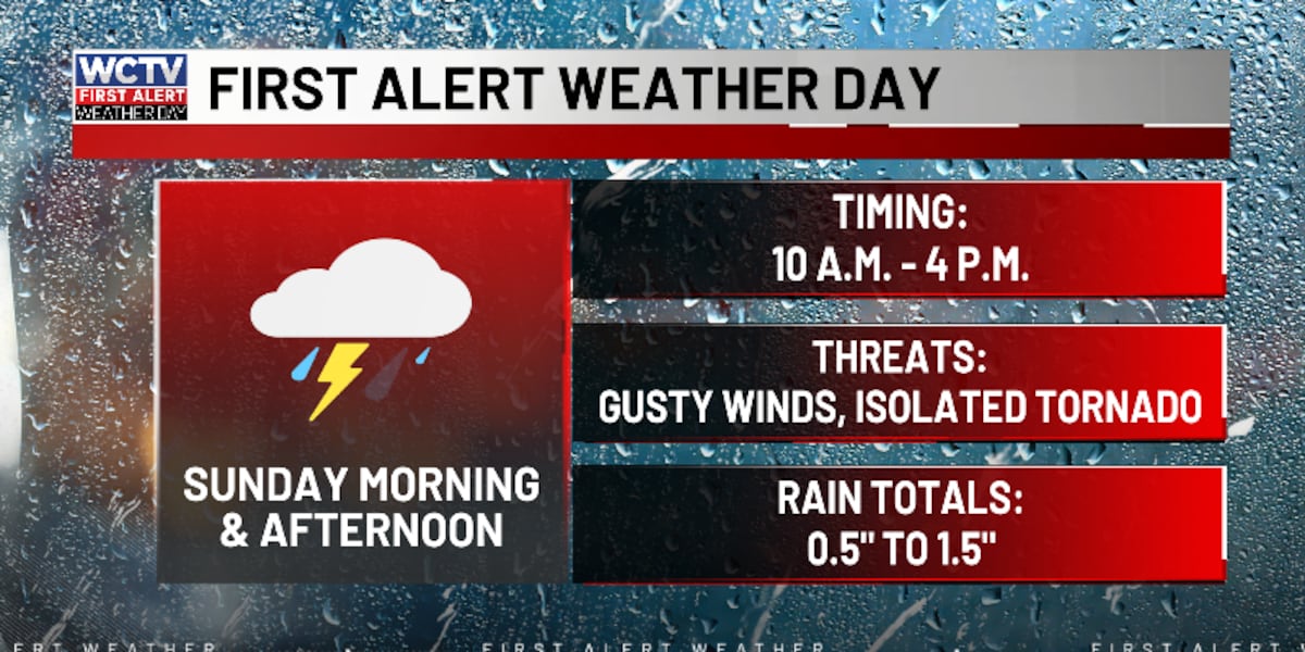
TALLAHASSEE, Fla. (WCTV) – We will be watching the skies closely today as beneficial rain moves in, there is also a risk for severe storms.
Beneficial rain with a risk for strong to severe thunderstorms this afternoon.Tornado Watch until 3 p.m.
The majority of the Big Bend and South Georgia is under a tornado watch until 3 p.m. for the threat of severe thunderstorms and isolated tornadoes.
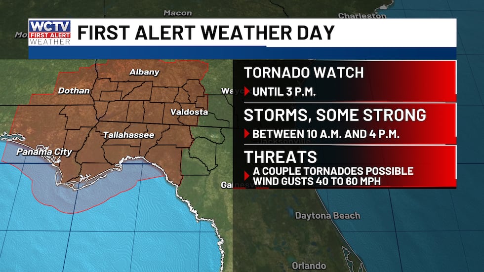 A tornado watch is in effect for the majority of the Big Bend and South Georgia.(WCTV)Timing out today’s storms
A line of showers and storms is approaching the Florida panhandle and will progress eastward throughout the morning.
While beneficial rainfall is expected, there is a Slight Risk (Level 2 of 5) for severe weather todayfor ALL of the Big Bend and South Georgia.
The line of storms is expected to strengthen this morning and into the afternoon, which is why the WCTV First Alert Weather Team has declared a First Alert Weather Day.
A few of these storms have the potential to be strong to severe, with damaging wind gusts as the primary threat.
While there is a chance of a few showers through the early and mid-morning, it looks like the main line arrives along the Apalachicola River, western Gerogia and the western Big Bend between 10 and 11 a.m.
By noon, storms will be approaching Cairo, Thomasville, Tallahassee, and Franklin County beaches. The leading edge will likely have some decent wind gusts between 30 and 50 mph, with some occasional severe wind gusts up to 60 mph.
Storms march east and arrive into the eastern Big Bend by 2 p.m. and should be out by 4 or 5 p.m.
Additional evening and early overnight showers are possible, but the severe risk will wrap up by 4 p.m.
A tornado or two cannot be ruled out, though the tornado threat remains low at this time.
The sun we get in the morning (and dry), the worse the more intense the storms will be. The WCTV First Weather Team
Looking Ahead to Next Week
Conditions improve significantly after Sunday. Next week looks much quieter with pleasant temperatures in the 70s and low 80s, with only a slight 20% chance of rain Thursday through Saturday. Sunday’s storms will be the main weather event to monitor.
To stay updated on all the latest forecasts and weather, follow WCTV First Alert Weather on Facebook and X (Twitter).
Click here to see all the latest weather headlines and here to view the First Alert Radar. Receive push alerts and watch the latest forecast anytime on the free WCTV First Alert Weather app. Click here to download it now.
Interested in becoming a WCTV First Alert Weather Watcher? Click here to join the team!
Copyright 2026 WCTV. All rights reserved.