
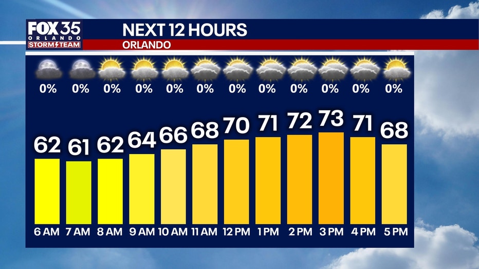
ORLANDO, Fla. – We’re waking up to dry conditions this morning after last night’s rain across Central Florida.
Clouds will gradually decrease throughout today; however, a completely sunny day isn’t anticipated.
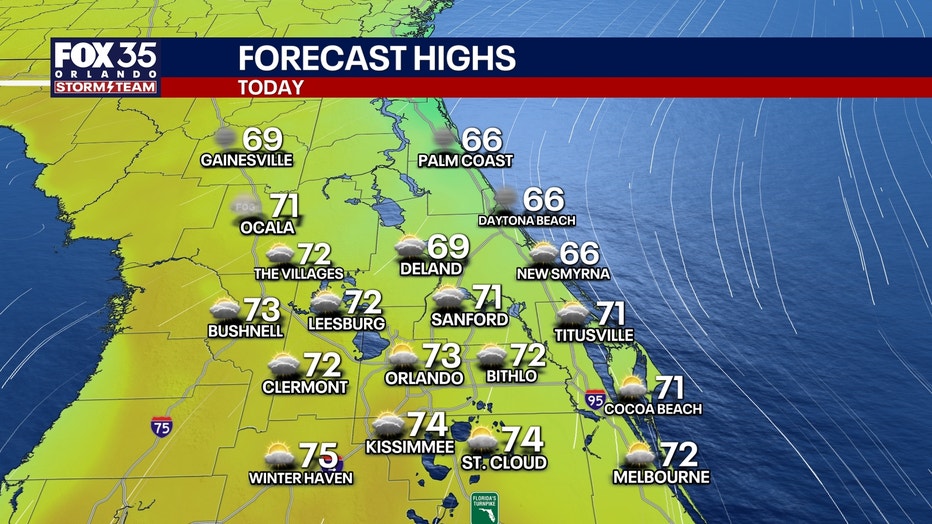
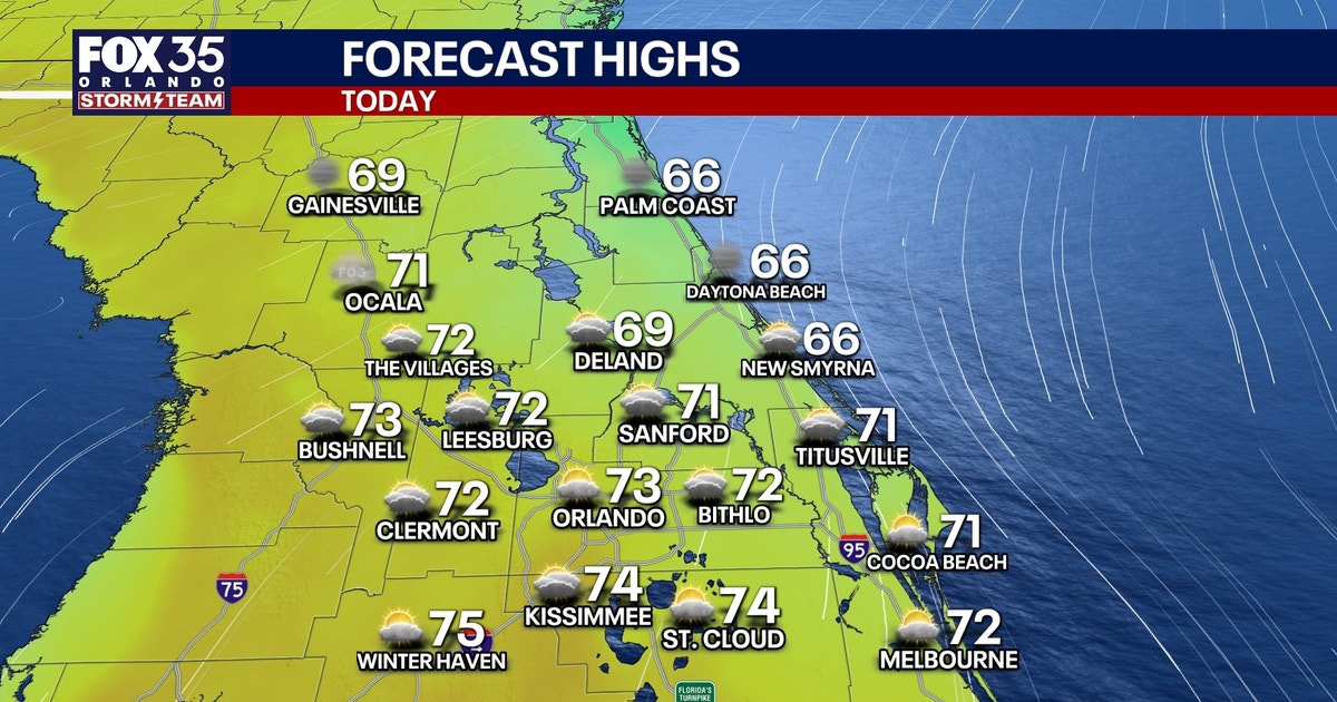
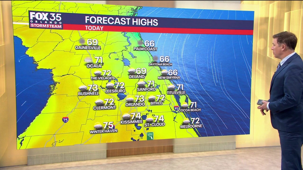
Partly to mostly cloudy skies are on the way with cooler afternoon temperatures. Highs will climb into the mid 60s along the coast and to the low and mid 70s inland.
Partly cloudy skies stick around as we head into tonight. Temperatures will fall into the low and mid 50s for morning lows.
Big warm-up on the way
High pressure will build into the region throughout the rest of the work week.
This means another dry stretch with above average temperatures over the next several days.
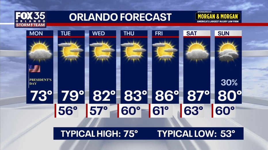
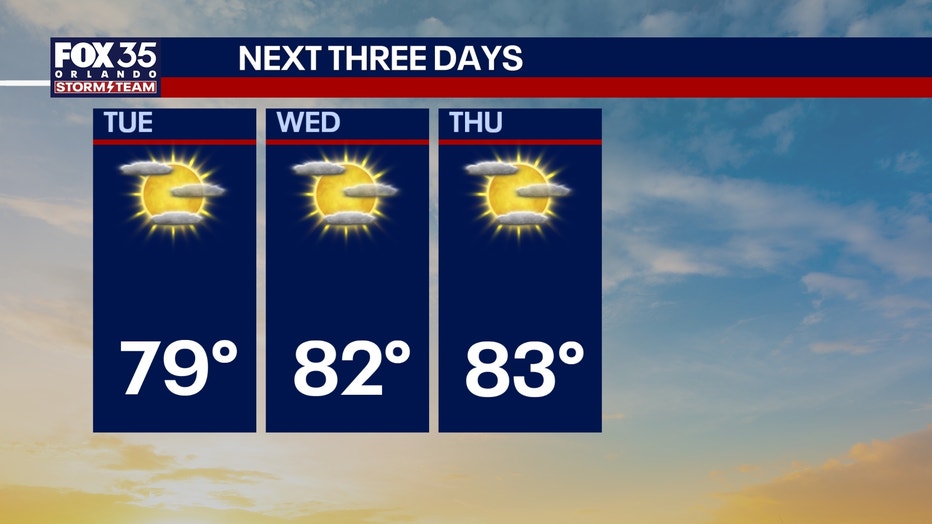
Highs tomorrow will be just shy of 80 degrees, before reaching the mid 80s by Friday with a high of 86°. Saturday’s high will be even warmer, with a high of 87°.
Our next round of rain won’t arrive until Sunday as we’ll see a 30% chance of a few showers.
The Source: This story was written with information from the FOX 35 Storm Team.