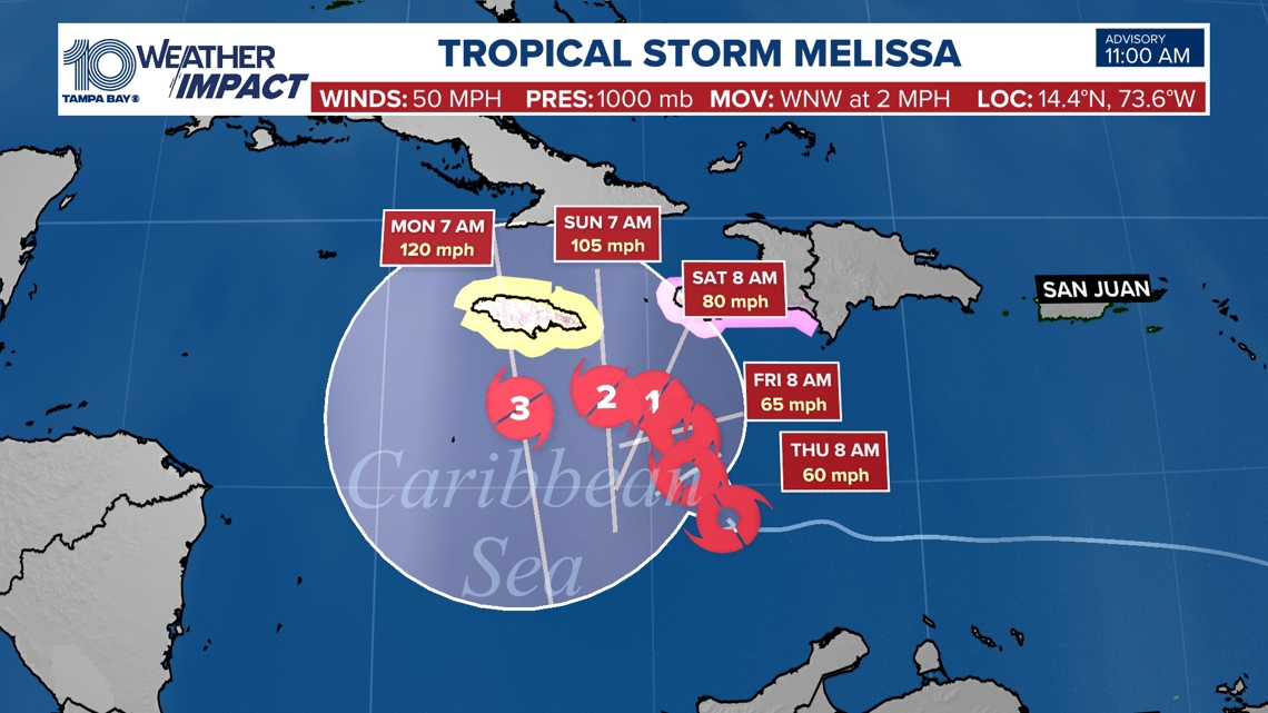
The storm is almost stationary, but will gradually strengthen to a major hurricane by next Monday
TAMPA, Fla. — Tropical Storm Melissa formed in the Caribbean at around 11 a.m. Tuesday, the National Hurricane Center announced.
The storm is now almost stationary in the Central Carribean and will slowly move west northwest the next couple of days while gradually strengthening.
Melissa Forecast Track:
The latest forecast track is now more confident in the storm keeping that westerly track over the next several days towards Jamaica.
How long it keeps a slightly northerly motion is still the question– this will determine if the storm makes direct impact to the islands of Hispanola and Jamaica.
Melissa is forecast to gradually strengthen, becoming a Category 1 hurricane by Saturday and then a category 3 hurricane by next Monday.
As of now, heavy tropical downpours and gusty winds look likely for the Dominican Republic and Haiti, as well as Jamaica, for the next several days into the weekend. If you have travel plans there in the coming days, I would keep an eye on this forecast and your bookings. No impact on the Tampa Bay area is expected.
A Tropical Storm Watch is in effect for Jamaica, and a Hurricane Watch is in effect from Port Au Prince, Haiti, to the border of the Dominican Republic.

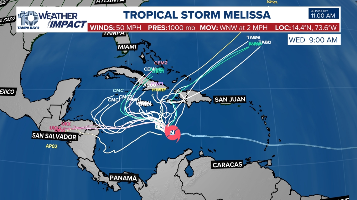
Melissa Spaghetti Models:
All models show that Melissa turns into the Atlantic, but the question is when. Latest model data is hinting that the storm will continue on a more westerly track longer, lingering in the Caribbean.
Melissa could directly impact Jamaica, Cuba, and the Bahamas this weekend into next week. If you have travel plans there, I would keep a close eye on this forecast and consider cancelling.
Models continue to keep this away from the Bay area.