
TALLAHASSEE, Fla. (WCTV) – Our stretch of warm weather continues for midweek, but be prepared for morning fog and increasing rain chances as the week progresses.
Tonight Through Wednesday Night
Another dry night is ahead for the region. Low temperatures are not as cool. We bottom out in the low-50s under a partly cloudy sky. Some areas of dense fog are possible.
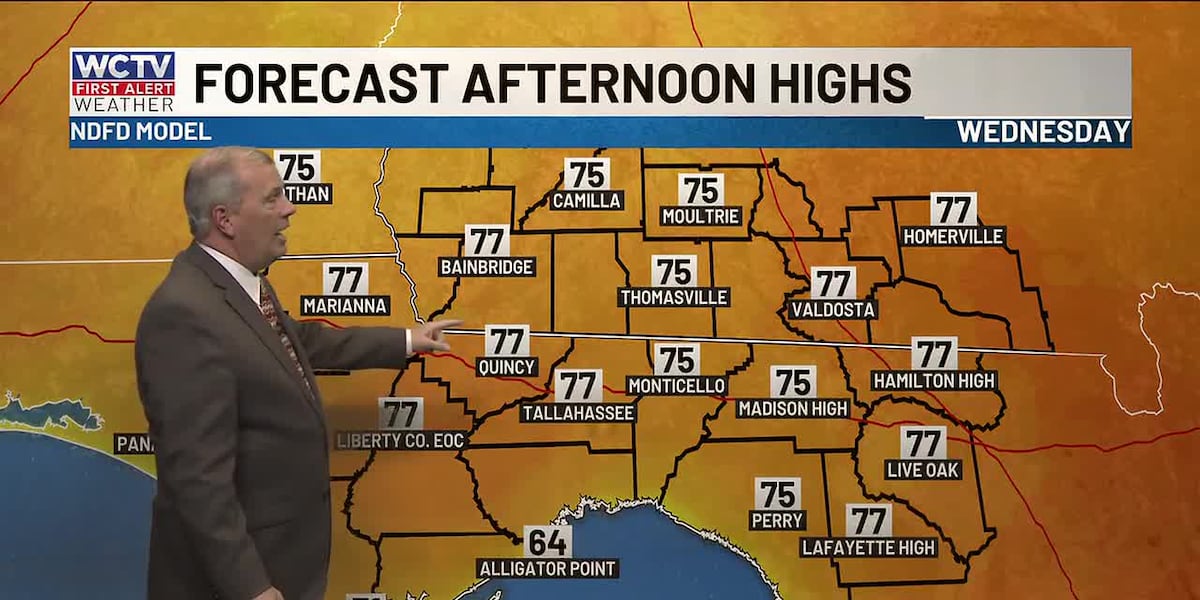
Our warming trend will continue for the middle of the week. Highs on Wednesday climb into the mid-and-upper-70s under a partly sunny sky. A stray shower is possible, but it will not rain for everyone.
Again, a stray sprinkle is possible for Wednesday night, but the rain chance is not widespread. Lows fall into the mid-and-upper-50s under a partly to mostly cloudy sky.
Ending The Work Week
Rain chances gradually increase to end the work week as we stay above average.
Isolated showers are possible on Thursday under a mix of Sun and clouds. Highs climb into the upper-70s and low-80s. Lows dip into the low-60s.
We could see some spotty showers on Friday under a partly sunny sky. Temperatures hover in the low-80s. We could flirt with a record high in Tallahassee. Overnight lows fall into the low-60s.
Weekend Forecast
Another cold front is lurking for the weekend.
Scattered showers are possible on Saturday under a mix of Sun and clouds. Again, a record high is on the table as temperatures hover in the low-80s. Lows settle in the low-50s.
We are turning cooler and drier on Sunday. Temperatures only reach the low-to-mid-60s during the afternoon under a partly cloudy sky. The wind is also looking breezy to end the weekend. Overnight lows are much cooler. We tumble into the low-and-mid-30s.
To stay updated on all the latest forecasts and weather, follow WCTV First Alert Weather on Facebook and X (Twitter).
Click here to see all the latest weather headlines and here to view the First Alert Radar. Receive push alerts and watch the latest forecast anytime on the free WCTV First Alert Weather app. Click here to download it now.
Interested in becoming a WCTV First Alert Weather Watcher? Click here to join the team!
Copyright 2026 WCTV. All rights reserved.