
JACKSONVILLE, Fla. — Here’s what the First Alert Weather Team said you can expect for the First Alert Weather forecast:
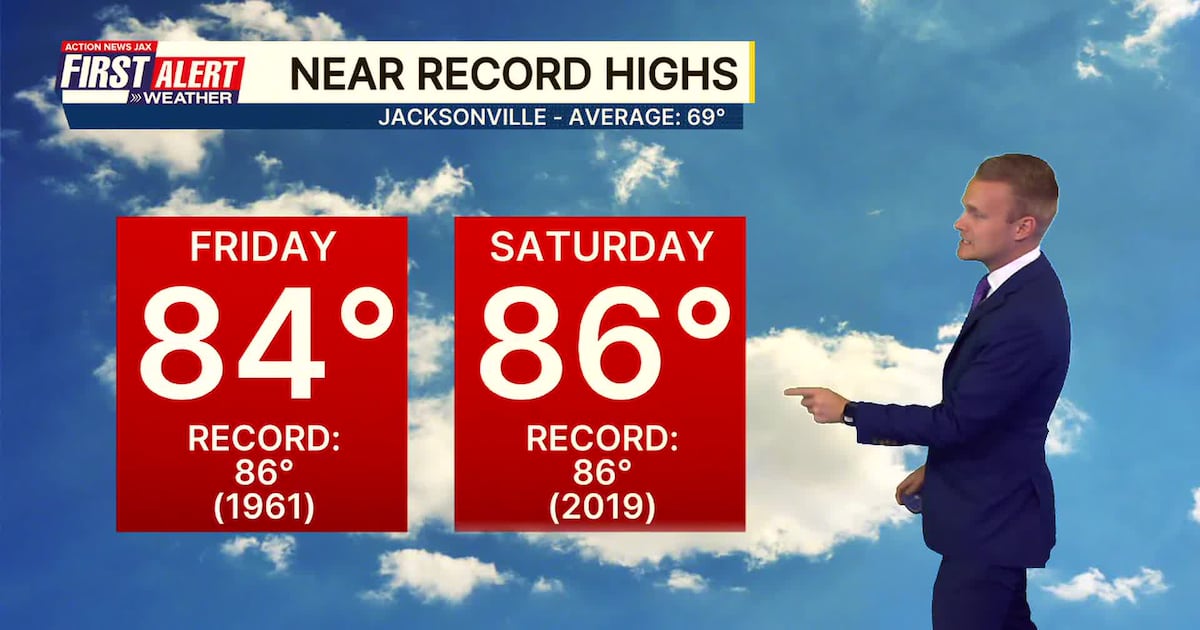
Partly cloudy tonight with lows near 50 degrees – not too far from where we should be this time of year.The rest of the week will be warm & dry under partly cloudy skies. Highs will be near 80 on Wednesday & Thursday, reaching near record highs in the mid 80s on Friday.The weekend will feel like spring early & more like winter late. Saturday’s highs will be near records in the mid 80s. A strong cold front will bring a shower or two Sat. night into early Sunday, but no significant rain is likely to occur. Highs on Sunday will top out near 70 about mid-day, then slowly fall through the afternoon with gusty winds out of the north.A return to winter early next week with highs only in the 50s & lows in the 30s. Cold enough for some inland frost &/or a light freeze early Monday & early Tuesday.
WATCH THE FORECAST | DOWNLOAD THE APPS
Follow Action News Jax Meteorologists on Twitter for updates:
Mike Buresh | Garrett Bedenbaugh | Corey Simma | Trevor Gibbs
First Alert 7-day Forecast:TONIGHT: Partly cloudy. Low: 50WEDNESDAY: Partly cloudy. High: 79WEDNESDAY NIGHT: Partly cloudy. Low: 55THURSDAY: Partly cloudy, rather warm. High: 80FRIDAY: Partly sunny & warm. 59/84 (record=86/1961)SATURDAY: Warm & partly sunny with a shower at night. 59/86 (record=86/2019)SUNDAY: A shower early then partly cloudy, windy & cooler. 57/70… falling through the 60s late.MONDAY: Mostly sunny, windy & cold. 35/59TUESDAY: Partly sunny, breezy & cold. 34/59
LISTEN: Mike Buresh ‘All the Weather, All the Time’ Podcast
INTERACTIVE RADAR: Keep track of the rain as it moves through your neighborhood