
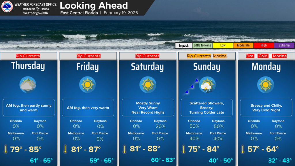
Thursday morning is off to a foggy start.
Dense fog is affecting several portions of east Central Florida, according to NWS Melbourne.
Okeechobee, Indian River, Saint Lucie and Martin counties are heavily affected.
After the fog dissipates, temperatures will be in the 80s across the greater Orlando metro and surrounding areas.
There is a high risk of rip currents at all Central Florida beaches, according to NWS Melbourne.
Entering the water is discouraged.
Looking ahead, temperatures willhave record highs Friday and Saturday before a cold front with a chance of rain arrives on Sunday.
The temperature drop on Sunday is expected to last through Monday, which hosts temperatures ranging from 57 to 64 degrees.