
TALLAHASSEE, Fla. (WCTV) – Weather shiplash is on the way for the Big Bend and South Georgia. Near-record warmth and mugginess on Friday, followed by isolated strong thunderstorms Saturday evening and a plunge into well-below-average cold by Sunday.
Muggy start with afternoon showers on Friday
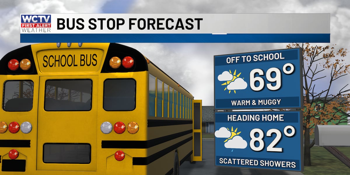
Friday morning will be muggy with coastal fog limiting visibility in some areas. Morning temperatures will hover in the 60s. The fog will clear as the day progresses, leaving mostly cloudy skies with some breaks of sun.
Highs will reach the low 80s, within a few degrees of record highs for this time of year. The main weather concern on Friday will be scattered showers with some heavy downpours expected this afternoon. The combination of moisture and warmth will create a humid feel throughout the day.
Saturday starts mild, with storms in the evening
Saturday will start mild in the mid 60s with some coastal morning fog. Mostly cloudy skies will persist through the morning with a few showers possible. Conditions will remain breezy with winds gusting to around 20 mph outside of storms.
The significant weather threat arrives Saturday evening. A better chance for showers and a few storms is expected, especially across South Georgia. The National Weather Service has issued a Marginal Risk (Level 1 of 5) for strong to severe storms in South Georgia Saturday evening.
Isolated damaging wind gusts between 40 to 60 mph are the primary threat with any storms that develop. For boaters, the Gulf waters will be a little choppy with waves up to 3 feet.
The strong cold front will sweep through the region Saturday night, ushering in a much colder air mass.
Windy and clearing to end the weekend
Sunday will be windy as the cold front moves through. Expect gusts to 25 mph inland, with gusts reaching 40 mph near the coast, creating rough waters for boaters. Skies will clear by the afternoon with plenty of sunshine. Highs will reach only the mid 60s.
Much cooler early next week
Turning cooler next week. Highs on Monday and Tuesday will only reach the 50s, with morning lows dipping into the 20s and 30s.
Frost and a light freeze are expected on Tuesday morning and Wednesday morning. Protect sensitive plants and ensure pets have adequate shelter during these cold nights.
A warming trend will begin late in the week, bringing more moderate temperatures by Thursday and Friday.
To stay updated on all the latest forecasts and weather, follow WCTV First Alert Weather on Facebook and X (Twitter).
Click here to see all the latest weather headlines and here to view the First Alert Radar. Receive push alerts and watch the latest forecast anytime on the free WCTV First Alert Weather app. Click here to download it now.
Interested in becoming a WCTV First Alert Weather Watcher? Click here to join the team!
Copyright 2026 WCTV. All rights reserved.