
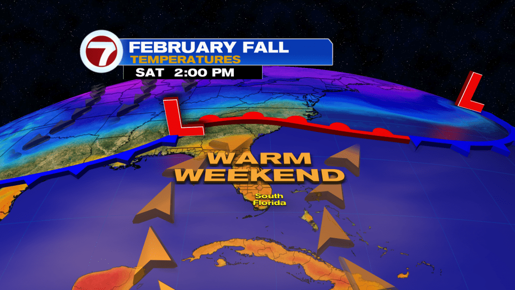
The warming trend continues into the final full weekend of February before a powerful cold front arrives, unleashing another winter chill for early next week.
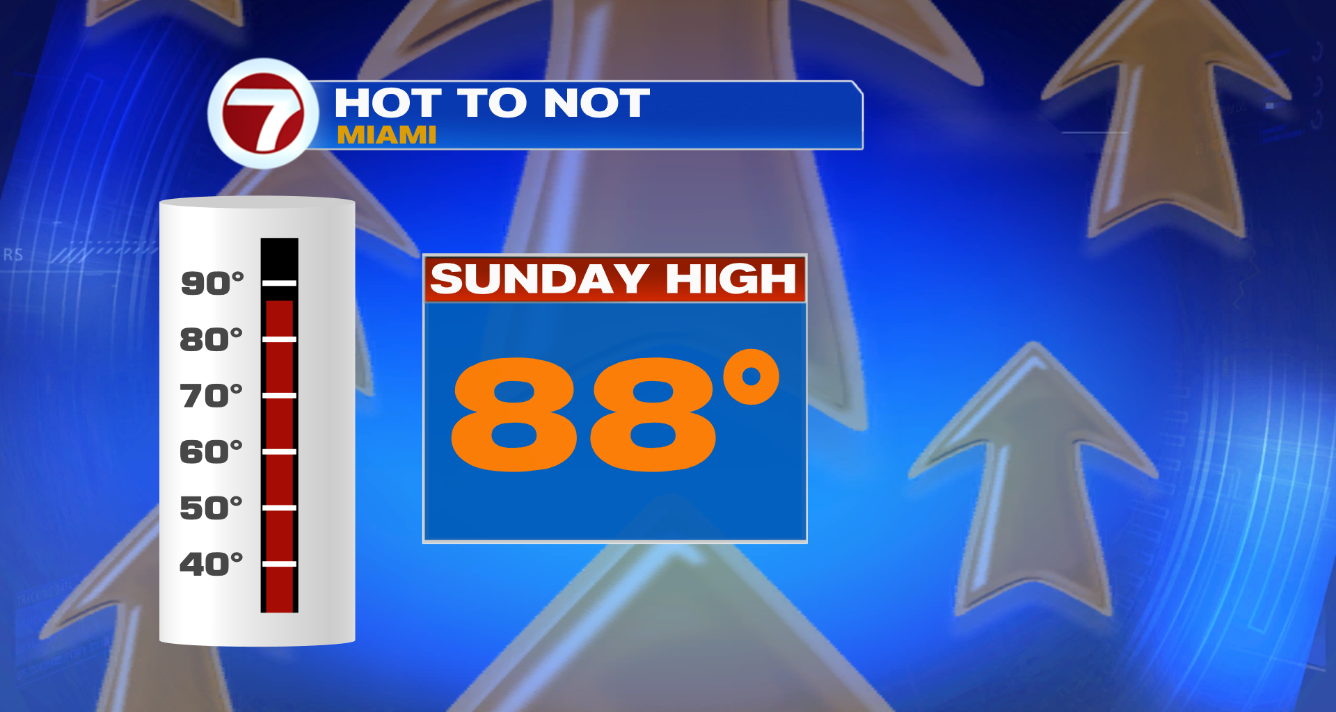
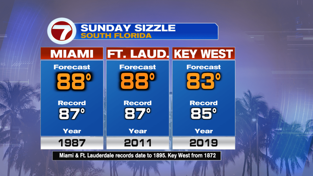
At least for the weekend, it will turn fairly hot — for winter standards at least — making for beautiful weather to be outside. Highs will reach the mid 80s on Saturday and then upper 80s on Sunday.
In fact, both Miami and Fort Lauderdale are forecast to break their record high temperature on Sunday.
Expect partly to mostly sunny skies on Saturday as some thin, upper level clouds will attempt to filter out some of the sunshine during the first half of the day.
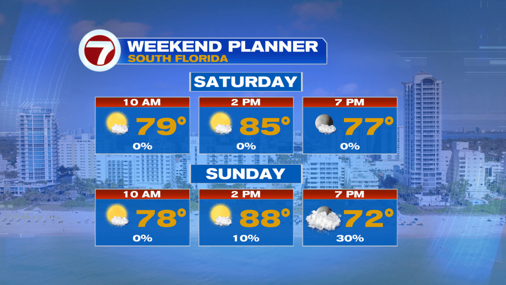
Then on Sunday, sunny skies through the early afternoon will then give way to increasing clouds and a quick-passing shower chance during the late-afternoon to early evening hours as a cold front moves in.

If you’re lucky enough to get rain, it won’t be much at all, making no improvement to the worsening drought situation across South Florida.
Behind that front will be a dramatic drop in temperatures. Lows Monday morning will be in the low 50s with inland areas reaching the 40s, and it’s not until Tuesday morning when the cold air peaks. That’s when widespread lows in the 40s are forecast.
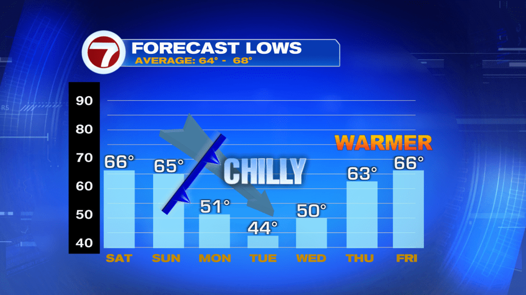
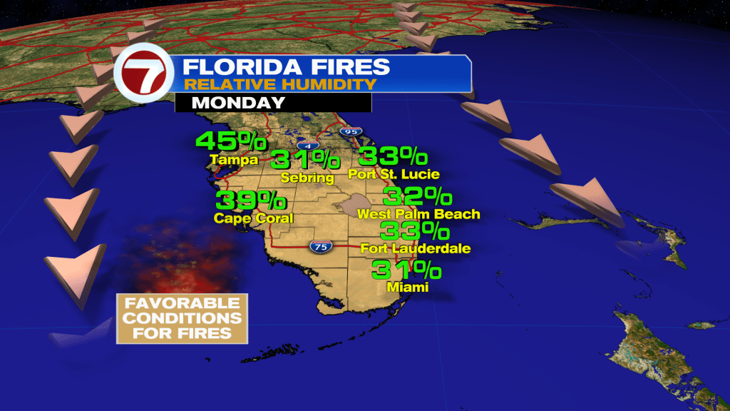
Otherwise, highs both of those days will be cold in the 60s but at least it will be sunny. One thing to note is that it will be windy on Monday, which will contribute to a favorable environment for brush fires to develop so outdoor burning should be avoided.
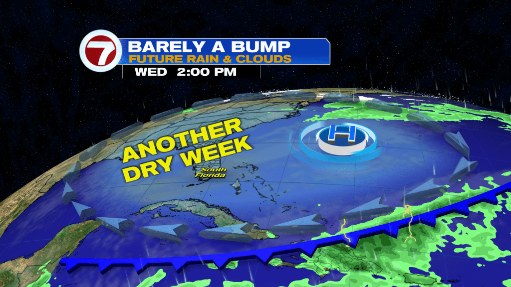
Beyond Tuesday, temperatures will start to warm up again all while it stays dry and quiet courtesy of high pressure in control.
Join our Newsletter for the latest news right to your inbox