
West Palm Beach, FLA. (WPEC) — South Florida will see a noticeable change in weather today as a cold front sweeps through the region this afternoon into early evening. Showers will increase ahead of the front, followed by much colder and drier air that will settle in tonight and linger through Wednesday morning.
Behind the front, strong high pressure will build in from the northwest. As this happens, winds will turn northwesterly and become breezy and gusty overnight into Monday.
Colder air will rapidly push into the region tonight, with lows dropping to:
Upper 30s to around 40 degrees north of Lake OkeechobeeLower to mid 40s across much of the interiorMid to upper 40s along the east coast metro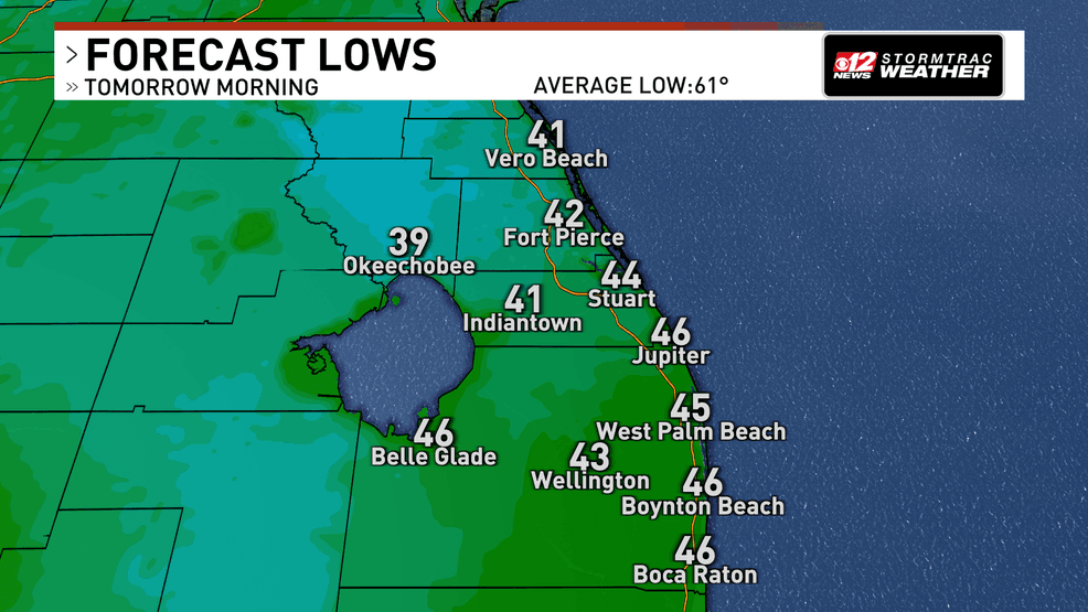
Bundle up: cold front sends Central and South Florida into the 30s and 40s. (WPEC)
When wind is factored in, it will feel even colder. Wind chill values overnight will fall into:
Low to mid 30s near Lake OkeechobeeMid to upper 30s across inland areasLower 40s along the coast
A Cold Weather Advisory is in effect for Okeechobee, inland St. Lucie and inland Indian River County from 3 to 9 a.m. Monday.
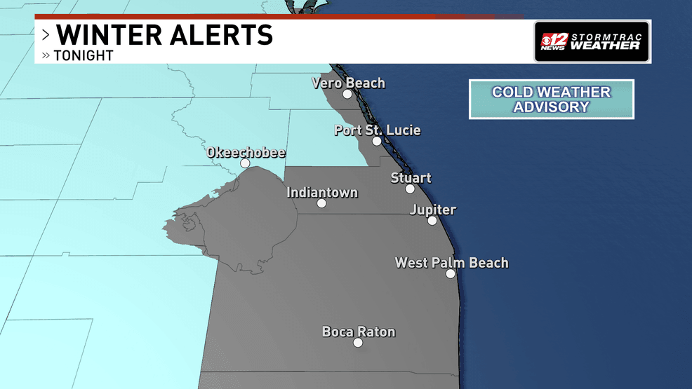
A Cold Weather Advisory is in effect for Okeechobee, inland St. Lucie and inland Indian River County from 3 to 9 a.m. Monday. (WPEC)
Cold air advection, which is the steady flow of colder air into the region, will continue through Monday. Afternoon highs will struggle to reach the lower 60s across most of South Florida, with mid 60s possible in extreme southwestern areas.
Dry air moving in behind the front will cause dewpoints to tumble into the 20s and 30s Monday, and combined with breezy winds, will raise fire weather concerns with fire weather warnings in effect across South and Central Florida.
Monday night into Tuesday morning will bring another cold start with temperatures in the low-to-mid 30s and low 40s.
A Freeze Watch is in effect from Late Monday Night until Tuesday morning as temperatures are expected to get into the 30s.
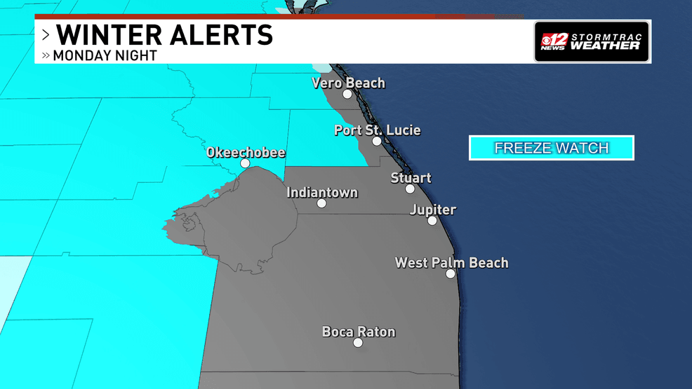
A Freeze Watch is in effect from Late Monday Night until Tuesday morning as temperatures are expected to get into the 30s. (WPEC)
Wind chill values could dip into the mid to upper 20s near Lake Okeechobee and inland Southwest Florida early Tuesday.
Highs Tuesday will remain cool, generally in the lower to mid 60s.
Gradual warmup midweek
Tuesday night into Wednesday morning will likely be one more chilly start, with 30s inland and 40s elsewhere. As high pressure shifts east, winds will turn southeasterly and allow temperatures to rebound.
By Wednesday afternoon, highs will climb back into the lower 70s along the coast and mid to upper 70s inland. Even warmer conditions are expected Thursday, with highs returning to the upper 70s and lower 80s.
Another front may approach late next week, potentially bringing renewed shower chances, but details remain uncertain.