
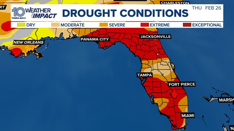
For the first time since record-keeping began in 2000, every part of the state of Florida is now experiencing some level of drought, according to the U.S. Drought Monitor.
The latest map shows the entire state ranging from abnormally dry (D0) to exceptional drought (D4), underscoring how widespread the dry pattern has become.
Here at home, there was little to no change in drought conditions this past week across West Central and Southwest Florida.
Moderate to extreme drought continues to grip the region as rainfall deficits deepen. Many locations have picked up less than 25% to 50% of normal rainfall over the past 30 days, and waterways and soil moisture remain unusually low for this time of year.
The impacts are already being felt.
Polk County farmers say this is the worst dryness they’ve seen in about 15 years, and fire danger continues to increase as vegetation dries out.
With long-range outlooks favoring warmer temperatures and limited rainfall, the current deficits are likely to carry into the spring and could allow drought conditions to persist or worsen without meaningful rain.
September usually marks the end of Florida’s rainy season, but last year ended very dry, and rainfall has remained well below normal over the past six months, deepening the state’s drought deficit.
While some rain is forecast for this weekend, forecasters caution that it will take significantly more rainfall over a sustained period to ease the ongoing drought and improve soil moisture, river levels, and water resources across the region.