
ORLANDO, Fla. – The workweek is ending on an unsettled note as our next storm system moves in.
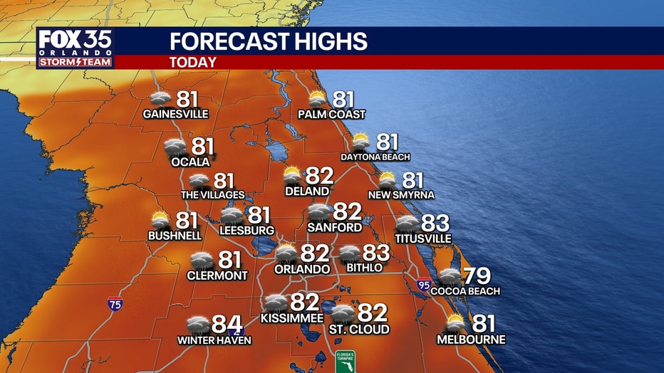
The plus is that we really need the rain, but outdoor plans will need to be monitored because of the threat of downpours and storms. We’re starting the day off on a dry note, but clouds are increasing and that trend continues through the morning. Temps will still be able to warm in the lower 80s, despite the clouds.
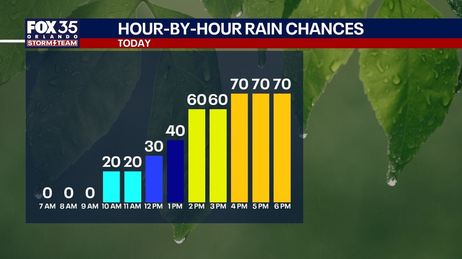
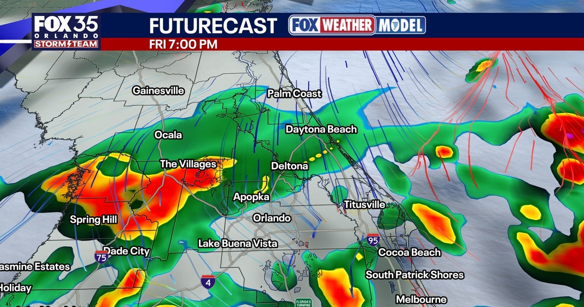
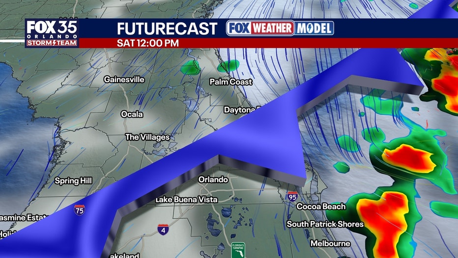
By lunchtime, a few showers and storms start to ignite SW of Orlando with some “lift” ahead of the main cold front. Through the afternoon and into the evening, coverage of showers and storms increases with a few stronger storms possible. The set-up in the atmosphere including instability will help bring the potential for some small hail and gusty wind.
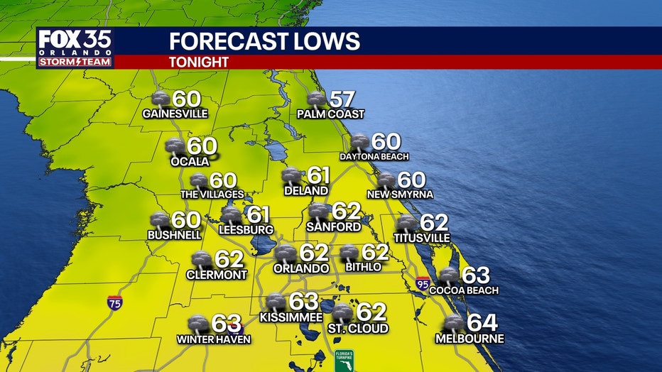
Overnight, we’ll see numerous showers and storms as this cold front works southeast. Lows with the clouds and moisture only get back into the lower to middle 60s.
The weekend starts unsettled as this system continues to impact us here at home.
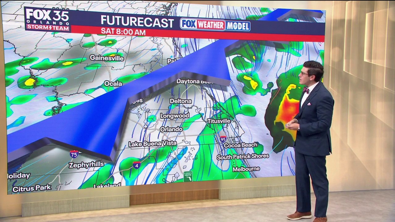
Rain is likely to kick off our Saturday with some embedded thunderstorms as well. The cold front will be slowly pushing through the viewing area during with the threat of showers and storms holding through midday. They’ll be hit or miss in nature with showers and storms becoming more widely scattered during the afternoon.
Moisture will continue to taper off in the evening as this cold front sags southeast with colder and drier air starting to sink in. The clouds will hold though, and, with the rain, temps will struggle to get out of the middle 70s. It’ll be less humid and cooler Saturday night with lows falling back into the middle to upper 50s.
Drier air wins out Sunday as high pressure starts to build in. That brings a return to more sunshine, making for a beautiful end to the weekend.
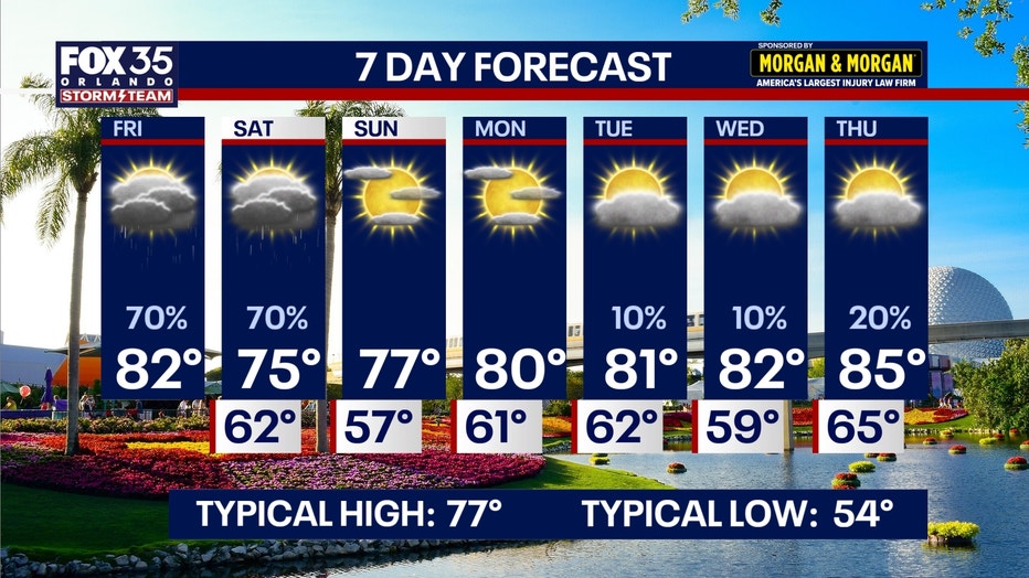
Temperatures will essentially be perfect for this time of year, topping out in the upper 70s. As this ridge of high pressure builds in, highs continue to moderate through the start of the workweek and beyond.
Afternoon readings jump back into the lower 80s Monday and Tuesday which is well above average for this time of year. In fact, temps will run around 5-10° above normal as we progress through the latter half of next week. Conditions look mainly dry, but with onshore flow coming from the Atlantic, we’ll see the potential for stray showers, especially near the beaches Tuesday, Wednesday and Thursday.
The Source: This story was written with information from the FOX 35 Storm Team.