
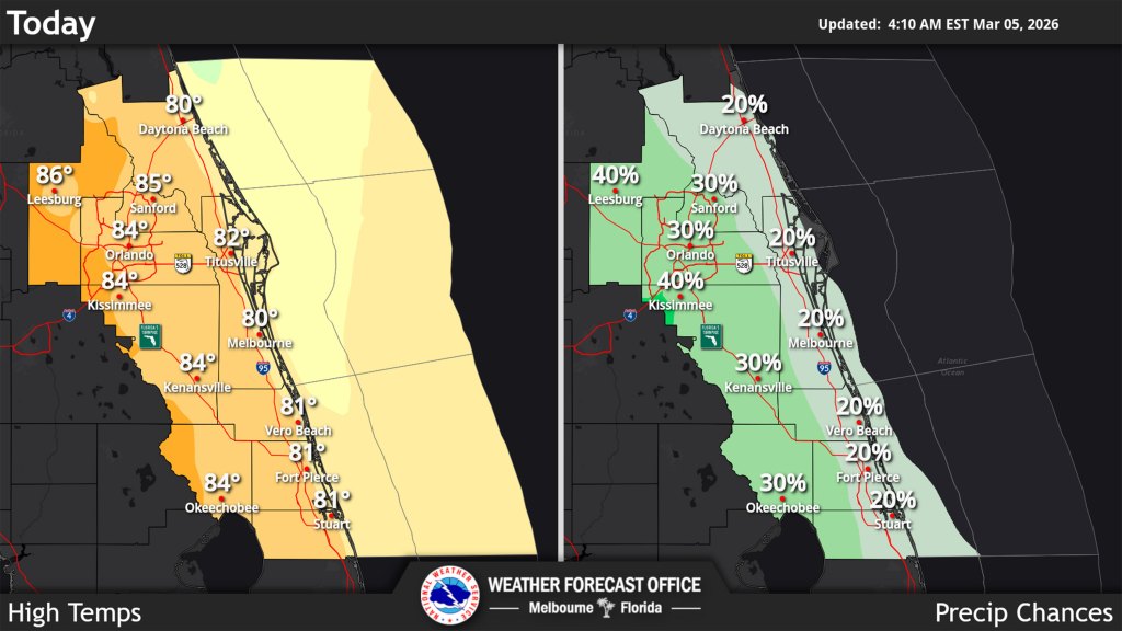
Temperatures across Central Florida remain higher than normal with the mid-80s expected inland on Thursday along with a chance for afternoon rain, according to the National Weather Service in Melbourne.
An east coast sea breeze will steadily move inland each day into the weekend prompting isolated to scattered showers. The NWS states there is a 20%-40% chance for precipitation Thursday and Friday, especially across the interior counties.
Rain chances climb to 40-50% by Saturday in the afternoon as more moisture builds in the region.
“Surface heating and sea breeze/lake breeze interactions along with cold temperatures aloft should be supportive for a few lighting strikes each afternoon,” the NWS said in its forecaster’s discussion. “However, model sounding profiles suggest a limited environment for more organized convection due to weak shear and drier mid levels.”
Temps will hit the mid 80s in the interior and low 80s on the coast Thursday.
“Slightly warmer Friday and Saturday with low 80s along the coast and mid to upper 80s inland,” forecasters said. “Low temperatures hold mostly in the mid 60s areawide.”
There’s still a chance for patchy fog early Thursday, and mostly north of Interstate 4, with better chances on Friday and Saturday mornings.
At the beach, there is a high risk of rip currents, along with rough surf.
Farther out, mostly isolated showers are forecast for Sunday and temperatures are expected to climb further into the new week hitting the mid to upper 80s west of I-95 by the afternoon while lows will be in the mid-60s.