
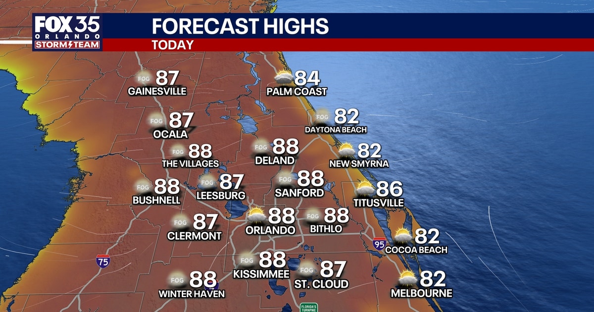
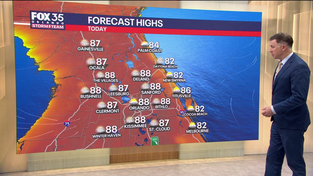
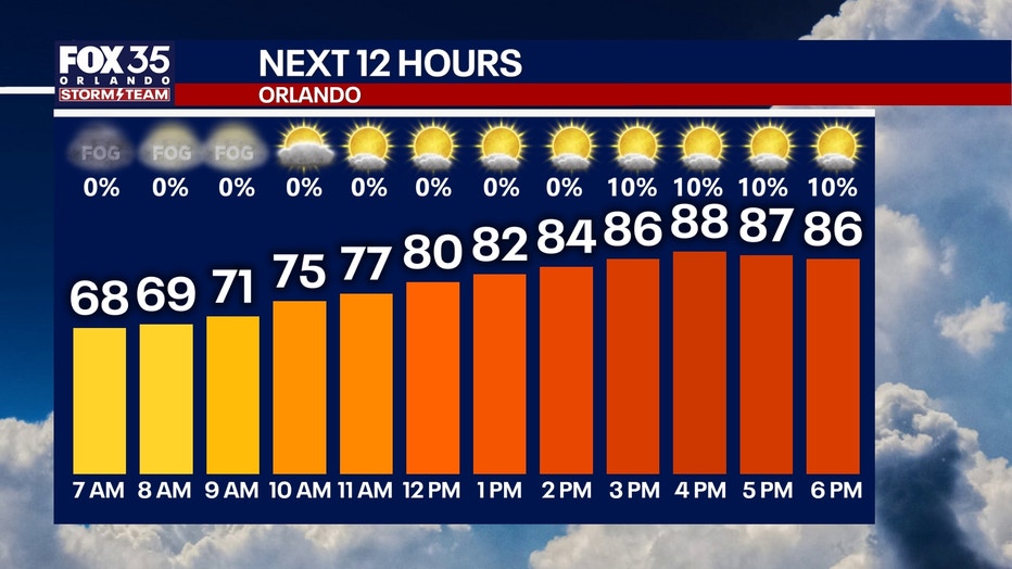
ORLANDO, Fla. – Patchy dense fog is possible this morning across Central Florida.
Give yourself a few extra minutes to get out the door and to your destinations safely. The fog will clear and lift by 9 a.m. or 10 a.m., giving way to a partly to mostly sunny sky.

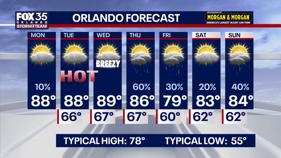
Temperatures will be heating up in a big way this afternoon. Plan for highs to approach the mid 80s along the coast and soar to the upper 80s inland.
The low chance exists for a few very isolated showers and downpours. These will mostly take place southeast of the I-4 corridor, in Brevard, Osceola, and eastern Orange County.
Another warm and muggy night is on the way as temperatures fall into the mid and upper 60s. Patchy dense fog will be possible once again into the predawn hours of tomorrow morning as well.
Temperatures will be heating up in a big way this week. Afternoon highs will reach more summer-like levels, climbing to 88° Tuesday and 89° Wednesday in Orlando.
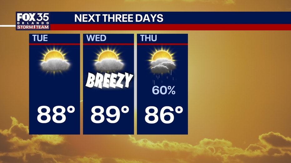
By the end of next week, our stretch of 80s looks like it will come to an end, at least just barely.
Our next system comes into play, increasing our chances of rain for Thursday specifically. As a result, high temperatures will fall back into the 70s briefly, with a high of 79° Friday.
We’ll bounce back to the 80s by next weekend with spotty showers and a few thunderstorms sticking around. The frontal boundary bringing Thursday’s rain will drift back north, keeping scattered showers in the forecast through next weekend.
The Source: This story was written with information from the FOX 35 Storm Team.