
Spring level warmth is here, south Florida, and it’s actually going to get warmer over the next few days. Even now, temperatures are running about 5-degrees above average with readings resembling early May instead of early March! Fortunately, there’s a helpful breeze arriving off the ocean and keeping conditions comfortable.
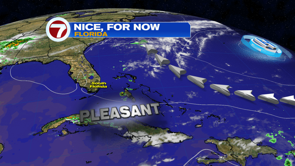
For the time being, we’re still on the western periphery of High Pressure. It’s a much weaker High than in previous days, so winds have noticeably come down. Often in this type of setup, you’d expect moisture from the tropics to get scooped up and pulled in our direction. However, there’s plenty of drying that will hang on.
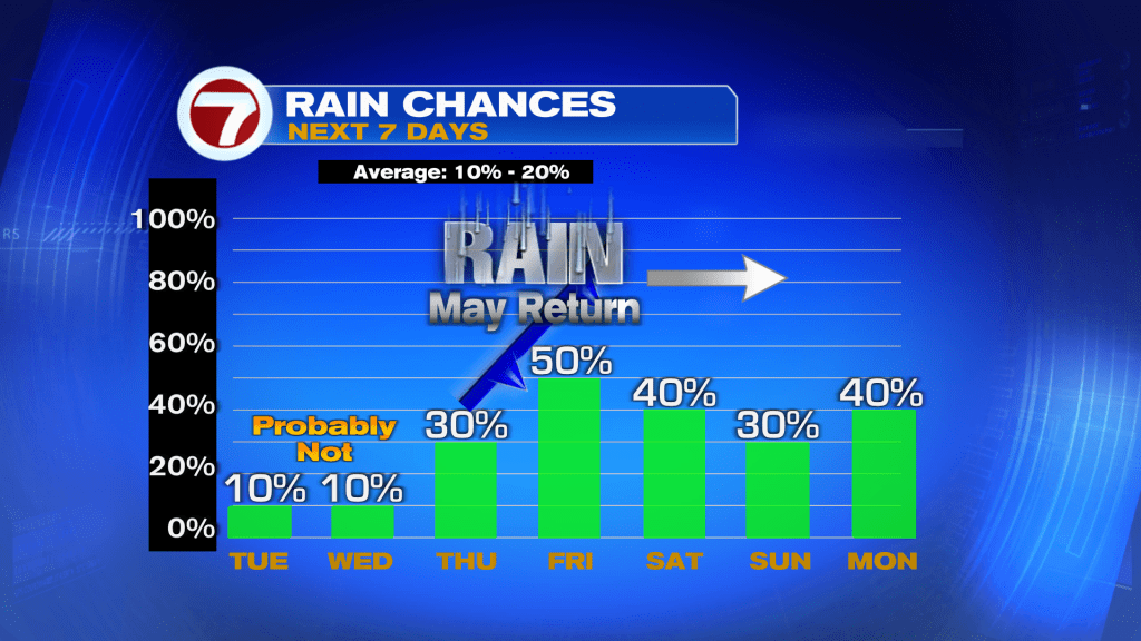
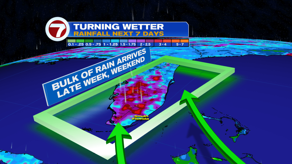
Notice, here, that rain chances are very slim (at best) in the short run. It’s not until late Thursday and Friday that rain prospects actually spike higher. The reason? A future Front.
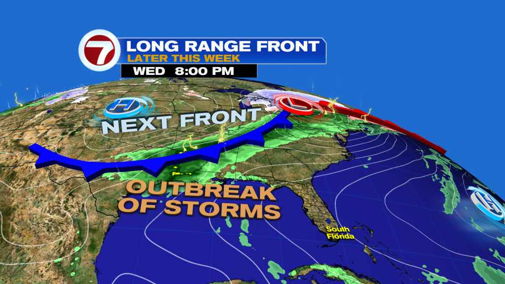
A Cold Front will slice into a large swath of warm and humid air across the deep south (and well beyond). Eventually, this will be the Front that moves into Florida at the end of the work week.
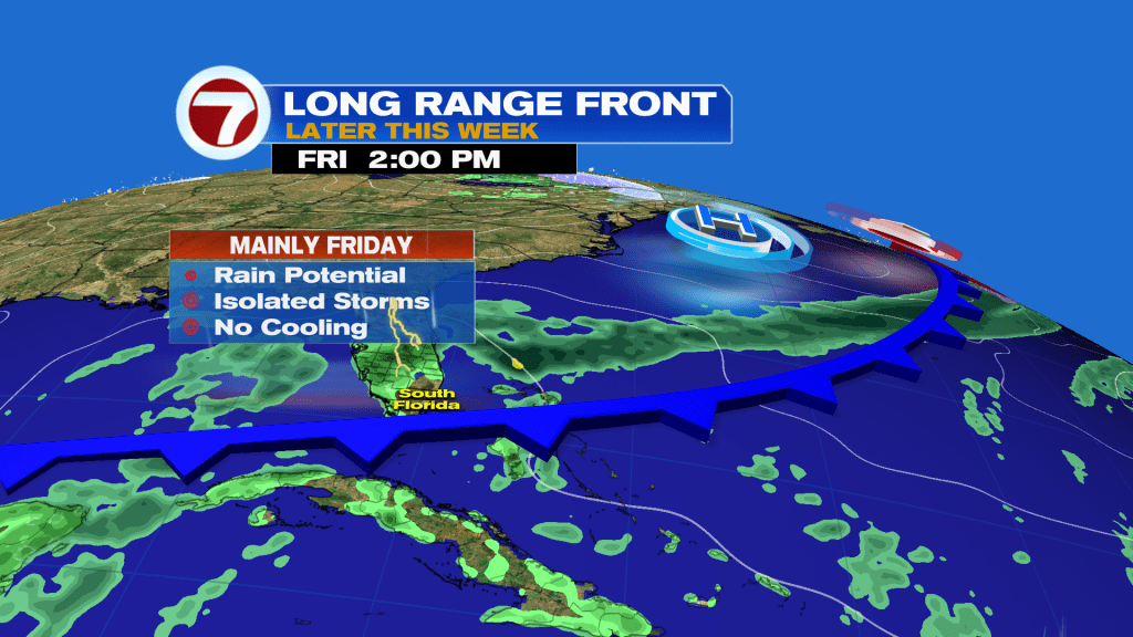
Upon reaching south Florida, the frontal boundary will be much weaker. A couple isolated storms will be possible, but the bigger focus will be on how much rainfall can be triggered by the slowing Front. Most of the forecast models show the Front remaining intact and potentially stalling “around our region” prior to the weekend. Then, it’s a matter of monitoring the continued potential for showers. It’ll be a mostly cloudy and unsettled start to the weekend. Any of this rain will be beneficial due to the severe drought that continues.
Copyright 2025 Sunbeam Television Corp. All rights reserved. This material may not be published, broadcast, rewritten or redistributed.
Join our Newsletter for the latest news right to your inbox