
JACKSONVILLE, Fla. — Here’s what the First Alert Weather Team said you can expect for the First Alert Weather forecast:
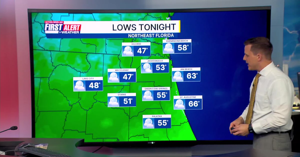
Clear and dry evening with temperatures dipping into the 60s after sunset50s in the morning inland and lower 60s along the coast in NE FloridaDry day tomorrowHighs in the mid to upper 70s to near 80 degrees tomorrowTurning breezy over the weekend as local nor’easter conditions set up.NE winds over the weekend with rough ocean conditionsWinds gusting 30+ mph along the coastOnly an isolated shower is possible on Sunday
WATCH THE FORECAST | DOWNLOAD THE APPS
Tropics:Tropical Storm Melissa is meandering in the Central CaribbeanMelissa is forecast to become a major hurricane later this weekendMelissa’s movement will be very slow as it tracks westward the next several daysMelissa will bring high winds and flooding rain to Jamaica, Cuba & HispaniolaImpacts will last several days due to the slow movement of the stormLong-range forecasts pull Melissa up into the Western Atlantic, away from the U.S.There are currently no other active stormsMore: Talking the Tropics with Mike
Follow Action News Jax Meteorologists on Twitter for updates:
Mike Buresh | Garrett Bedenbaugh | Corey Simma | Trevor Gibbs
First Alert 7-day Forecast:TONIGHT: Mostly clear and dry. Cool. LOW: 53TOMORROW: Mostly sunny and mild. High: 80SATURDAY: Mostly sunny. Turning breezy. 62/80SUNDAY: Partly cloudy, isolated shower. Breezy. 65/80MONDAY: Partly cloudy, a few showers. Breezy. 66/77TUESDAY: Partly cloudy, isolated shower. 64/76WEDNESDAY: Partly sunny. 60/78THURSDAY: Partly sunny & cooler. 55/70